<< Our Photo Pages >> The Beacon (Cumbria) - Stone Circle in England in Cumbria
Submitted by Anonymous on Thursday, 15 February 2001 Page Views: 11760
Neolithic and Bronze AgeSite Name: The Beacon (Cumbria) Alternative Name: KnapperthawCountry: England County: Cumbria Type: Stone Circle
Nearest Town: Ulverston Nearest Village: Knapperthaw
Map Ref: SD28008423 Landranger Map Number: 96
Latitude: 54.248667N Longitude: 3.106491W
Condition:
| 5 | Perfect |
| 4 | Almost Perfect |
| 3 | Reasonable but with some damage |
| 2 | Ruined but still recognisable as an ancient site |
| 1 | Pretty much destroyed, possibly visible as crop marks |
| 0 | No data. |
| -1 | Completely destroyed |
| 5 | Superb |
| 4 | Good |
| 3 | Ordinary |
| 2 | Not Good |
| 1 | Awful |
| 0 | No data. |
| 5 | Can be driven to, probably with disabled access |
| 4 | Short walk on a footpath |
| 3 | Requiring a bit more of a walk |
| 2 | A long walk |
| 1 | In the middle of nowhere, a nightmare to find |
| 0 | No data. |
| 5 | co-ordinates taken by GPS or official recorded co-ordinates |
| 4 | co-ordinates scaled from a detailed map |
| 3 | co-ordinates scaled from a bad map |
| 2 | co-ordinates of the nearest village |
| 1 | co-ordinates of the nearest town |
| 0 | no data |
Be the first person to rate this site - see the 'Contribute!' box in the right hand menu.
Internal Links:
External Links:
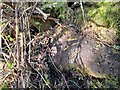
Near Knapperthaw Farm, below Beacon Hill 3 km (2 miles) NW of Greenodd 135 m above sea level (Another "Enclosure" on the OS Map).
For more information see Pastscape Monument NO 38613. An entry from 1889 reads: "Rather more than a quarter of a mile north of Knapperthaw, are the remains of a stone circle, which has been erected on a stony ring embankment or platform. On the northwest side of this still remain five stones (which have probably never been upright), of small size and in close order. No others remain, although the sites of some can still be traced. The extreme diameter of the ring is about 100 feet, but as it is about 9 feet wide, and as the only large stones that remain are upon its inner side, the diameter of the stone circle probably did not exceed 90 feet. There appears to be some vestiges of an inner chamber on the northwest, and on the southwest is an entrance or gap in the ring, probably ancient."
Further entries from 1969 and 1994 conclude this is a probable ring barrow or funerary enclosure/embanked stone circle in poor condition.
You may be viewing yesterday's version of this page. To see the most up to date information please register for a free account.
Do not use the above information on other web sites or publications without permission of the contributor.
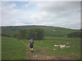
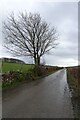
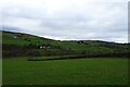
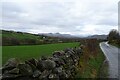
Nearby Images from Geograph Britain and Ireland:
©2014(licence)
©2024(licence)
©2024(licence)
©2024(licence)
©2022(licence)
The above images may not be of the site on this page, they are loaded from Geograph.
Please Submit an Image of this site or go out and take one for us!
Click here to see more info for this site
Nearby sites
Key: Red: member's photo, Blue: 3rd party photo, Yellow: other image, Green: no photo - please go there and take one, Grey: site destroyed
Download sites to:
KML (Google Earth)
GPX (GPS waypoints)
CSV (Garmin/Navman)
CSV (Excel)
To unlock full downloads you need to sign up as a Contributory Member. Otherwise downloads are limited to 50 sites.
![]()
Turn off the page maps and other distractions
Nearby sites listing. In the following links * = Image available
122m NW 304° Lowick Ring Cairn (SD279843)
2.1km NW 309° Great Burney* Ring Cairn (SD2640185541)
2.1km NW 312° Great Burney* Cairn (SD26458565)
2.9km NNW 328° Heathwaite Settlement* Ancient Village or Settlement (SD265867)
3.1km WSW 246° Kirkby Moor Ringcairn* Round Cairn (SD25148299)
3.2km WSW 242° The Kirk Stone Row* Multiple Stone Rows / Avenue (SD2509182770)
3.3km WSW 241° The Kirk Ring Cairn* Stone Circle (SD2507082693)
3.7km ESE 112° Greenodd Holy Well (Egton with Newland) Holy Well or Sacred Spring (SD3144082770)
4.1km ESE 120° Sheriff's Well (Greenodd) Holy Well or Sacred Spring (SD3150082130)
4.1km W 270° St Mary's Well (Kirkby Ireleth) Holy Well or Sacred Spring (SD2389584270)
4.3km NNW 327° Giants Grave (Woodland)* Cairn (SD257879)
4.5km NNW 327° Giants Grave (Cumbria)* Ring Cairn (SD256880)
4.5km W 260° Kirkby Hall Holy Well (Kirkby Ireleth) Holy Well or Sacred Spring (SD2357083550)
4.7km NW 322° Heathwaite Fell Ancient Village or Settlement (SD251880)
4.9km NNW 344° White Borran Cairn, Woodland Fell* Ring Cairn (SD2668788943)
5.4km SSE 164° Hoad Hill* Cairn (SD294790)
6.2km N 352° Blawith Fells and Tarn Riggs (near Beacon Tarn) Cairn (SD2725490383)
6.7km NE 48° Rusland* Standing Stone (Menhir) (SD33098867)
6.8km NNE 29° Bethecar Moor Round Cairn* Round Cairn (SD3142090164)
8.8km S 183° Great Urswick Long Barrow* Long Barrow (SD27427540)
9.0km NNW 333° The Hawk Settlement* Ancient Village or Settlement (SD241923)
9.1km S 183° Great Urswick Fort* Hillfort (SD274751)
9.2km WNW 288° Ash House* Standing Stones (SD19288729)
9.7km SSW 194° Lindal Standing Stone* Standing Stone (Menhir) (SD255749)
9.7km S 174° Birkrigg Common Round Cairn 3 Round Cairn (SD288746)
View more nearby sites and additional images


 We would like to know more about this location. Please feel free to add a brief description and any relevant information in your own language.
 Wir möchten mehr über diese Stätte erfahren. Bitte zögern Sie nicht, eine kurze Beschreibung und relevante Informationen in Deutsch hinzuzufügen.
 Nous aimerions en savoir encore un peu sur les lieux. S'il vous plaît n'hesitez pas à ajouter une courte description et tous les renseignements pertinents dans votre propre langue.
 Quisieramos informarnos un poco más de las lugares. No dude en añadir una breve descripción y otros datos relevantes en su propio idioma.