<< Our Photo Pages >> Knox Well - Holy Well or Sacred Spring in England in Yorkshire (North)
Submitted by jamesrattue on Thursday, 15 October 2015 Page Views: 1754
Springs and Holy WellsSite Name: Knox WellCountry: England
NOTE: This site is 0.271 km away from the location you searched for.
County: Yorkshire (North) Type: Holy Well or Sacred Spring
Nearest Village: Reighton
Map Ref: TA134752
Latitude: 54.160094N Longitude: 0.264805W
Condition:
| 5 | Perfect |
| 4 | Almost Perfect |
| 3 | Reasonable but with some damage |
| 2 | Ruined but still recognisable as an ancient site |
| 1 | Pretty much destroyed, possibly visible as crop marks |
| 0 | No data. |
| -1 | Completely destroyed |
| 5 | Superb |
| 4 | Good |
| 3 | Ordinary |
| 2 | Not Good |
| 1 | Awful |
| 0 | No data. |
| 5 | Can be driven to, probably with disabled access |
| 4 | Short walk on a footpath |
| 3 | Requiring a bit more of a walk |
| 2 | A long walk |
| 1 | In the middle of nowhere, a nightmare to find |
| 0 | No data. |
| 5 | co-ordinates taken by GPS or official recorded co-ordinates |
| 4 | co-ordinates scaled from a detailed map |
| 3 | co-ordinates scaled from a bad map |
| 2 | co-ordinates of the nearest village |
| 1 | co-ordinates of the nearest town |
| 0 | no data |
Internal Links:
External Links:
")
Taking the footpath eastwards from the main road just below the church and then deviating up the hill just beyond a fence through the thinnest of the gorse, brings you to a slight dip just beyond another fence, which seems to be Knox Well. It was dry when visited and hardly worth the effort. In 1848 it was Knock Well, and gave its name to the hillside, an aspect which has vanished from modern maps.
You may be viewing yesterday's version of this page. To see the most up to date information please register for a free account.
Do not use the above information on other web sites or publications without permission of the contributor.
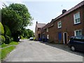
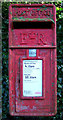
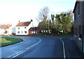
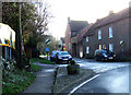
Nearby Images from Geograph Britain and Ireland:
©2012(licence)
©2016(licence)
©2016(licence)
©2016(licence)
©2014(licence)
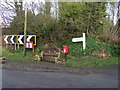
The above images may not be of the site on this page, they are loaded from Geograph.
Please Submit an Image of this site or go out and take one for us!
Click here to see more info for this site
Nearby sites
Key: Red: member's photo, Blue: 3rd party photo, Yellow: other image, Green: no photo - please go there and take one, Grey: site destroyed
Download sites to:
KML (Google Earth)
GPX (GPS waypoints)
CSV (Garmin/Navman)
CSV (Excel)
To unlock full downloads you need to sign up as a Contributory Member. Otherwise downloads are limited to 50 sites.
Turn off the page maps and other distractions
Nearby sites listing. In the following links * = Image available
3.8km S 190° Keld Spring* Holy Well or Sacred Spring (TA128714)
4.6km SW 225° Rudston D Cursus Cursus (TA102719)
5.4km NNW 345° Filey Roman Signal Station* Ancient Village or Settlement (TA1187080412)
5.9km SW 221° Maidens Grave* Henge (TA09677063)
6.1km ESE 120° Bempton Stones* Marker Stone (TA18737226)
6.1km N 0° Spittals, Filey Brigg* Rock Outcrop (TA133813)
6.1km NNW 345° Sailors' Well* Holy Well or Sacred Spring (TA117811)
6.4km N 356° Carr Naze (Filey) Misc. Earthwork (TA1275581605)
7.1km SSW 197° Greenland Fort Hillfort (TA115684)
7.4km S 188° Caythorpe Misc. Earthwork (TA125678)
7.5km SSW 206° Rudston A Cursus Cursus (TA103684)
7.7km WNW 299° Spell Howe (Folkton) Cairn (TA06577878)
7.8km WSW 250° Willy Howe* Round Barrow(s) (TA06167235)
7.9km SSW 205° Rudston C Cursus Cursus (TA102680)
7.9km WNW 291° Folkton Round Barrow* Round Barrow(s) (TA059778)
8.3km SSW 208° Rudston D Cursus Cursus (TA097678)
8.3km SSW 207° Rudston Monolith* Standing Stone (Menhir) (TA0980367743)
8.4km SW 215° Rudston C Cursus Cursus (TA088682)
8.7km SSW 209° Rudston B Cursus Cursus (TA094675)
8.8km WNW 288° Sharp Howes* Barrow Cemetery (TA049777)
8.8km SSW 210° Rudston Cursus Group Cursus (TA092674)
8.9km ESE 119° Dane's Dyke* Ancient Village or Settlement (TA21317115)
9.0km WSW 255° Ba’l Hill* Round Barrow(s) (TA048726)
9.0km NNW 334° Gristhorpe Tumuli* Round Barrow(s) (TA093832)
9.0km SSW 198° Southside Mount* Round Barrow(s)
View more nearby sites and additional images


 We would like to know more about this location. Please feel free to add a brief description and any relevant information in your own language.
 Wir möchten mehr über diese Stätte erfahren. Bitte zögern Sie nicht, eine kurze Beschreibung und relevante Informationen in Deutsch hinzuzufügen.
 Nous aimerions en savoir encore un peu sur les lieux. S'il vous plaît n'hesitez pas à ajouter une courte description et tous les renseignements pertinents dans votre propre langue.
 Quisieramos informarnos un poco más de las lugares. No dude en añadir una breve descripción y otros datos relevantes en su propio idioma.