<< Our Photo Pages >> Carve Hill Low - Barrow Cemetery in England in Greater Manchester
Submitted by vagabondnma on Monday, 28 March 2005 Page Views: 9666
Neolithic and Bronze AgeSite Name: Carve Hill Low Alternative Name: Top of Quarlton Low/ Cairn, Carve Hill CairnCountry: England County: Greater Manchester Type: Barrow Cemetery
Nearest Town: Bury Nearest Village: Hawkshaw
Map Ref: SD755159
Latitude: 53.639037N Longitude: 2.372029W
Condition:
| 5 | Perfect |
| 4 | Almost Perfect |
| 3 | Reasonable but with some damage |
| 2 | Ruined but still recognisable as an ancient site |
| 1 | Pretty much destroyed, possibly visible as crop marks |
| 0 | No data. |
| -1 | Completely destroyed |
| 5 | Superb |
| 4 | Good |
| 3 | Ordinary |
| 2 | Not Good |
| 1 | Awful |
| 0 | No data. |
| 5 | Can be driven to, probably with disabled access |
| 4 | Short walk on a footpath |
| 3 | Requiring a bit more of a walk |
| 2 | A long walk |
| 1 | In the middle of nowhere, a nightmare to find |
| 0 | No data. |
| 5 | co-ordinates taken by GPS or official recorded co-ordinates |
| 4 | co-ordinates scaled from a detailed map |
| 3 | co-ordinates scaled from a bad map |
| 2 | co-ordinates of the nearest village |
| 1 | co-ordinates of the nearest town |
| 0 | no data |
Internal Links:
External Links:
")
Although not listed on the Bury Archaelogical Society's list, this is acknowledged elsewhere as a burial mound. It is probably either Neolithic or Bronze Age. Others in the area are of these times and my guess is Late Neolithic/Early Bronze Age. John Dixon, in his wonderful book 'Journeys through Brigantia - volume 11' (Aussteiger Publications) refers to it on page 118 and gives it its name 'Carve Hill', so I bow to his knowledge. He also says the following: "To the North East of Top of Quarlton stands Carve Hill upon the side of which stands a steep-sided mound. The height of the mound on the West is 4.2m, and on the East 6.4m. Though there is no trace of a ditch, the mound is thought to have its origins in the Bronze Age and may be a large burial mound."
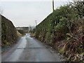
Access: At the western end of Hawkshaw. Park at the Red Lion (?) pub and cross back over the road and head North up the public footpath. You go up the side of a stream valley. It will loom in front of you. There is no public access to the top of the mound, though there is a public footpath through the field that the mound is in. The farmer was watching me the whole time and I believe he's not as friendly as some, so best ask permission before you try scalng it. I'd love to know if you can see Dodd Lee from the top.
Looking North East is (SU767169) where a Prehistoric Battle Axe was found (Bury Arch Society) - could this be the 'Pond Bay' marked on the map in ancient type on the OS map? I guess I will have to risk the 'Danger Area' marked all around and find out........
You may be viewing yesterday's version of this page. To see the most up to date information please register for a free account.
")
")
Do not use the above information on other web sites or publications without permission of the contributor.
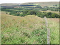
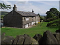
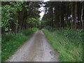
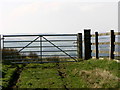
Nearby Images from Geograph Britain and Ireland:
©2011(licence)
©2011(licence)
©2011(licence)
©2007(licence)
©2010(licence)
The above images may not be of the site on this page, they are loaded from Geograph.
Please Submit an Image of this site or go out and take one for us!
Click here to see more info for this site
Nearby sites
Key: Red: member's photo, Blue: 3rd party photo, Yellow: other image, Green: no photo - please go there and take one, Grey: site destroyed
Download sites to:
KML (Google Earth)
GPX (GPS waypoints)
CSV (Garmin/Navman)
CSV (Excel)
To unlock full downloads you need to sign up as a Contributory Member. Otherwise downloads are limited to 50 sites.
Turn off the page maps and other distractions
Nearby sites listing. In the following links * = Image available
1.3km SSE 151° Dodd Lee* Barrow Cemetery (SD76121476)
1.8km SE 128° Whippalow Hill* Barrow Cemetery (SD76921477)
2.2km S 181° Affetside Cross (Lancashire) Ancient Cross (SD7546613689)
2.2km S 181° Affetside Cross (Bury)* Ancient Cross (SD7546613686)
3.9km W 269° Cheetham Close* Stone Circle (SD71631586)
4.3km NNE 33° Robin Hood's Well, Haslingden* Holy Well or Sacred Spring (SD77861954)
5.0km E 86° Whitelow* Cairn (SD80501626)
5.1km S 184° Dry Hillock Marker Stone* Marker Stone (SD7511310830)
5.2km SE 125° Castlesteads (Walmersley)* Hillfort (SD797129)
6.9km SW 228° Toothill Long Barrow* Long Barrow (SD704113)
7.0km ESE 112° Walmersley Golf Club stone* Modern Stone Circle etc (SD82011319)
7.2km WSW 251° Horrocks Moor Barrow* Artificial Mound (SD687136)
7.4km SSW 207° St Peter's Church (Bolton)* Ancient Cross (SD721093)
7.4km WSW 247° Priests Crown* Long Barrow (SD68621307)
7.6km SSW 204° Haulgh (Bolton) Cairn (SD72420899)
7.7km NW 309° White Hall* Round Barrow(s) (SD696208)
7.7km WSW 251° Moortop Barrows* Round Barrow(s) (SD682134)
7.8km E 97° Wind Hill Cheesden* Round Barrow(s) (SD8326214945)
7.9km ESE 115° Castle Hill, Heywood Hillfort (SD827125)
8.0km SSW 210° Bolton Museum* Museum (SD715090)
8.1km WSW 249° Brown Stones* Stone Row / Alignment (SD679130)
8.2km ENE 63° Waugh's Well (Edenfield) Holy Well or Sacred Spring (SD82871957)
8.4km N 8° Thirteen Stone Hill* Stone Circle (SD7665324273)
8.5km WSW 257° Counting Hill Row* Stone Row / Alignment (SD672141)
8.5km WSW 239° Thurstones Row Stone Row / Alignment (SD681116)
View more nearby sites and additional images


 We would like to know more about this location. Please feel free to add a brief description and any relevant information in your own language.
 Wir möchten mehr über diese Stätte erfahren. Bitte zögern Sie nicht, eine kurze Beschreibung und relevante Informationen in Deutsch hinzuzufügen.
 Nous aimerions en savoir encore un peu sur les lieux. S'il vous plaît n'hesitez pas à ajouter une courte description et tous les renseignements pertinents dans votre propre langue.
 Quisieramos informarnos un poco más de las lugares. No dude en añadir una breve descripción y otros datos relevantes en su propio idioma.