<< Our Photo Pages >> Lowton Barrow - Round Barrow(s) in England in Cheshire
Submitted by LivingRocks on Wednesday, 26 January 2005 Page Views: 8294
Neolithic and Bronze AgeSite Name: Lowton Barrow Alternative Name: Winwick Lane, Golborne Barrow, Kenyon Hall FarmCountry: England County: Cheshire Type: Round Barrow(s)
Nearest Town: Warrington Nearest Village: Lowton
Map Ref: SJ619948
Latitude: 53.448576N Longitude: 2.575138W
Condition:
| 5 | Perfect |
| 4 | Almost Perfect |
| 3 | Reasonable but with some damage |
| 2 | Ruined but still recognisable as an ancient site |
| 1 | Pretty much destroyed, possibly visible as crop marks |
| 0 | No data. |
| -1 | Completely destroyed |
| 5 | Superb |
| 4 | Good |
| 3 | Ordinary |
| 2 | Not Good |
| 1 | Awful |
| 0 | No data. |
| 5 | Can be driven to, probably with disabled access |
| 4 | Short walk on a footpath |
| 3 | Requiring a bit more of a walk |
| 2 | A long walk |
| 1 | In the middle of nowhere, a nightmare to find |
| 0 | No data. |
| 5 | co-ordinates taken by GPS or official recorded co-ordinates |
| 4 | co-ordinates scaled from a detailed map |
| 3 | co-ordinates scaled from a bad map |
| 2 | co-ordinates of the nearest village |
| 1 | co-ordinates of the nearest town |
| 0 | no data |
Internal Links:
External Links:
")
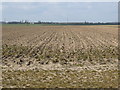
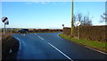
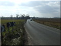
I originally located the site of this barrow via www.pastscape.org and living only 5mins away had to check it out. The given co-ordinates are right by the roadside and it appears that agriculture and road construction have completely destroyed any surface features. Past excavations revealed evidence of cremations and a bronze pin.
You may be viewing yesterday's version of this page. To see the most up to date information please register for a free account.
Do not use the above information on other web sites or publications without permission of the contributor.
Nearby Images from Geograph Britain and Ireland:
©2013(licence)
©2019(licence)
©2011(licence)
©2012(licence)
©2013(licence)
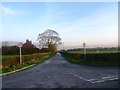
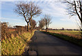
The above images may not be of the site on this page, they are loaded from Geograph.
Please Submit an Image of this site or go out and take one for us!
Click here to see more info for this site
Nearby sites
Key: Red: member's photo, Blue: 3rd party photo, Yellow: other image, Green: no photo - please go there and take one, Grey: site destroyed
Download sites to:
KML (Google Earth)
GPX (GPS waypoints)
CSV (Garmin/Navman)
CSV (Excel)
To unlock full downloads you need to sign up as a Contributory Member. Otherwise downloads are limited to 50 sites.
Turn off the page maps and other distractions
Nearby sites listing. In the following links * = Image available
1.4km WSW 238° St Oswald's Well (Winwick)* Holy Well or Sacred Spring (SJ6074294099)
1.7km SSW 198° Highfield Lane* Round Barrow(s) (SJ61379320)
2.4km W 271° The Bloody Stone* Marker Stone (SJ59469488)
2.5km SW 217° St Oswald (Winwick)* Ancient Cross (SJ6037592833)
2.7km WNW 300° Castle Hill (Newton Le Willows)* Round Barrow(s) (SJ59609617)
3.0km E 80° Kinknall Stone Natural Stone / Erratic / Other Natural Feature (SJ649953)
4.0km NW 316° Lady Hill* Round Barrow(s) (SJ5916497670)
4.0km SSE 162° Parkfields Park Stone Circle* Modern Stone Circle etc (SJ63119099)
4.5km SE 146° The Birchwood Monolith* Modern Stone Circle etc (SJ64409110)
6.3km W 274° Windmill Hill (Earlestown)* Round Barrow(s) (SJ55639531)
6.3km S 181° St Elphin's Well (Warrington) Holy Well or Sacred Spring (SJ61698847)
7.3km E 100° Great Woolden Hall Farm* Hillfort (SJ691935)
8.1km ESE 103° Great Woolden Hall Ancient Village or Settlement (SJ698929)
11.8km ENE 58° Boothstown Round Barrow(s) (SD720010)
11.9km NNW 343° Mabs Cross* Ancient Cross (SD5852706268)
12.4km SW 235° St Luke's Church (Farnworth) Ancient Cross (SJ5171287749)
12.4km WSW 254° St Anne's Well (St Helens)* Holy Well or Sacred Spring (SJ49969143)
13.6km SSE 148° Legh Oaks Farm Ancient Village or Settlement (SJ690832)
13.9km SE 126° Fairy Brow Round Barrow(s) (SJ73088654)
14.0km SE 129° Arthill Heath Farm Ancient Village or Settlement (SJ728859)
15.5km S 180° Whitley Village Round Barrow(s) (SJ617793)
16.1km SE 139° Bucklow Hill* Round Barrow(s) (SJ7235582567)
16.3km NNW 338° Standish Well Holy Well or Sacred Spring (SD560100)
16.4km ENE 76° St Mary the Virgin (Eccles) Ancient Cross (SJ77899868)
16.6km SE 131° Rostherne Celtic Head* Sculptured Stone (SJ743837)
View more nearby sites and additional images


 We would like to know more about this location. Please feel free to add a brief description and any relevant information in your own language.
 Wir möchten mehr über diese Stätte erfahren. Bitte zögern Sie nicht, eine kurze Beschreibung und relevante Informationen in Deutsch hinzuzufügen.
 Nous aimerions en savoir encore un peu sur les lieux. S'il vous plaît n'hesitez pas à ajouter une courte description et tous les renseignements pertinents dans votre propre langue.
 Quisieramos informarnos un poco más de las lugares. No dude en añadir una breve descripción y otros datos relevantes en su propio idioma.