<< Our Photo Pages >> Holy Well (Lower Burnham) - Holy Well or Sacred Spring in England in Lincolnshire
Submitted by HOLYWELL on Monday, 24 January 2011 Page Views: 5841
Springs and Holy WellsSite Name: Holy Well (Lower Burnham) Alternative Name: Well of the Blessed Redeemer; Alley WellCountry: England County: Lincolnshire Type: Holy Well or Sacred Spring
Nearest Village: Haxey
Map Ref: SE78520205
Latitude: 53.509282N Longitude: 0.817488W
Condition:
| 5 | Perfect |
| 4 | Almost Perfect |
| 3 | Reasonable but with some damage |
| 2 | Ruined but still recognisable as an ancient site |
| 1 | Pretty much destroyed, possibly visible as crop marks |
| 0 | No data. |
| -1 | Completely destroyed |
| 5 | Superb |
| 4 | Good |
| 3 | Ordinary |
| 2 | Not Good |
| 1 | Awful |
| 0 | No data. |
| 5 | Can be driven to, probably with disabled access |
| 4 | Short walk on a footpath |
| 3 | Requiring a bit more of a walk |
| 2 | A long walk |
| 1 | In the middle of nowhere, a nightmare to find |
| 0 | No data. |
| 5 | co-ordinates taken by GPS or official recorded co-ordinates |
| 4 | co-ordinates scaled from a detailed map |
| 3 | co-ordinates scaled from a bad map |
| 2 | co-ordinates of the nearest village |
| 1 | co-ordinates of the nearest town |
| 0 | no data |
Internal Links:
External Links:
 (PID:72900)")
This ancient Holy Well is “ ...dedicated to the ever-blessed Redeemer, and on the festival of His Ascension was supposed to possess the power of healing all sorts of deformities, weaknesses, and cutaneous diseases in children, numbers of which were brought from all parts to be dipped in it on that day.”
Antiquarian Stonehouse (1839) notes: “about one hundred and twenty years ago, the concourse of visitors was so great that a Village Feast was held at the same time… and at a much later period conveniences were annually made for the use of the bathers, and gingerbread-stalls and other slight reflections were provided on the spot. This practice has, however, of late years fallen altogether into disuse… The spring now appears in a dirty and neglected state.”
The spring arises and is called the being at the top of Holy Well lane, with Holy Well House the nearest dwelling. It had been for years only a dry, roughly rectangular, hollow when, quite recently, Mr. Horton, (editor of the Epworth Bells) and some colleagues, went to open it. ‘Within minutes of digging, water gushed out, and the hollow filled.’ No evidence of constructional material was seen and the well was fenced in and left. A sample of water was analysed and found to contain beneficial salts.
For more information see Pastscape Monument No. 59224 for Holy Well and the Battle of Maserfield; and The Northern Antiquarian's page for Holy Well, Lower Burnham, Haxey, Lincolnshire. TNA give directions for finding this site, together with a brief archaeology & history and local folklore.
You may be viewing yesterday's version of this page. To see the most up to date information please register for a free account.
Do not use the above information on other web sites or publications without permission of the contributor.
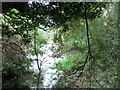
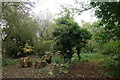
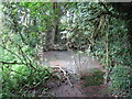
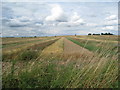
Nearby Images from Geograph Britain and Ireland:
©2019(licence)
©2016(licence)
©2010(licence)
©2010(licence)
©2016(licence)
The above images may not be of the site on this page, they are loaded from Geograph.
Please Submit an Image of this site or go out and take one for us!
Click here to see more info for this site
Nearby sites
Key: Red: member's photo, Blue: 3rd party photo, Yellow: other image, Green: no photo - please go there and take one, Grey: site destroyed
Download sites to:
KML (Google Earth)
GPX (GPS waypoints)
CSV (Garmin/Navman)
CSV (Excel)
To unlock full downloads you need to sign up as a Contributory Member. Otherwise downloads are limited to 50 sites.
Turn off the page maps and other distractions
Nearby sites listing. In the following links * = Image available
5.0km NE 35° West Butterwick Henge (SE813062)
9.4km NW 304° Hatfield Moor* Ancient Trackway (SE7060407233)
11.0km N 354° Crowle Stone* Early Christian Sculptured Stone (SE772130)
14.7km NE 48° Crosby Stone Natural Stone / Erratic / Other Natural Feature (SE893121)
15.4km ESE 104° Ashwell* Holy Well or Sacred Spring (SK936985)
17.0km NE 45° Dragonby* Natural Stone / Erratic / Other Natural Feature (SE905142)
17.6km ENE 63° Gokwell Priory (Broughton) Misc. Earthwork (SE94081028)
18.3km SE 128° St. Helen's Well (Hemswell)* Holy Well or Sacred Spring (SK932911)
18.5km NW 305° Bransdale Ridge BS1* Marker Stone (SE6318012415)
18.6km ENE 70° Broughton Cross* Ancient Cross (SE960086)
20.1km SSW 198° St John's Well (Welham) Holy Well or Sacred Spring (SK72558280)
20.6km W 274° Doncaster Museum and Art Gallery* Museum (SE579030)
20.6km NNE 26° Kell Well (Walcot)* Holy Well or Sacred Spring (SE873207)
20.9km SE 126° Aisthorpe springs Holy Well or Sacred Spring (SK956899)
21.7km NNE 27° Countess Close* Ancient Village or Settlement (SE879216)
21.9km NNE 27° Julian's Bower* Turf Maze (SE880218)
21.9km SSW 193° Castle Hill (Nottinghamshire) Hillfort (SK741806)
22.3km NE 46° Holy Well (Winterton) Holy Well or Sacred Spring (SE944178)
23.1km ESE 123° Newell's Well (Glentham) Holy Well or Sacred Spring (SK981897)
23.5km ENE 77° St. Helen's Well (Wrawby) Holy Well or Sacred Spring (TA0137907720)
23.9km W 263° Edlington Woods* Cave or Rock Shelter (SK548988)
24.4km S 190° Lady well (Headon)* Holy Well or Sacred Spring (SK7483877954)
25.7km W 271° Scabba Wood Rock Shelter Cave or Rock Shelter (SE527020)
25.9km E 92° The Maiden-Well Holy Well or Sacred Spring (TA045015)
26.1km E 92° Maiden Well (Maidenwell) Holy Well or Sacred Spring (TA047015)
View more nearby sites and additional images


 We would like to know more about this location. Please feel free to add a brief description and any relevant information in your own language.
 Wir möchten mehr über diese Stätte erfahren. Bitte zögern Sie nicht, eine kurze Beschreibung und relevante Informationen in Deutsch hinzuzufügen.
 Nous aimerions en savoir encore un peu sur les lieux. S'il vous plaît n'hesitez pas à ajouter une courte description et tous les renseignements pertinents dans votre propre langue.
 Quisieramos informarnos un poco más de las lugares. No dude en añadir una breve descripción y otros datos relevantes en su propio idioma.