<< Text Pages >> Cregg Lough Well - Holy Well or Sacred Spring in Ireland (Republic of) in Co. Galway
Submitted by KaiHofmann on Thursday, 25 April 2013 Page Views: 1819
Springs and Holy WellsSite Name: Cregg Lough WellCountry: Ireland (Republic of)
NOTE: This site is 11.385 km away from the location you searched for.
County: Co. Galway Type: Holy Well or Sacred Spring
Nearest Town: Clifden
Latitude: 53.495931N Longitude: 9.946869W
Condition:
| 5 | Perfect |
| 4 | Almost Perfect |
| 3 | Reasonable but with some damage |
| 2 | Ruined but still recognisable as an ancient site |
| 1 | Pretty much destroyed, possibly visible as crop marks |
| 0 | No data. |
| -1 | Completely destroyed |
| 5 | Superb |
| 4 | Good |
| 3 | Ordinary |
| 2 | Not Good |
| 1 | Awful |
| 0 | No data. |
| 5 | Can be driven to, probably with disabled access |
| 4 | Short walk on a footpath |
| 3 | Requiring a bit more of a walk |
| 2 | A long walk |
| 1 | In the middle of nowhere, a nightmare to find |
| 0 | No data. |
| 5 | co-ordinates taken by GPS or official recorded co-ordinates |
| 4 | co-ordinates scaled from a detailed map |
| 3 | co-ordinates scaled from a bad map |
| 2 | co-ordinates of the nearest village |
| 1 | co-ordinates of the nearest town |
| 0 | no data |
Be the first person to rate this site - see the 'Contribute!' box in the right hand menu.
Internal Links:
External Links:
Holy Well or Sacred Spring in Co. Galway
Holy well west of Cregg Lough, a cillin lies closeby to the south.
You may be viewing yesterday's version of this page. To see the most up to date information please register for a free account.
Do not use the above information on other web sites or publications without permission of the contributor.
Nearby Images from Geograph Britain and Ireland:
©2006(licence)
©2006(licence)
©2006(licence)
©2006(licence)
©2006(licence)
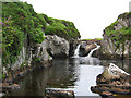
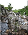
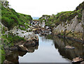
The above images may not be of the site on this page, they are loaded from Geograph.
Please Submit an Image of this site or go out and take one for us!
Click here to see more info for this site
Nearby sites
Click here to view sites on an interactive map of the areaKey: Red: member's photo, Blue: 3rd party photo, Yellow: other image, Green: no photo - please go there and take one, Grey: site destroyed
Download sites to:
KML (Google Earth)
GPX (GPS waypoints)
CSV (Garmin/Navman)
CSV (Excel)
To unlock full downloads you need to sign up as a Contributory Member. Otherwise downloads are limited to 50 sites.
Turn off the page maps and other distractions
Nearby sites listing. In the following links * = Image available
2.1km W 275° Lough Ouashleen Burial Chamber or Dolmen
2.4km NW 307° Lough Auna Tomb Burial Chamber or Dolmen
5.1km N 350° Baunoge Stone Row / Alignment (L701563)
5.6km WNW 283° Letternoosh Tomb Burial Chamber or Dolmen
5.8km N 358° Letterfrack Tomb Burial Chamber or Dolmen
6.0km NNW 347° Keelkyle Standing Stone (Menhir)
6.1km NNW 337° Roscrea Standing Stone (Menhir)
6.1km NW 313° Crocknaraw NE Standing Stones (L665556)
6.2km W 267° Clifden Cist Cist
6.3km W 280° Letterdeen* Standing Stone (Menhir)
6.5km NNW 339° Rosleague Standing Stones (L687574)
6.5km WNW 288° Streamstown Standing Stones (L647535)
6.5km WNW 288° Streamstown Stone Circle (L647535)
6.6km W 278° Letterdeen Tomb Burial Chamber or Dolmen
6.8km NW 311° Crocknaraw SW Standing Stones (L658559)
6.9km W 266° D'Arcy Stones 1* Standing Stones
7.0km W 265° D'Arcy Stones 2* Modern Stone Circle etc
7.1km NW 323° Cloonederown Standing Stones
7.9km W 264° Mannin Bay Fish Weir Ancient Mine, Quarry or other Industry
8.0km NE 34° Pollacappul Burial Chamber or Dolmen
8.7km NW 320° St Gregory's Well (Doonen) Holy Well or Sacred Spring (L65375807)
9.2km NW 318° St Ceannanach's Church (Catron) Ancient Cross (L64795828)
9.7km NNW 346° Derryinver* Stone Row / Alignment (L688608)
9.7km NW 313° Carton Island Crannog
10.2km W 277° Knockavally Megalithic Tomb II Burial Chamber or Dolmen
View more nearby sites and additional images


 We would like to know more about this location. Please feel free to add a brief description and any relevant information in your own language.
 Wir möchten mehr über diese Stätte erfahren. Bitte zögern Sie nicht, eine kurze Beschreibung und relevante Informationen in Deutsch hinzuzufügen.
 Nous aimerions en savoir encore un peu sur les lieux. S'il vous plaît n'hesitez pas à ajouter une courte description et tous les renseignements pertinents dans votre propre langue.
 Quisieramos informarnos un poco más de las lugares. No dude en añadir una breve descripción y otros datos relevantes en su propio idioma.