<< Text Pages >> St John's Well (Dronfield) - Holy Well or Sacred Spring in England in Derbyshire
Submitted by Anne T on Monday, 08 January 2018 Page Views: 1400
Springs and Holy WellsSite Name: St John''s Well (Dronfield)Country: England
NOTE: This site is 1.665 km away from the location you searched for.
County: Derbyshire Type: Holy Well or Sacred Spring
Nearest Town: Dronfield
Map Ref: SK353783
Latitude: 53.300482N Longitude: 1.471791W
Condition:
| 5 | Perfect |
| 4 | Almost Perfect |
| 3 | Reasonable but with some damage |
| 2 | Ruined but still recognisable as an ancient site |
| 1 | Pretty much destroyed, possibly visible as crop marks |
| 0 | No data. |
| -1 | Completely destroyed |
| 5 | Superb |
| 4 | Good |
| 3 | Ordinary |
| 2 | Not Good |
| 1 | Awful |
| 0 | No data. |
| 5 | Can be driven to, probably with disabled access |
| 4 | Short walk on a footpath |
| 3 | Requiring a bit more of a walk |
| 2 | A long walk |
| 1 | In the middle of nowhere, a nightmare to find |
| 0 | No data. |
| 5 | co-ordinates taken by GPS or official recorded co-ordinates |
| 4 | co-ordinates scaled from a detailed map |
| 3 | co-ordinates scaled from a bad map |
| 2 | co-ordinates of the nearest village |
| 1 | co-ordinates of the nearest town |
| 0 | no data |
Be the first person to rate this site - see the 'Contribute!' box in the right hand menu.
Internal Links:
External Links:
Holy Well or Sacred Spring in Derbyshire
The Northern Antiquarian (TNA) features a page for this holy well - see their entry for St John’s Well, Dronfield, Derbyshire, which gives directions for finding this well, together with photographs and a description.
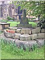
TNA tells us: " According to local historian Mr. Ken Ward, the well is that now found in the courtyard of the forge: a 16th century building now developed into a small shopping complex. He states it is 80 metres from the south porch of the church supporting Bassano’s location. The site is along Church Street (previously Church Lane) which he believes was once called St. John’s Lane. The well is a circular one with modern stonework on the top. However, this encloses a much older ring of six layers with a grill apparently opening out into a larger chamber below. It appears to be a deeper well than would be expected, but it is spring-fed and was presumably deepened for use in the forge."
Note: Have you visited this site? Do you have any photographs or information to add?
You may be viewing yesterday's version of this page. To see the most up to date information please register for a free account.
Do not use the above information on other web sites or publications without permission of the contributor.
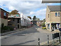
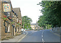
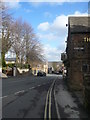
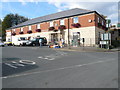
Nearby Images from Geograph Britain and Ireland:
©2007(licence)
©2007(licence)
©2008(licence)
©2007(licence)
©2019(licence)
The above images may not be of the site on this page, they are loaded from Geograph.
Please Submit an Image of this site or go out and take one for us!
Click here to see more info for this site
Nearby sites
Key: Red: member's photo, Blue: 3rd party photo, Yellow: other image, Green: no photo - please go there and take one, Grey: site destroyed
Download sites to:
KML (Google Earth)
GPX (GPS waypoints)
CSV (Garmin/Navman)
CSV (Excel)
To unlock full downloads you need to sign up as a Contributory Member. Otherwise downloads are limited to 50 sites.
Turn off the page maps and other distractions
Nearby sites listing. In the following links * = Image available
5.2km WNW 303° Peace Well* Holy Well or Sacred Spring (SK3093881126)
5.5km NNW 331° Ecclesall Woods* Rock Art (SK326831)
6.2km W 268° Owler Bar Cairn (SK291780)
6.5km W 277° Brown Edge* Stone Circle (SK288790)
6.8km WNW 284° Strawberry Lea* Ring Cairn (SK287799)
6.9km WSW 247° Barbrook 4* Ring Cairn (SK2896375621)
6.9km WNW 297° Giant's Chair (Yorkshire)* Standing Stone (Menhir) (SK291814)
7.0km W 262° Barbrook 3* Stone Circle (SK28337728)
7.7km NE 47° Birley Spa Holy Well or Sacred Spring (SK40908361)
7.8km WSW 250° Barbrook cairn* Cairn (SK27917561)
7.9km WSW 250° Barbrook 1* Stone Circle (SK27857558)
7.9km WSW 251° Big Moor Cairn Field* Barrow Cemetery (SK278757)
7.9km WSW 252° Barbrook 2* Stone Circle (SK27757582)
7.9km WNW 299° God's Spring* Holy Well or Sacred Spring (SK283821)
8.1km WSW 252° Big Moor Cairns SW* Barrow Cemetery (SK27587579)
8.1km WSW 251° Barbrook Cupmarked Stone* Standing Stone (Menhir) (SK27647560)
8.1km WNW 288° Ciceley Low I* Ring Cairn (SK2752080782)
8.1km WNW 288° Ciceley Low II* Ring Cairn (SK2752080782)
8.2km WNW 300° Harrys Stone* Ancient Temple (SK282824)
8.3km WSW 250° Big Moor* Ancient Village or Settlement (SK275754)
8.3km SW 235° Birchen Edge 1* Ring Cairn (SK285735)
8.4km WNW 288° Fingerem Stone* Cairn (SK273809)
8.4km W 266° The Hurkling Stone* Marker Stone (SK269777)
8.5km W 266° White Edge Cairn* Cairn (SK26847762)
8.7km WSW 248° Swine Sty* Ancient Village or Settlement (SK272750)
View more nearby sites and additional images


 We would like to know more about this location. Please feel free to add a brief description and any relevant information in your own language.
 Wir möchten mehr über diese Stätte erfahren. Bitte zögern Sie nicht, eine kurze Beschreibung und relevante Informationen in Deutsch hinzuzufügen.
 Nous aimerions en savoir encore un peu sur les lieux. S'il vous plaît n'hesitez pas à ajouter une courte description et tous les renseignements pertinents dans votre propre langue.
 Quisieramos informarnos un poco más de las lugares. No dude en añadir una breve descripción y otros datos relevantes en su propio idioma.