<< Our Photo Pages >> Lavenham Close - Round Barrow(s) in England in Cheshire
Submitted by vicky on Monday, 22 July 2002 Page Views: 5123
Neolithic and Bronze AgeSite Name: Lavenham CloseCountry: England
NOTE: This site is 0.461 km away from the location you searched for.
County: Cheshire Type: Round Barrow(s)
Nearest Town: Macclesfield Nearest Village: Tytherington
Map Ref: SJ914749 Landranger Map Number: 118
Latitude: 53.271017N Longitude: 2.130412W
Condition:
| 5 | Perfect |
| 4 | Almost Perfect |
| 3 | Reasonable but with some damage |
| 2 | Ruined but still recognisable as an ancient site |
| 1 | Pretty much destroyed, possibly visible as crop marks |
| 0 | No data. |
| -1 | Completely destroyed |
| 5 | Superb |
| 4 | Good |
| 3 | Ordinary |
| 2 | Not Good |
| 1 | Awful |
| 0 | No data. |
| 5 | Can be driven to, probably with disabled access |
| 4 | Short walk on a footpath |
| 3 | Requiring a bit more of a walk |
| 2 | A long walk |
| 1 | In the middle of nowhere, a nightmare to find |
| 0 | No data. |
| 5 | co-ordinates taken by GPS or official recorded co-ordinates |
| 4 | co-ordinates scaled from a detailed map |
| 3 | co-ordinates scaled from a bad map |
| 2 | co-ordinates of the nearest village |
| 1 | co-ordinates of the nearest town |
| 0 | no data |
Internal Links:
External Links:
")
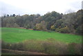
This site is a Bronze Age round barrow located in a cul-de-sac on a knoll to the north of Beech Hall school.
As at Woodhouse End, the site was used as a dug out by the Home Guard during the Second World War. In 1973 an investigation of a spoil heap from one of their trenches revealed nineteen small fragments of pottery and a small quantity of calcinated human bones. The sherds were described as being red on the outside and black in the interior, some of which were decorated with dots and believed to be the remains of a Collared urn.
Access
This barrow can be found in the cul-de-sac of Lavenham Close on the Tytherington Estate, to the rear of Beech Hall School.
References
Cheshire County Sites and Monuments Record
G. Rowley “Macclesfield in Prehistory” (1982)
D.M.Longley “Prehistory” in C.R.Elrington (ed) “The Victoria History of the County of Chester, volume 1, Oxford University Press (1987)
You may be viewing yesterday's version of this page. To see the most up to date information please register for a free account.
Do not use the above information on other web sites or publications without permission of the contributor.
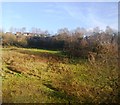
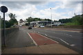
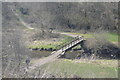
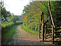
Nearby Images from Geograph Britain and Ireland:
©2013(licence)
©2014(licence)
©2016(licence)
©2006(licence)
©2015(licence)
The above images may not be of the site on this page, they are loaded from Geograph.
Please Submit an Image of this site or go out and take one for us!
Click here to see more info for this site
Nearby sites
Key: Red: member's photo, Blue: 3rd party photo, Yellow: other image, Green: no photo - please go there and take one, Grey: site destroyed
Download sites to:
KML (Google Earth)
GPX (GPS waypoints)
CSV (Garmin/Navman)
CSV (Excel)
To unlock full downloads you need to sign up as a Contributory Member. Otherwise downloads are limited to 50 sites.
Turn off the page maps and other distractions
Nearby sites listing. In the following links * = Image available
200m S 180° Beech Hall Round Barrow(s) (SJ914747)
720m SW 236° Macclesfield Cemetery* Round Barrow(s) (SJ908745)
761m SSW 203° West Park Crosses* Ancient Cross (SJ911742)
854m SSW 200° West Park Boulder* Natural Stone / Erratic / Other Natural Feature (SJ911741)
1.7km W 277° Prestbury Road (Macclesfield)* Ancient Cross (SJ89727511)
1.8km S 170° St Anne's Well (Macclesfield)* Holy Well or Sacred Spring (SJ917731)
2.4km NNW 327° St Peter (Prestbury)* Ancient Cross (SJ9008676910)
2.9km SE 125° Macclesfield Common I Round Barrow(s) (SJ938732)
3.0km ESE 123° Macclesfield Common II Round Barrow(s) (SJ939733)
3.1km N 353° Butley Stone Circle (SJ9178)
3.4km SW 232° New Farm, Henbury* Stone Circle (SJ887728)
3.5km NNW 348° Bonis Hall Lane* Round Barrow(s) (SJ907783)
3.5km N 349° Butley Barrow* Round Barrow(s) (SJ9072278334)
3.7km SE 126° Teggs Nose Farm Round Barrow(s) (SJ944727)
3.8km SSE 163° Sutton Hall* Round Barrow(s) (SJ925713)
4.4km ENE 70° Gin Clough Farm* Standing Stone (Menhir) (SJ9554076365)
4.6km ENE 68° Black Rock Farm* Round Barrow(s) (SJ957766)
4.7km SE 133° Langley Conical mound* Round Barrow(s) (SJ948717)
4.7km NNE 34° Nab Head (Cheshire)* Round Barrow(s) (SJ940788)
4.8km ENE 64° Great Low Hillfort (SJ957770)
4.9km NE 55° Little Low Round Barrow(s) (SJ954777)
4.9km NNE 31° Nab Wood Round Barrow(s) (SJ939791)
4.9km SE 128° Teggs Nose reservoir* Round Barrow(s) (SJ953719)
4.9km SW 234° Bearhurst Farm* Round Barrow(s) (SJ874720)
5.0km NNW 345° Adlington Hall pre-Norman cross* Ancient Cross (SJ901797)
View more nearby sites and additional images


 We would like to know more about this location. Please feel free to add a brief description and any relevant information in your own language.
 Wir möchten mehr über diese Stätte erfahren. Bitte zögern Sie nicht, eine kurze Beschreibung und relevante Informationen in Deutsch hinzuzufügen.
 Nous aimerions en savoir encore un peu sur les lieux. S'il vous plaît n'hesitez pas à ajouter une courte description et tous les renseignements pertinents dans votre propre langue.
 Quisieramos informarnos un poco más de las lugares. No dude en añadir una breve descripción y otros datos relevantes en su propio idioma.