<< Our Photo Pages >> Bod-Silin Cairns - Barrow Cemetery in Wales in Conwy
Submitted by Bladup on Friday, 18 November 2016 Page Views: 1801
Neolithic and Bronze AgeSite Name: Bod-Silin CairnsCountry: Wales County: Conwy Type: Barrow Cemetery
Map Ref: SH67647205
Latitude: 53.228948N Longitude: 3.984289W
Condition:
| 5 | Perfect |
| 4 | Almost Perfect |
| 3 | Reasonable but with some damage |
| 2 | Ruined but still recognisable as an ancient site |
| 1 | Pretty much destroyed, possibly visible as crop marks |
| 0 | No data. |
| -1 | Completely destroyed |
| 5 | Superb |
| 4 | Good |
| 3 | Ordinary |
| 2 | Not Good |
| 1 | Awful |
| 0 | No data. |
| 5 | Can be driven to, probably with disabled access |
| 4 | Short walk on a footpath |
| 3 | Requiring a bit more of a walk |
| 2 | A long walk |
| 1 | In the middle of nowhere, a nightmare to find |
| 0 | No data. |
| 5 | co-ordinates taken by GPS or official recorded co-ordinates |
| 4 | co-ordinates scaled from a detailed map |
| 3 | co-ordinates scaled from a bad map |
| 2 | co-ordinates of the nearest village |
| 1 | co-ordinates of the nearest town |
| 0 | no data |
Internal Links:
External Links:
")
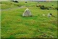
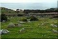
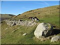
At least three cairns (OS 25000 map shows two), a couple of hut circles and a field system.
You may be viewing yesterday's version of this page. To see the most up to date information please register for a free account.
")
")
")
")
Do not use the above information on other web sites or publications without permission of the contributor.
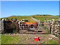
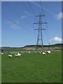
Nearby Images from Geograph Britain and Ireland:
©2021(licence)
©2009(licence)
©2017(licence)
©2009(licence)
©2015(licence)
The above images may not be of the site on this page, they are loaded from Geograph.
Please Submit an Image of this site or go out and take one for us!
Click here to see more info for this site
Nearby sites
Key: Red: member's photo, Blue: 3rd party photo, Yellow: other image, Green: no photo - please go there and take one, Grey: site destroyed
Download sites to:
KML (Google Earth)
GPX (GPS waypoints)
CSV (Garmin/Navman)
CSV (Excel)
To unlock full downloads you need to sign up as a Contributory Member. Otherwise downloads are limited to 50 sites.
Turn off the page maps and other distractions
Nearby sites listing. In the following links * = Image available
253m S 187° Wern-y-Pandy Settlement* Ancient Village or Settlement (SH676718)
367m SSE 147° Carnedd y Saeson* Cairn (SH6783471738)
379m E 91° Nant y Felin-fach Cairn* Cairn (SH68027203)
445m S 169° Foel Dduarth (West)* Ancient Village or Settlement (SH67717161)
463m SSW 211° Anafon Valley Cairns* Cairn (SH67397166)
474m SE 129° Foel Dduarth (Centre)* Ancient Village or Settlement (SH68007174)
585m ESE 102° Foel Dduarth (East)* Ancient Village or Settlement (SH68217191)
960m E 79° Foel Ganol* Cairn (SH68597221)
1.3km SSW 204° Meuryn Isaf Cairn (SH671709)
1.4km WNW 287° Maes Y Gaer* Hillfort (SH663725)
1.5km E 83° Carn yr Llechwedd* Cairn (SH691722)
1.6km ENE 77° Ffridd Newydd Arrow stones* Rock Art (SH69237238)
1.8km E 80° Maen Ffordd Rufeinig* Standing Stone (Menhir) (SH694723)
1.9km SSW 207° Coed Aber Roundhouse* Ancient Village or Settlement (SH6674570381)
1.9km ESE 122° Afon Anafon Arrow Stone* Sculptured Stone (SH69267098)
2.1km ENE 57° Garreg Fawr* Carving (SH6939373132)
2.5km WSW 241° Cras (Gwynedd)* Cairn (SH65397089)
2.8km WSW 240° Cairn N of Moel Wnion* Cairn (SH65197071)
2.9km NE 52° Dinas Settlement* Ancient Village or Settlement (SH700738)
3.3km E 89° Llanerch Fedw* Cairn (SH709720)
3.4km ESE 114° Carnedd y Ddelw* Clava Cairn (SH707706)
3.6km SW 227° Moel Wnion (Gwynedd)* Cairn (SH64966971)
3.8km E 92° Bwlch y Ddeufaen N Standing Stone (Menhir) (SH7145671828)
3.9km E 93° Bwlch y Ddeufaen S Standing Stone (Menhir) (SH7151071772)
4.0km E 95° Barclodiad-y-Gawres (Conwy)* Cairn (SH716716)
View more nearby sites and additional images


 We would like to know more about this location. Please feel free to add a brief description and any relevant information in your own language.
 Wir möchten mehr über diese Stätte erfahren. Bitte zögern Sie nicht, eine kurze Beschreibung und relevante Informationen in Deutsch hinzuzufügen.
 Nous aimerions en savoir encore un peu sur les lieux. S'il vous plaît n'hesitez pas à ajouter une courte description et tous les renseignements pertinents dans votre propre langue.
 Quisieramos informarnos un poco más de las lugares. No dude en añadir una breve descripción y otros datos relevantes en su propio idioma.