<< Our Photo Pages >> Llain y Maen - Standing Stone (Menhir) in Wales in Gwynedd
Submitted by TAlanJones on Sunday, 26 May 2024 Page Views: 31
Neolithic and Bronze AgeSite Name: Llain y MaenCountry: Wales County: Gwynedd Type: Standing Stone (Menhir)
Nearest Town: Blaenau Ffestiniog
Map Ref: SH7025245687
Latitude: 52.992752N Longitude: 3.934521W
Condition:
| 5 | Perfect |
| 4 | Almost Perfect |
| 3 | Reasonable but with some damage |
| 2 | Ruined but still recognisable as an ancient site |
| 1 | Pretty much destroyed, possibly visible as crop marks |
| 0 | No data. |
| -1 | Completely destroyed |
| 5 | Superb |
| 4 | Good |
| 3 | Ordinary |
| 2 | Not Good |
| 1 | Awful |
| 0 | No data. |
| 5 | Can be driven to, probably with disabled access |
| 4 | Short walk on a footpath |
| 3 | Requiring a bit more of a walk |
| 2 | A long walk |
| 1 | In the middle of nowhere, a nightmare to find |
| 0 | No data. |
| 5 | co-ordinates taken by GPS or official recorded co-ordinates |
| 4 | co-ordinates scaled from a detailed map |
| 3 | co-ordinates scaled from a bad map |
| 2 | co-ordinates of the nearest village |
| 1 | co-ordinates of the nearest town |
| 0 | no data |
Internal Links:
External Links:
")
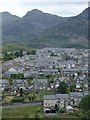
Situated within the town of Blaenau Ffestiniog the stone lies along Wynne Ave, 100m+ to the north of the town's health centre. Although not a standing stone exactly this unassuming boulder, passed by pedestrians and motorists daily, does have an interesting pedigree and as such it deserves its location at this spot and, in my view, a place on the Megalithic Portal map.
As you may be aware Blaenau Ffestiniog town developed in the frist half of the 19th century during the heyday of the Welsh Slate industry. Prior to this the area was sparsely populated with a few homesteads scattered along the mountainside. One such homestead was Maenofferen farm which was located at this spot and it is believed that this stone was one of several stones that formed an earlier monument on the landscape. The farm burnt down during the 19th century and Maenofferen Chappel replaced it as the town developed. Today the area consists of private and supported housing with the stone occupying a low verge at the enteance of a supported housing car park. Maenofferen means 'many stones or stone mass' indicating the possibility of a prehistoric stone circle, and local legend states that this stone was an offering/sacrificial stone at the centre of the circle. As a further endorsement the exact spot where this stone lies has its own official place name. It is called Llain y Maen - the Place of the Stone or Stone Site in English.
The stone measures 1.6m at its longest with a depth of 1.4m and its height is 0.8m.
An unassuming yet interesting stone.
You may be viewing yesterday's version of this page. To see the most up to date information please register for a free account.
")
")
")
Do not use the above information on other web sites or publications without permission of the contributor.
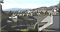
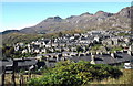
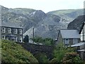
Nearby Images from Geograph Britain and Ireland:
©2007(licence)
©2007(licence)
©2016(licence)
©2014(licence)
©2014(licence)
The above images may not be of the site on this page, they are loaded from Geograph.
Please Submit an Image of this site or go out and take one for us!
Click here to see more info for this site
Nearby sites
Key: Red: member's photo, Blue: 3rd party photo, Yellow: other image, Green: no photo - please go there and take one, Grey: site destroyed
Download sites to:
KML (Google Earth)
GPX (GPS waypoints)
CSV (Garmin/Navman)
CSV (Excel)
To unlock full downloads you need to sign up as a Contributory Member. Otherwise downloads are limited to 50 sites.
Turn off the page maps and other distractions
Nearby sites listing. In the following links * = Image available
489m S 185° Cwm Bowydd Farm Hut Circle* Ancient Village or Settlement (SH702452)
922m ESE 105° Pen Mawr Afon Du Bach* Natural Stone / Erratic / Other Natural Feature (SH71144543)
984m SSW 196° Y Garth Settlement* Ancient Village or Settlement (SH69954475)
1.1km WSW 258° Gelli Gonan* Ancient Village or Settlement (SH692455)
1.4km SSW 207° Cistfaen Llys Dorfil* Cist (SH69584447)
1.4km SSW 208° Llys Dorfil* Ancient Village or Settlement (SH69574447)
1.4km SSW 208° Llys Dorfil Hut Circle* Ancient Village or Settlement (SH69564447)
1.5km SSW 192° Llanerch Y Moch standing stone* Modern Stone Circle etc (SH699442)
1.9km S 181° Llwyn y Crair Sphynx* Natural Stone / Erratic / Other Natural Feature (SH70184374)
2.1km SSW 193° Coed y Cribau Hut Circle* Ancient Village or Settlement (SH69744365)
2.2km SSE 147° Settlement South of Manod Bach* Ancient Village or Settlement (SH714438)
2.4km SSW 192° Cymerau Uchaf* Ancient Village or Settlement (SH697434)
2.4km ESE 114° Manod Mawr Shelter Modern Stone Circle etc (SH7239544666)
2.6km N 4° Hut Circle West of Llynnau Barlwyd* Ancient Village or Settlement (SH70504830)
2.6km N 6° Cairn West of Llynnau Barlwyd* Cairn (SH70624831)
2.8km SE 146° Cwm Teigl Stones* Stone Row / Alignment (SH718433)
2.9km N 5° Moel Farlwyd Hut Circle* Ancient Village or Settlement (SH7058448535)
2.9km ESE 119° Cwm Teigl Settlement* Ancient Village or Settlement (SH7278244175)
3.0km SE 124° Cwm Teigl Hut Circle* Ancient Village or Settlement (SH7273543921)
3.0km WSW 237° Llyn Ystradau Settlement* Ancient Village or Settlement (SH67654410)
3.2km S 174° Blaen Ddol Hut Circle Settlement Ancient Village or Settlement (SH705425)
3.2km SW 225° Nant Ystrad Hut Circle* Ancient Village or Settlement (SH67924345)
3.3km SW 223° Nant Ystradau Cist* Cist (SH67934337)
3.3km SW 222° Plas Ystrad Hut Circle* Ancient Village or Settlement (SH67954325)
3.4km SW 235° Nant Ddu Cairn* Cairn (SH6745243810)
View more nearby sites and additional images


 We would like to know more about this location. Please feel free to add a brief description and any relevant information in your own language.
 Wir möchten mehr über diese Stätte erfahren. Bitte zögern Sie nicht, eine kurze Beschreibung und relevante Informationen in Deutsch hinzuzufügen.
 Nous aimerions en savoir encore un peu sur les lieux. S'il vous plaît n'hesitez pas à ajouter une courte description et tous les renseignements pertinents dans votre propre langue.
 Quisieramos informarnos un poco más de las lugares. No dude en añadir una breve descripción y otros datos relevantes en su propio idioma.