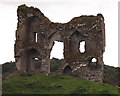
<< Our Photo Pages >> Rosslara - Wedge Tomb in Ireland (Republic of) in Co. Clare
Submitted by Enkidu41 on Thursday, 03 June 2004 Page Views: 7622
Neolithic and Bronze AgeSite Name: RosslaraCountry: Ireland (Republic of)
NOTE: This site is 9.256 km away from the location you searched for.
County: Co. Clare Type: Wedge Tomb
Nearest Town: Ennis Nearest Village: Broadford
Map Ref: R531819
Discovery Map Number: D58
Latitude: 52.886272N Longitude: 8.697453W
Condition:
| 5 | Perfect |
| 4 | Almost Perfect |
| 3 | Reasonable but with some damage |
| 2 | Ruined but still recognisable as an ancient site |
| 1 | Pretty much destroyed, possibly visible as crop marks |
| 0 | No data. |
| -1 | Completely destroyed |
| 5 | Superb |
| 4 | Good |
| 3 | Ordinary |
| 2 | Not Good |
| 1 | Awful |
| 0 | No data. |
| 5 | Can be driven to, probably with disabled access |
| 4 | Short walk on a footpath |
| 3 | Requiring a bit more of a walk |
| 2 | A long walk |
| 1 | In the middle of nowhere, a nightmare to find |
| 0 | No data. |
| 5 | co-ordinates taken by GPS or official recorded co-ordinates |
| 4 | co-ordinates scaled from a detailed map |
| 3 | co-ordinates scaled from a bad map |
| 2 | co-ordinates of the nearest village |
| 1 | co-ordinates of the nearest town |
| 0 | no data |
Internal Links:
External Links:
")
In a field by a minor road off the R352 the collapsed 12' by 8' capstone of this ruined wedge tomb lies propped up by an ash tree which has grown up through the chamber
You may be viewing yesterday's version of this page. To see the most up to date information please register for a free account.
Do not use the above information on other web sites or publications without permission of the contributor.
Nearby Images from Geograph Britain and Ireland:
©2011(licence)

©2021(licence)

©2021(licence)

©2021(licence)

©2021(licence)
The above images may not be of the site on this page, they are loaded from Geograph.
Please Submit an Image of this site or go out and take one for us!
Click here to see more info for this site
Nearby sites
Click here to view sites on an interactive map of the areaKey: Red: member's photo, Blue: 3rd party photo, Yellow: other image, Green: no photo - please go there and take one, Grey: site destroyed
Download sites to:
KML (Google Earth)
GPX (GPS waypoints)
CSV (Garmin/Navman)
CSV (Excel)
To unlock full downloads you need to sign up as a Contributory Member. Otherwise downloads are limited to 50 sites.
Turn off the page maps and other distractions
Nearby sites listing. In the following links * = Image available
2.4km SE 141° Coolbaun* Burial Chamber or Dolmen (R546800)
6.6km WSW 252° Milltown Wedge Tomb* Wedge Tomb (R468799)
9.1km SSE 151° Broadford* Burial Chamber or Dolmen (R574739)
10.2km WSW 241° Magh Adair* Standing Stone (Menhir) (R441770)
10.9km W 261° Knockaroura* Stone Row / Alignment (R423803)
13.3km SW 221° Knappogue* Standing Stones (R443719)
13.6km SSW 206° Craggaunowen* Crannog (R471697)
15.1km WNW 292° Caheraphuca Wedge Tomb (R391878)
16.7km SW 227° Mooghaun* Hillfort
16.8km E 79° Innis Cealtra* Portal Tomb (R697850)
19.1km W 267° Ballyallia Lake Stone Circle (R340810)
24.4km ESE 104° Barbaha Stone Row / Alignment (R768759)
24.7km ESE 103° Coumroe Stone Circle (R772763)
25.0km W 276° St Tola's High Cross (Dysert O'Dea) Ancient Cross
26.0km NNW 335° Crannagh* Portal Tomb (M425057)
27.4km NW 305° Cappaghkennedy* Wedge Tomb (R307978)
27.6km WNW 290° Killinaboy Church Early Christian Sculptured Stone (R27139158)
27.8km WNW 302° Slievenaglasha* Wedge Tomb (R295968)
28.4km WNW 301° Tullycommon* Wedge Tomb (R287966)
28.7km WNW 303° Castletown Souterrain* Souterrain (Fogou, Earth House) (R291978)
28.8km WNW 294° Commons North 2* Wedge Tomb (R269940)
28.8km WNW 300° Cahercommaun* Hillfort (R282965)
28.8km WNW 303° Castletown Wedge Tomb* Wedge Tomb (R290978)
28.8km WNW 294° Commons North 1* Wedge Tomb (R2685394031)
29.0km WNW 293° Parknabinnia 3* Wedge Tomb (R26489357)
View more nearby sites and additional images


 We would like to know more about this location. Please feel free to add a brief description and any relevant information in your own language.
 Wir möchten mehr über diese Stätte erfahren. Bitte zögern Sie nicht, eine kurze Beschreibung und relevante Informationen in Deutsch hinzuzufügen.
 Nous aimerions en savoir encore un peu sur les lieux. S'il vous plaît n'hesitez pas à ajouter une courte description et tous les renseignements pertinents dans votre propre langue.
 Quisieramos informarnos un poco más de las lugares. No dude en añadir una breve descripción y otros datos relevantes en su propio idioma.