<< Our Photo Pages >> Tyddyn Felin hut circle E - Ancient Village or Settlement in Wales in Gwynedd
Submitted by TAlanJones on Tuesday, 17 January 2023 Page Views: 1613
Multi-periodSite Name: Tyddyn Felin hut circle ECountry: Wales
NOTE: This site is 1.886 km away from the location you searched for.
County: Gwynedd Type: Ancient Village or Settlement
Nearest Town: Trawsfynydd
Map Ref: SH7132037130
Latitude: 52.916132N Longitude: 3.915218W
Condition:
| 5 | Perfect |
| 4 | Almost Perfect |
| 3 | Reasonable but with some damage |
| 2 | Ruined but still recognisable as an ancient site |
| 1 | Pretty much destroyed, possibly visible as crop marks |
| 0 | No data. |
| -1 | Completely destroyed |
| 5 | Superb |
| 4 | Good |
| 3 | Ordinary |
| 2 | Not Good |
| 1 | Awful |
| 0 | No data. |
| 5 | Can be driven to, probably with disabled access |
| 4 | Short walk on a footpath |
| 3 | Requiring a bit more of a walk |
| 2 | A long walk |
| 1 | In the middle of nowhere, a nightmare to find |
| 0 | No data. |
| 5 | co-ordinates taken by GPS or official recorded co-ordinates |
| 4 | co-ordinates scaled from a detailed map |
| 3 | co-ordinates scaled from a bad map |
| 2 | co-ordinates of the nearest village |
| 1 | co-ordinates of the nearest town |
| 0 | no data |
Internal Links:
External Links:
")
Identified by Coflein as a hut circle with a 4m diameter with 'wandering wall that extends c36m W, and fragmentary walls to N&E that define overall enclosure c45m E/W. Low earthworks in pasture, on S bank of river' NPRN 89433.
Sad to say there was no visible hut circle when I visited. The site area was very boggy with a raised levelled area to the SW. There was an area of aligned stones a little to the west but this looked like a more modern occurrence.
I visited the site following a conversation with the land owner. He was not aware of any archaeological sites within the pasture identified.
You may be viewing yesterday's version of this page. To see the most up to date information please register for a free account.
")
")
")
Do not use the above information on other web sites or publications without permission of the contributor.
Nearby Images from Geograph Britain and Ireland:
©2017(licence)
©2007(licence)
©2007(licence)

©2017(licence)
©2007(licence)
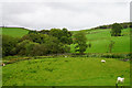
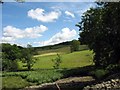
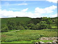
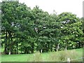
The above images may not be of the site on this page, they are loaded from Geograph.
Please Submit an Image of this site or go out and take one for us!
Click here to see more info for this site
Nearby sites
Key: Red: member's photo, Blue: 3rd party photo, Yellow: other image, Green: no photo - please go there and take one, Grey: site destroyed
Download sites to:
KML (Google Earth)
GPX (GPS waypoints)
CSV (Garmin/Navman)
CSV (Excel)
To unlock full downloads you need to sign up as a Contributory Member. Otherwise downloads are limited to 50 sites.
Turn off the page maps and other distractions
Nearby sites listing. In the following links * = Image available
1.3km NNW 340° Barrows at Tomen Y Mur* Barrow Cemetery (SH7091038330)
1.3km NNW 344° Llwyn Crwn Roman Burial Mounds* Artificial Mound (SH710384)
1.3km NNW 336° Roman Military Road south of Tomen Y Mur* Ancient Trackway (SH7081038350)
1.6km ENE 63° Dolbelydr Enclosed Hut Circle Settlement* Ancient Village or Settlement (SH7272037810)
1.6km NNW 339° Sarn Helen Roman Military Road (Tomen Y Mur)* Ancient Trackway (SH708386)
1.7km NNW 332° Tomen Y Mur (The Wall Mound)* Artificial Mound (SH70553867)
1.8km NNW 338° Julius Perpetuus was here* Marker Stone (SH707388)
1.9km NNW 343° Roman Amphitheatre at Tomen Y Mur* Misc. Earthwork (SH70813891)
2.1km ENE 70° Roman Burial Mound (Dolddinas)* Artificial Mound (SH7331337786)
2.2km ENE 69° Dolddinas Roman Practice Camps* Ancient Village or Settlement (SH7340037880)
2.6km ENE 57° Craig Wen Hut Circle and oval enclosure/annex* Ancient Village or Settlement (SH7354038510)
3.2km NW 307° Nurse Cae Du Enclosed Hut Circle Settlement* Ancient Village or Settlement (SH688391)
3.2km WSW 244° Taith Cambria (Cambrian Way)* Ancient Trackway (SH684358)
3.3km SSE 146° Fridd Bodyfyddau enclosed settlement* Ancient Village or Settlement (SH731343)
3.5km N 3° The Stone of Goronwy* Holed Stone (SH7156640579)
3.7km NW 315° Tyddyn Cwper Enclosed Settlement* Ancient Village or Settlement (SH6880039810)
3.8km E 87° Nant Bryn Celynog Settlement* Ancient Village or Settlement (SH7511037210)
3.8km E 88° Nant Bryn Celynog Enclosure* Ancient Village or Settlement (SH7517037170)
3.9km SSE 149° Hut Circle Settlement north west of Craiglaseithin* Ancient Village or Settlement (SH7323033760)
3.9km SSE 160° Ffridd Glap Cairn Field* Barrow Cemetery (SH7256033450)
3.9km E 86° Nant Bryn Celynog Stone and possible Cairn* Standing Stone (Menhir) (SH7523037280)
3.9km SSE 159° Ffridd Glap Kerb Cairn* Cairn (SH7264233441)
4.1km SSE 154° Stones West of Craiglaseithin* Natural Stone / Erratic / Other Natural Feature (SH7300033390)
4.1km SE 143° Hut Circle Settlement west of Moel Oernant* Ancient Village or Settlement (SH7369033760)
4.1km WSW 250° Hut Circle West of Moelfryn Isaf* Ancient Village or Settlement (SH674358)
View more nearby sites and additional images


 We would like to know more about this location. Please feel free to add a brief description and any relevant information in your own language.
 Wir möchten mehr über diese Stätte erfahren. Bitte zögern Sie nicht, eine kurze Beschreibung und relevante Informationen in Deutsch hinzuzufügen.
 Nous aimerions en savoir encore un peu sur les lieux. S'il vous plaît n'hesitez pas à ajouter une courte description et tous les renseignements pertinents dans votre propre langue.
 Quisieramos informarnos un poco más de las lugares. No dude en añadir una breve descripción y otros datos relevantes en su propio idioma.