<< Our Photo Pages >> Careby Camp - Hillfort in England in Lincolnshire
Submitted by vicky on Wednesday, 17 March 2004 Page Views: 10022
Iron Age and Later PrehistorySite Name: Careby CampCountry: England
NOTE: This site is 7.044 km away from the location you searched for.
County: Lincolnshire Type: Hillfort
Nearest Town: Stamford Nearest Village: Witham on the Hill
Map Ref: TF040157 Landranger Map Number: 130
Latitude: 52.728952N Longitude: 0.461376W
Condition:
| 5 | Perfect |
| 4 | Almost Perfect |
| 3 | Reasonable but with some damage |
| 2 | Ruined but still recognisable as an ancient site |
| 1 | Pretty much destroyed, possibly visible as crop marks |
| 0 | No data. |
| -1 | Completely destroyed |
| 5 | Superb |
| 4 | Good |
| 3 | Ordinary |
| 2 | Not Good |
| 1 | Awful |
| 0 | No data. |
| 5 | Can be driven to, probably with disabled access |
| 4 | Short walk on a footpath |
| 3 | Requiring a bit more of a walk |
| 2 | A long walk |
| 1 | In the middle of nowhere, a nightmare to find |
| 0 | No data. |
| 5 | co-ordinates taken by GPS or official recorded co-ordinates |
| 4 | co-ordinates scaled from a detailed map |
| 3 | co-ordinates scaled from a bad map |
| 2 | co-ordinates of the nearest village |
| 1 | co-ordinates of the nearest town |
| 0 | no data |
Internal Links:
External Links:
")
Have you visited this site? Please add a comment below.
You may be viewing yesterday's version of this page. To see the most up to date information please register for a free account.
")
")
Do not use the above information on other web sites or publications without permission of the contributor.
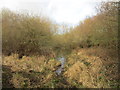
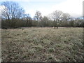
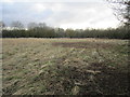
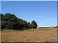
Nearby Images from Geograph Britain and Ireland:
©2020(licence)
©2020(licence)
©2020(licence)
©2006(licence)
©2020(licence)
The above images may not be of the site on this page, they are loaded from Geograph.
Please Submit an Image of this site or go out and take one for us!
Click here to see more info for this site
Nearby sites
Key: Red: member's photo, Blue: 3rd party photo, Yellow: other image, Green: no photo - please go there and take one, Grey: site destroyed
Download sites to:
KML (Google Earth)
GPX (GPS waypoints)
CSV (Garmin/Navman)
CSV (Excel)
To unlock full downloads you need to sign up as a Contributory Member. Otherwise downloads are limited to 50 sites.
Turn off the page maps and other distractions
Nearby sites listing. In the following links * = Image available
4.0km W 275° Holy Well (Careby and Aunby) Holy Well or Sacred Spring (TF00031598)
5.0km SW 215° Walk Farm Enclosure Ancient Village or Settlement (TF012116)
6.9km SE 140° Barholm Causewayed Enclosure Causewayed Enclosure (TF085105)
7.8km S 170° Uffington Causewayed Enclosure Causewayed Enclosure (TF055080)
10.0km SSE 157° Barnack (Timber Circle) Timber Circle (TF081066)
10.0km SSE 155° Barnack Cursus Cursus (TF08360672)
10.7km SE 135° Maxey Cursus Cursus (TF118083)
10.7km SE 135° Maxey Cursus Cursus (TF11800830)
10.8km SSE 148° Bainton Cursus Cursus (TF099066)
11.3km SSE 161° St John the Baptist (Barnack)* Ancient Cross (TF07930505)
11.4km SW 232° Sheela-Na-Gig (Empingham)* Sculptured Stone (SK951085)
11.6km SE 134° Maxey Pit Circle A Timber Circle (TF125078)
11.6km W 266° Greetham* Holy Well or Sacred Spring (SK924146)
11.7km SE 135° Maxey Pit Circle A Timber Circle (TF125077)
11.7km SE 134° Maxey Henge Henge (TF12600772)
12.4km SE 133° Maxey Cursus Cursus (TF133074)
12.5km SE 132° Etton Causewayed Enclosure* Causewayed Enclosure (TF135075)
13.1km SE 142° St Botolph (Helpston) Ancient Cross (TF12200552)
13.1km SW 218° Wytchley Warren (Edith Weston) Cairn (SK961052)
13.5km ESE 123° Northborough Causewayed Enclosure Causewayed Enclosure (TF155085)
13.6km ESE 102° Deeping St Nicholas Round Barrow(s) (TF174132)
13.6km ESE 102° Deeping St Nicholas 28 Timber Circle (TF174132)
14.6km SSW 205° Tixover Grange Long Barrow (SK981023)
15.1km S 171° Thornhaugh Henge Henge (TF066008)
15.8km NNW 344° Round Hills Fort* Hillfort (SK992308)
View more nearby sites and additional images


 We would like to know more about this location. Please feel free to add a brief description and any relevant information in your own language.
 Wir möchten mehr über diese Stätte erfahren. Bitte zögern Sie nicht, eine kurze Beschreibung und relevante Informationen in Deutsch hinzuzufügen.
 Nous aimerions en savoir encore un peu sur les lieux. S'il vous plaît n'hesitez pas à ajouter une courte description et tous les renseignements pertinents dans votre propre langue.
 Quisieramos informarnos un poco más de las lugares. No dude en añadir una breve descripción y otros datos relevantes en su propio idioma.