<< Text Pages >> Blatherwycke stone cross - Marker Stone in England in Northamptonshire
Submitted by Dents on Thursday, 19 October 2023 Page Views: 277
Medieval (High and Late)Site Name: Blatherwycke stone cross Alternative Name: Medieval stone crossCountry: England
NOTE: This site is 1.897 km away from the location you searched for.
County: Northamptonshire Type: Marker Stone
Nearest Village: Blatherwycke
Map Ref: SP988969
Latitude: 52.560974N Longitude: 0.543973W
Condition:
| 5 | Perfect |
| 4 | Almost Perfect |
| 3 | Reasonable but with some damage |
| 2 | Ruined but still recognisable as an ancient site |
| 1 | Pretty much destroyed, possibly visible as crop marks |
| 0 | No data. |
| -1 | Completely destroyed |
| 5 | Superb |
| 4 | Good |
| 3 | Ordinary |
| 2 | Not Good |
| 1 | Awful |
| 0 | No data. |
| 5 | Can be driven to, probably with disabled access |
| 4 | Short walk on a footpath |
| 3 | Requiring a bit more of a walk |
| 2 | A long walk |
| 1 | In the middle of nowhere, a nightmare to find |
| 0 | No data. |
| 5 | co-ordinates taken by GPS or official recorded co-ordinates |
| 4 | co-ordinates scaled from a detailed map |
| 3 | co-ordinates scaled from a bad map |
| 2 | co-ordinates of the nearest village |
| 1 | co-ordinates of the nearest town |
| 0 | no data |
Internal Links:
External Links:
Marker Stone/ Boundary Cross in Northamptonshire
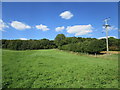
Medieval stone boundary cross sited between Blatherwycke and Kings Cliffe in North Northamptonshire. Sadly situated on private land so permission or trespass necessary.
You may be viewing yesterday's version of this page. To see the most up to date information please register for a free account.
")
Do not use the above information on other web sites or publications without permission of the contributor.
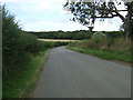
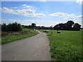
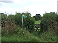
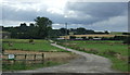
Nearby Images from Geograph Britain and Ireland:
©2014(licence)
©2020(licence)
©2014(licence)
©2014(licence)
©2020(licence)
The above images may not be of the site on this page, they are loaded from Geograph.
Please Submit an Image of this site or go out and take one for us!
Click here to see more info for this site
Nearby sites
Key: Red: member's photo, Blue: 3rd party photo, Yellow: other image, Green: no photo - please go there and take one, Grey: site destroyed
Download sites to:
KML (Google Earth)
GPX (GPS waypoints)
CSV (Garmin/Navman)
CSV (Excel)
To unlock full downloads you need to sign up as a Contributory Member. Otherwise downloads are limited to 50 sites.
Turn off the page maps and other distractions
Nearby sites listing. In the following links * = Image available
5.4km N 354° Tixover Grange Long Barrow (SK981023)
8.7km ENE 65° Thornhaugh Henge Henge (TF066008)
8.7km NNW 343° Wytchley Warren (Edith Weston) Cairn (SK961052)
9.3km WSW 253° The Jo Stone* Natural Stone / Erratic / Other Natural Feature (SP8995293949)
11.0km NW 304° The Old Maze* Turf Maze (SK8954902833)
11.3km ENE 73° Upton Causewayed Enclosure Causewayed Enclosure (TF095005)
12.2km NNW 344° Sheela-Na-Gig (Empingham)* Sculptured Stone (SK951085)
12.2km NE 49° St John the Baptist (Barnack)* Ancient Cross (TF07930505)
12.2km SW 236° Parliament Stone* Natural Stone / Erratic / Other Natural Feature (SP888898)
12.4km E 87° Water Newton Mill Bowl Barrow* Round Barrow(s) (TL11269770)
12.9km NNE 32° Uffington Causewayed Enclosure Causewayed Enclosure (TF055080)
13.4km NE 45° Barnack (Timber Circle) Timber Circle (TF081066)
13.7km NE 45° Barnack Cursus Cursus (TF08360672)
14.2km WSW 257° Great Easton Roman Well* Holy Well or Sacred Spring (SP850933)
14.7km NE 50° Bainton Cursus Cursus (TF099066)
14.9km N 10° Walk Farm Enclosure Ancient Village or Settlement (TF012116)
15.2km E 86° Robin Hood and Little John* Standing Stones (TL1395098389)
15.3km WNW 293° Ridlington settlement Misc. Earthwork (SK846027)
15.9km ENE 58° St Botolph (Helpston) Ancient Cross (TF12200552)
16.7km NE 37° Barholm Causewayed Enclosure Causewayed Enclosure (TF085105)
17.3km NE 50° Maxey Cursus Cursus (TF11800830)
17.3km NE 50° Maxey Cursus Cursus (TF118083)
17.3km S 172° Titchmarch Cursus Cursus (TL016798)
17.4km NE 53° Maxey Pit Circle A Timber Circle (TF125077)
17.4km NW 317° Oakham Timber Circle Timber Circle (SK867095)
View more nearby sites and additional images


 We would like to know more about this location. Please feel free to add a brief description and any relevant information in your own language.
 Wir möchten mehr über diese Stätte erfahren. Bitte zögern Sie nicht, eine kurze Beschreibung und relevante Informationen in Deutsch hinzuzufügen.
 Nous aimerions en savoir encore un peu sur les lieux. S'il vous plaît n'hesitez pas à ajouter une courte description et tous les renseignements pertinents dans votre propre langue.
 Quisieramos informarnos un poco más de las lugares. No dude en añadir una breve descripción y otros datos relevantes en su propio idioma.