<< Text Pages >> Ethelfleda's Hill Fort (Wednesdbury) - Hillfort in England in West Midlands
Submitted by Anne T on Sunday, 07 July 2024 Page Views: 1555
Iron Age and Later PrehistorySite Name: Ethelfleda's Hill Fort (Wednesdbury) Alternative Name: Iron Age Hillfort (Wednesbury)Country: England
NOTE: This site is 3.254 km away from the location you searched for.
County: West Midlands Type: Hillfort
Nearest Town: Wednesbury
Map Ref: SO9880095300
Latitude: 52.555539N Longitude: 2.019131W
Condition:
| 5 | Perfect |
| 4 | Almost Perfect |
| 3 | Reasonable but with some damage |
| 2 | Ruined but still recognisable as an ancient site |
| 1 | Pretty much destroyed, possibly visible as crop marks |
| 0 | No data. |
| -1 | Completely destroyed |
| 5 | Superb |
| 4 | Good |
| 3 | Ordinary |
| 2 | Not Good |
| 1 | Awful |
| 0 | No data. |
| 5 | Can be driven to, probably with disabled access |
| 4 | Short walk on a footpath |
| 3 | Requiring a bit more of a walk |
| 2 | A long walk |
| 1 | In the middle of nowhere, a nightmare to find |
| 0 | No data. |
| 5 | co-ordinates taken by GPS or official recorded co-ordinates |
| 4 | co-ordinates scaled from a detailed map |
| 3 | co-ordinates scaled from a bad map |
| 2 | co-ordinates of the nearest village |
| 1 | co-ordinates of the nearest town |
| 0 | no data |
Internal Links:
External Links:
Hillfort in West Midlands
Now destroyed, this Iron Age Hillfort is recorded as Historic England Research Record 19191, although there does not appear to be a corresponding listing on the Historic England website.
Heritage Gateway tells us: "The possible site of an Iron Age Hillfort is suggested by place-name evidence, although no surface trace remains. The site is traditionally associated with Ethelfleda, a member of the Anglo Saxon royal house, and sister of Edward the Elder. Ethelfleda is said to have established a castle on the site. There are several antiquarian accounts of earthworks on the site around Church Hill ... The place-name Wednesbury is suggestive of a prehistoric earthwork: [one source has] speculated that the Saxons may have built a (pagan) temple and later a Christian church inside an earlier stronghold."
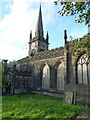
They continue: "Church Hill is a flattish-topped hill lying close to the River Tame. It rises gently up from the surrounding flood plain before steepening around the around the summit itself and plateauing out at about 163m above OD. The hill's form and topographical location are certainly suited to it being the site of a stronghold, although if so no surface trace survives today. The west end of the summit of Church Hill is occupied by St Bartholomew's Church. Immediately to the west and north, Ethelfleda Memorial Gardens and St Mary's RC Church have been terraced into the slope. The intervening stretch of churchyard seems to have preserved the former hill profile, but no sign of an encircling rampart or ditch can be seen."
St Bartholemew's Church can be found just north west of the grid reference given in the Heritage Gateway Research Record, at SO 98712 95346. The church website, church history, adds: "It is a Grade 2 listed building first mentioned in 1088 ... Sitting on the top of Church Hill, seen for miles around, St Bart's has been at the heart of Wednesbury for centuries."
I have not (so far) been able to track down any antiquarian papers mentioned in the HGRR entry which give information about this site, so if you have come across them, please would you kindly post any information, or a link to the paper, on this site page by adding a comment - thank you.
With thanks to Tim@Timmo101 who let us know about this site through X/Twitter.
Note: Do you have any information or images of this site to add? Thank you.
You may be viewing yesterday's version of this page. To see the most up to date information please register for a free account.
Do not use the above information on other web sites or publications without permission of the contributor.
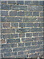
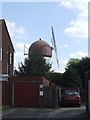
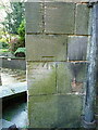
Nearby Images from Geograph Britain and Ireland:

©2011(licence)
©2021(licence)
©2011(licence)
©2021(licence)
©2021(licence)
The above images may not be of the site on this page, they are loaded from Geograph.
Please Submit an Image of this site or go out and take one for us!
Click here to see more info for this site
Nearby sites
Key: Red: member's photo, Blue: 3rd party photo, Yellow: other image, Green: no photo - please go there and take one, Grey: site destroyed
Download sites to:
KML (Google Earth)
GPX (GPS waypoints)
CSV (Garmin/Navman)
CSV (Excel)
To unlock full downloads you need to sign up as a Contributory Member. Otherwise downloads are limited to 50 sites.
Turn off the page maps and other distractions
Nearby sites listing. In the following links * = Image available
5.4km SE 137° St Augustine's Well (Sandwell)* Holy Well or Sacred Spring (SP0248391296)
8.1km WNW 295° St Peter (Wolverhampton)* Ancient Cross (SO9141998765)
8.3km WNW 296° The Bargain Stone* Holed Stone (SO913989)
9.0km WNW 295° West Park (Wolverhampton)* Natural Stone / Erratic / Other Natural Feature (SO90609912)
9.2km E 88° The King's Standing* Round Barrow(s) (SP080956)
9.3km WNW 304° Wulfruna's Well* Holy Well or Sacred Spring (SJ9102600470)
9.3km W 270° Lady Godiva's Cross* Ancient Cross (SO89439528)
10.3km SE 137° War Stone* Natural Stone / Erratic / Other Natural Feature (SP058877)
10.5km E 84° Rowton Well* Holy Well or Sacred Spring (SP0927496487)
10.5km N 360° The Great Stones of Landywood* Stone Circle (SJ9872805826)
11.4km SE 137° Birmingham Museum & Art Gallery Museum (SP066869)
11.6km ENE 77° Druid's Well (Sutton Park) Holy Well or Sacred Spring (SP1016297991)
11.7km E 84° Keeper's Well* Holy Well or Sacred Spring (SP1049296613)
13.3km SSE 154° Lapworth Museum Museum (SP047834)
15.1km NW 309° The Leper Well* Holy Well or Sacred Spring (SJ87030478)
15.1km SSW 207° Wychbury Camp* Hillfort (SO920818)
15.2km SSW 197° St Kenelm's Well* Holy Well or Sacred Spring (SO9444280755)
15.8km NE 44° Wall Roman sites (Letocetum)* Ancient Village or Settlement (SK0977506660)
15.9km SSW 200° The Four Stones* Modern Stone Circle etc (SO9337180328)
16.9km ENE 72° St Modwen's Well (Canwell) Holy Well or Sacred Spring (SK14890058)
16.9km SE 142° Moseley Bog Burnt Mound* Artificial Mound (SP0934382043)
17.3km NNE 18° Nun's Well (Cannock Wood)* Holy Well or Sacred Spring (SK04151180)
18.4km NNE 18° Castle Ring (Staffordshire)* Hillfort (SK045128)
18.5km SSW 211° Stakenbridge Lane* Round Barrow(s) (SO894794)
18.9km SW 232° The Giant's Well (Kinver)* Holy Well or Sacred Spring (SO839836)
View more nearby sites and additional images


 We would like to know more about this location. Please feel free to add a brief description and any relevant information in your own language.
 Wir möchten mehr über diese Stätte erfahren. Bitte zögern Sie nicht, eine kurze Beschreibung und relevante Informationen in Deutsch hinzuzufügen.
 Nous aimerions en savoir encore un peu sur les lieux. S'il vous plaît n'hesitez pas à ajouter une courte description et tous les renseignements pertinents dans votre propre langue.
 Quisieramos informarnos un poco más de las lugares. No dude en añadir una breve descripción y otros datos relevantes en su propio idioma.