<< Text Pages >> Lapworth Museum - Museum in England in West Midlands
Submitted by vicky on Saturday, 30 November 2002 Page Views: 7053
MuseumsSite Name: Lapworth MuseumCountry: England County: West Midlands Type: Museum
Nearest Town: Birmingham
Map Ref: SP047834 Landranger Map Number: 139
Latitude: 52.448541N Longitude: 1.932273W
Condition:
| 5 | Perfect |
| 4 | Almost Perfect |
| 3 | Reasonable but with some damage |
| 2 | Ruined but still recognisable as an ancient site |
| 1 | Pretty much destroyed, possibly visible as crop marks |
| 0 | No data. |
| -1 | Completely destroyed |
| 5 | Superb |
| 4 | Good |
| 3 | Ordinary |
| 2 | Not Good |
| 1 | Awful |
| 0 | No data. |
| 5 | Can be driven to, probably with disabled access |
| 4 | Short walk on a footpath |
| 3 | Requiring a bit more of a walk |
| 2 | A long walk |
| 1 | In the middle of nowhere, a nightmare to find |
| 0 | No data. |
| 5 | co-ordinates taken by GPS or official recorded co-ordinates |
| 4 | co-ordinates scaled from a detailed map |
| 3 | co-ordinates scaled from a bad map |
| 2 | co-ordinates of the nearest village |
| 1 | co-ordinates of the nearest town |
| 0 | no data |
Be the first person to rate this site - see the 'Contribute!' box in the right hand menu.
Internal Links:
External Links:
Museum in West Midlands
A large collection of stone axes.
Address: University of Birmingham, Edgbaston, B15 2TT
Phone: 0121 414 7294 or 6751
Opening Hours: Mon to Fri 9.00am - 5.00pm, Sat & Sun 2.00pm - 5.00pm . Closed Xmas - New Year & Easter.
Admission: Free
Visit their web site
You may be viewing yesterday's version of this page. To see the most up to date information please register for a free account.
Do not use the above information on other web sites or publications without permission of the contributor.
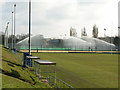
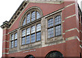
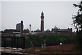
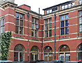
Nearby Images from Geograph Britain and Ireland:
©2012(licence)

©2022(licence)
©2013(licence)
©2011(licence)
©2013(licence)
The above images may not be of the site on this page, they are loaded from Geograph.
Please Submit an Image of this site or go out and take one for us!
Click here to see more info for this site
Nearby sites
Key: Red: member's photo, Blue: 3rd party photo, Yellow: other image, Green: no photo - please go there and take one, Grey: site destroyed
Download sites to:
KML (Google Earth)
GPX (GPS waypoints)
CSV (Garmin/Navman)
CSV (Excel)
To unlock full downloads you need to sign up as a Contributory Member. Otherwise downloads are limited to 50 sites.
Turn off the page maps and other distractions
Nearby sites listing. In the following links * = Image available
4.0km NNE 28° Birmingham Museum & Art Gallery Museum (SP066869)
4.4km NNE 14° War Stone* Natural Stone / Erratic / Other Natural Feature (SP058877)
4.8km ESE 106° Moseley Bog Burnt Mound* Artificial Mound (SP0934382043)
7.4km SE 140° Berry Mound* Hillfort (SP095778)
7.8km E 99° Burnt mound in Fox Hollies Park Artificial Mound (SP1247182177)
8.2km NNW 344° St Augustine's Well (Sandwell)* Holy Well or Sacred Spring (SP0248391296)
10.6km WSW 256° St Kenelm's Well* Holy Well or Sacred Spring (SO9444280755)
11.7km WSW 255° The Four Stones* Modern Stone Circle etc (SO9337180328)
12.6km NNE 15° The King's Standing* Round Barrow(s) (SP080956)
12.8km W 263° Wychbury Camp* Hillfort (SO920818)
13.9km NNE 19° Rowton Well* Holy Well or Sacred Spring (SP0927496487)
14.2km SSE 168° Beoley Hill Fort Hillfort (SP077695)
14.4km NNE 24° Keeper's Well* Holy Well or Sacred Spring (SP1049296613)
15.6km NNE 21° Druid's Well (Sutton Park) Holy Well or Sacred Spring (SP1016297991)
15.8km WSW 255° Stakenbridge Lane* Round Barrow(s) (SO894794)
16.1km WSW 239° Barrow Hill (Worcestershire)* Barrow Cemetery (SO9088475138)
16.2km ENE 67° Beggars Well* Holy Well or Sacred Spring (SP1962989822)
19.3km NW 308° Lady Godiva's Cross* Ancient Cross (SO89439528)
20.0km NNE 31° St Modwen's Well (Canwell) Holy Well or Sacred Spring (SK14890058)
20.1km ESE 102° Berkswell* Holy Well or Sacred Spring (SP244791)
20.3km NW 319° St Peter (Wolverhampton)* Ancient Cross (SO9141998765)
20.5km NW 319° The Bargain Stone* Holed Stone (SO913989)
20.7km W 271° The Giant's Well (Kinver)* Holy Well or Sacred Spring (SO839836)
21.1km NW 318° West Park (Wolverhampton)* Natural Stone / Erratic / Other Natural Feature (SO90609912)
21.1km W 270° Kinver* Promontory Fort / Cliff Castle (SO835832)
View more nearby sites and additional images


 We would like to know more about this location. Please feel free to add a brief description and any relevant information in your own language.
 Wir möchten mehr über diese Stätte erfahren. Bitte zögern Sie nicht, eine kurze Beschreibung und relevante Informationen in Deutsch hinzuzufügen.
 Nous aimerions en savoir encore un peu sur les lieux. S'il vous plaît n'hesitez pas à ajouter une courte description et tous les renseignements pertinents dans votre propre langue.
 Quisieramos informarnos un poco más de las lugares. No dude en añadir una breve descripción y otros datos relevantes en su propio idioma.