<< Our Photo Pages >> Wardy Hill - Hillfort in England in Cambridgeshire
Submitted by Andy B on Thursday, 25 March 2004 Page Views: 11544
Iron Age and Later PrehistorySite Name: Wardy HillCountry: England
NOTE: This site is 3.976 km away from the location you searched for.
County: Cambridgeshire Type: Hillfort
Nearest Town: Ely Nearest Village: Wardy Hill
Map Ref: TL478820 Landranger Map Number: 143
Latitude: 52.416032N Longitude: 0.171778E
Condition:
| 5 | Perfect |
| 4 | Almost Perfect |
| 3 | Reasonable but with some damage |
| 2 | Ruined but still recognisable as an ancient site |
| 1 | Pretty much destroyed, possibly visible as crop marks |
| 0 | No data. |
| -1 | Completely destroyed |
| 5 | Superb |
| 4 | Good |
| 3 | Ordinary |
| 2 | Not Good |
| 1 | Awful |
| 0 | No data. |
| 5 | Can be driven to, probably with disabled access |
| 4 | Short walk on a footpath |
| 3 | Requiring a bit more of a walk |
| 2 | A long walk |
| 1 | In the middle of nowhere, a nightmare to find |
| 0 | No data. |
| 5 | co-ordinates taken by GPS or official recorded co-ordinates |
| 4 | co-ordinates scaled from a detailed map |
| 3 | co-ordinates scaled from a bad map |
| 2 | co-ordinates of the nearest village |
| 1 | co-ordinates of the nearest town |
| 0 | no data |
Internal Links:
External Links:
")
The ringwork on Wardy Hill was excavated during the autumn of 1991. The site would have commanded the northern approach into The Cove, a large marsh embayment on the N side of the Isle of Ely. The landward defences - triple rampart entrance ditches - are without parallel in the region. Six round buildings were excavated within the interior.
More at the Cambridgeshire HER
Page originally by Vicky.
You may be viewing yesterday's version of this page. To see the most up to date information please register for a free account.
")
")
")
Do not use the above information on other web sites or publications without permission of the contributor.
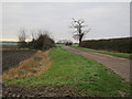
Nearby Images from Geograph Britain and Ireland:
©2016(licence)
©2016(licence)
©2013(licence)
©2012(licence)
©2012(licence)
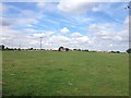
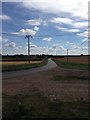
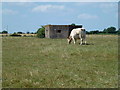
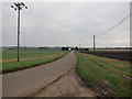
The above images may not be of the site on this page, they are loaded from Geograph.
Please Submit an Image of this site or go out and take one for us!
Click here to see more info for this site
Nearby sites
Key: Red: member's photo, Blue: 3rd party photo, Yellow: other image, Green: no photo - please go there and take one, Grey: site destroyed
Download sites to:
KML (Google Earth)
GPX (GPS waypoints)
CSV (Garmin/Navman)
CSV (Excel)
To unlock full downloads you need to sign up as a Contributory Member. Otherwise downloads are limited to 50 sites.
Turn off the page maps and other distractions
Nearby sites listing. In the following links * = Image available
4.6km SW 231° Sutton in the Isle Round Barrow Round Barrow(s) (TL443790)
7.8km SW 229° Haddenham Long Barrow (TL420767)
10.7km SW 220° Haddenham Enclosure Causewayed Enclosure (TL412736)
10.8km N 2° Manea Cursus Cursus (TL478928)
11.4km NNW 346° Stonea Camp* Hillfort (TL448930)
11.8km NNW 348° Wimblington Cursus Cursus (TL44979351)
12.9km SSW 206° Belsar's Hill* Hillfort (TL424703)
14.3km SE 145° Wicken Fen* Natural Stone / Erratic / Other Natural Feature (TL563705)
17.8km SSW 207° St Michael's Well (Cambridge)* Holy Well or Sacred Spring (TL40326584)
18.1km SW 233° Holywell (Cambridgeshire)* Holy Well or Sacred Spring (TL336707)
19.0km SSE 149° The Burwells* Holy Well or Sacred Spring (TL5866)
19.0km SW 231° Low Hill Bowl Barrow, Fen Drayton RSPB Reserve* Round Barrow(s) (TL33336960)
20.0km SW 231° Fenstanton Cursus Cursus (TL326689)
20.1km SSE 151° Devil's Dyke, Cambridgeshire* Misc. Earthwork (TL580646)
21.2km SSE 163° Bottisham Cursus Cursus (TL547619)
23.6km SW 218° Knapwell* Holy Well or Sacred Spring (TL33816300)
24.0km S 188° Cambridge Museum of Archaeology & Anthropology* Museum (TL450581)
24.2km SW 231° Hilton (Cambridgeshire)* Turf Maze (TL293663)
24.3km S 188° Cambridge Fitzwilliam Museum* Museum (TL44955790)
24.8km WSW 245° Godmanchester Cursus Cursus (TL25557092)
24.8km WSW 245° Godmanchester Cursus Cursus (TL25557092)
25.7km SE 124° Howe Hill Bowl Barrow* Round Barrow(s) (TL69536822)
25.7km WSW 249° Horse Common Spring* Holy Well or Sacred Spring (TL2472)
25.8km S 180° The Kingship Stone, Cherry Hinton Natural Stone / Erratic / Other Natural Feature (TL486562)
26.5km S 180° East Pit Nature Reserve* Ancient Village or Settlement (TL485555)
View more nearby sites and additional images


 We would like to know more about this location. Please feel free to add a brief description and any relevant information in your own language.
 Wir möchten mehr über diese Stätte erfahren. Bitte zögern Sie nicht, eine kurze Beschreibung und relevante Informationen in Deutsch hinzuzufügen.
 Nous aimerions en savoir encore un peu sur les lieux. S'il vous plaît n'hesitez pas à ajouter une courte description et tous les renseignements pertinents dans votre propre langue.
 Quisieramos informarnos un poco más de las lugares. No dude en añadir una breve descripción y otros datos relevantes en su propio idioma.