<< Our Photo Pages >> Seat of Judgement - Leighton Bromswold - Marker Stone in England in Cambridgeshire
Submitted by MattEU on Monday, 29 September 2008 Page Views: 7359
Multi-periodSite Name: Seat of Judgement - Leighton BromswoldCountry: England
NOTE: This site is 3.22 km away from the location you searched for.
County: Cambridgeshire Type: Marker Stone
Nearest Village: Leighton Bromswold
Map Ref: TL112756
Latitude: 52.367176N Longitude: 0.368223W
Condition:
| 5 | Perfect |
| 4 | Almost Perfect |
| 3 | Reasonable but with some damage |
| 2 | Ruined but still recognisable as an ancient site |
| 1 | Pretty much destroyed, possibly visible as crop marks |
| 0 | No data. |
| -1 | Completely destroyed |
| 5 | Superb |
| 4 | Good |
| 3 | Ordinary |
| 2 | Not Good |
| 1 | Awful |
| 0 | No data. |
| 5 | Can be driven to, probably with disabled access |
| 4 | Short walk on a footpath |
| 3 | Requiring a bit more of a walk |
| 2 | A long walk |
| 1 | In the middle of nowhere, a nightmare to find |
| 0 | No data. |
| 5 | co-ordinates taken by GPS or official recorded co-ordinates |
| 4 | co-ordinates scaled from a detailed map |
| 3 | co-ordinates scaled from a bad map |
| 2 | co-ordinates of the nearest village |
| 1 | co-ordinates of the nearest town |
| 0 | no data |
Internal Links:
External Links:
")
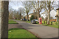
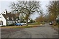
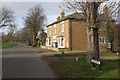
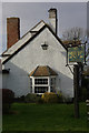
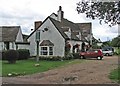
Drive into the village near small rolling hills until you get to the Green Man pub and turn right. A couple of hundred yards down the tree lined road you will find the stone on its plinth in front of the Church. There are a couple of benches for you to sit down on facing the leafy road but not facing the Church.
The Church does not seem to have any real distinctive features apart from the drainpipe which has to be seen to be believed (or look at the photo!).
I could not find the original location of the stone, as it has been moved to its present location.
You may be viewing yesterday's version of this page. To see the most up to date information please register for a free account.
")
")
")
")
Do not use the above information on other web sites or publications without permission of the contributor.
Nearby Images from Geograph Britain and Ireland:
©2008(licence)
©2011(licence)
©2008(licence)
©2008(licence)
©2015(licence)
The above images may not be of the site on this page, they are loaded from Geograph.
Please Submit an Image of this site or go out and take one for us!
Click here to see more info for this site
Nearby sites
Key: Red: member's photo, Blue: 3rd party photo, Yellow: other image, Green: no photo - please go there and take one, Grey: site destroyed
Download sites to:
KML (Google Earth)
GPX (GPS waypoints)
CSV (Garmin/Navman)
CSV (Excel)
To unlock full downloads you need to sign up as a Contributory Member. Otherwise downloads are limited to 50 sites.
Turn off the page maps and other distractions
Nearby sites listing. In the following links * = Image available
8.9km ENE 62° Monk's Hole Barrow Round Barrow(s) (TL1896479957)
9.9km ESE 115° Brampton Cursus Cursus (TL203716)
10.0km ESE 115° Brampton Long Barrow (TL204715)
10.2km SW 218° Harrowick, Upper Dean Natural Stone / Erratic / Other Natural Feature (TL0507267416)
10.5km WNW 295° Titchmarch Cursus Cursus (TL016798)
12.8km SE 136° Buckden B Cursus Cursus (TL20266659)
12.8km SE 137° Buckden C Cursus Cursus (TL202664)
13.2km WSW 258° Cotton Henge* Henge (SP983725)
13.3km ESE 107° Horse Common Spring* Holy Well or Sacred Spring (TL2472)
13.6km SE 134° Buckden A Cursus Cursus (TL212664)
13.9km WSW 258° West Cotton Monument Complex Long Barrow (SP97577248)
14.5km WSW 255° Raunds Ring Ditch Misc. Earthwork (SP972716)
15.0km WSW 255° Stanwick Lakes* Museum (SP96707150)
15.1km ESE 109° Godmanchester Cursus Cursus (TL25557092)
15.1km ESE 109° Godmanchester Cursus Cursus (TL25557092)
15.1km W 273° Three Hills Barrows, Woodford* Barrow Cemetery (SP961760)
15.2km W 260° Irthlingborough and Stanwick Barrows* Barrow Cemetery (SP963725)
15.4km WSW 254° Redlands Farm Long Barrow Long Barrow (SP965710)
16.1km SSW 191° Bolnhurst Earthwork Misc. Earthwork (TL084597)
18.4km SSE 160° Eynesbury Hodwick 1 Long Barrow (TL180585)
18.6km SSE 159° Eynesbury Hardwicke B Cursus Cursus (TL184584)
18.7km SSE 160° Eynesbury Hardwicke A Cursus Cursus (TL181582)
19.4km NNE 20° Stone Circle, James' Pond* Modern Stone Circle etc (TL17309405)
19.9km W 261° Finedon Stone Marker Stone (SP9161871928)
19.9km SW 214° Felmersham Cursus Cursus (TL004588)
View more nearby sites and additional images


 We would like to know more about this location. Please feel free to add a brief description and any relevant information in your own language.
 Wir möchten mehr über diese Stätte erfahren. Bitte zögern Sie nicht, eine kurze Beschreibung und relevante Informationen in Deutsch hinzuzufügen.
 Nous aimerions en savoir encore un peu sur les lieux. S'il vous plaît n'hesitez pas à ajouter une courte description et tous les renseignements pertinents dans votre propre langue.
 Quisieramos informarnos un poco más de las lugares. No dude en añadir una breve descripción y otros datos relevantes en su propio idioma.