<< Our Photo Pages >> Camlo Hill Stone - Standing Stone (Menhir) in Wales in Powys
Submitted by Sunny100 on Wednesday, 01 December 2010 Page Views: 8131
Neolithic and Bronze AgeSite Name: Camlo Hill Stone Alternative Name: Cwm Bedw Stone, Llyn Dwr Standing StoneCountry: Wales
NOTE: This site is 1.676 km away from the location you searched for.
County: Powys Type: Standing Stone (Menhir)
Nearest Town: Llandrindod Wells Nearest Village: Abbey Cwmhir
Map Ref: SO048696
Latitude: 52.316221N Longitude: 3.398012W
Condition:
| 5 | Perfect |
| 4 | Almost Perfect |
| 3 | Reasonable but with some damage |
| 2 | Ruined but still recognisable as an ancient site |
| 1 | Pretty much destroyed, possibly visible as crop marks |
| 0 | No data. |
| -1 | Completely destroyed |
| 5 | Superb |
| 4 | Good |
| 3 | Ordinary |
| 2 | Not Good |
| 1 | Awful |
| 0 | No data. |
| 5 | Can be driven to, probably with disabled access |
| 4 | Short walk on a footpath |
| 3 | Requiring a bit more of a walk |
| 2 | A long walk |
| 1 | In the middle of nowhere, a nightmare to find |
| 0 | No data. |
| 5 | co-ordinates taken by GPS or official recorded co-ordinates |
| 4 | co-ordinates scaled from a detailed map |
| 3 | co-ordinates scaled from a bad map |
| 2 | co-ordinates of the nearest village |
| 1 | co-ordinates of the nearest town |
| 0 | no data |
Internal Links:
External Links:
")
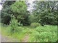
A standing stone between 2-3 feet high located on the northern flank of Camlo Hill. It is a bit difficult to find, but it is near a forestry trackway at the southern end of the Creigiau Forest. The village of Abbey Cwmhir is about 1 mile to the north-east.
It is actually a boulder that is pointed at the top, but a bit ordinary really, and thought to be of Bronze Age date. A few hundred yards west of the stone there is a prehistoric cairn - though not much to see their today. The stone is mentioned by R.A.C.M No 8.
You may be viewing yesterday's version of this page. To see the most up to date information please register for a free account.
")
")
")
Do not use the above information on other web sites or publications without permission of the contributor.
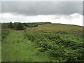
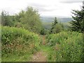
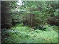
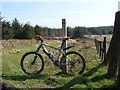
Nearby Images from Geograph Britain and Ireland:
©2012(licence)
©2012(licence)
©2012(licence)
©2012(licence)
©2012(licence)
The above images may not be of the site on this page, they are loaded from Geograph.
Please Submit an Image of this site or go out and take one for us!
Click here to see more info for this site
Nearby sites
Key: Red: member's photo, Blue: 3rd party photo, Yellow: other image, Green: no photo - please go there and take one, Grey: site destroyed
Download sites to:
KML (Google Earth)
GPX (GPS waypoints)
CSV (Garmin/Navman)
CSV (Excel)
To unlock full downloads you need to sign up as a Contributory Member. Otherwise downloads are limited to 50 sites.
Turn off the page maps and other distractions
Nearby sites listing. In the following links * = Image available
131m W 278° Llyn Dwr Cairn* Cairn (SO04676962)
5.2km W 261° Ty Lettice Barrows* Round Barrow(s) (SN99606889)
5.3km SSW 210° Dolmaengwyn* Standing Stone (Menhir) (SO02056506)
5.8km W 260° Ty Lettice* Round Cairn (SN99026866)
6.4km WSW 258° Cefn Ceidio* Cairn (SN98496842)
6.5km SSW 194° Wern Stone* Standing Stone (Menhir) (SO03076328)
6.6km SSW 199° Gwynfan Ring Cairn* Cairn (SO02566344)
6.7km NE 44° St Anno's Church (Llannano)* Misc. Earthwork (SO0956874345)
6.9km W 279° Creggin* Round Barrow(s) (SN980708)
7.0km WSW 239° Carn Wen - The Druid's circle* Ring Cairn (SN98686614)
8.6km S 171° The Temple, Llandrindod Wells* Stone Circle (SO0598261105)
8.6km S 174° Rock Park* Holy Well or Sacred Spring (SO055610)
8.7km SSW 198° Dol Y Fan Cairn* Cairn (SO01946135)
8.8km SSE 154° Cefnllys Burnt Mound* Misc. Earthwork (SO086616)
8.9km SSE 159° Bongam Bank* Cairn (SO0779761255)
8.9km S 169° Llandrindod Wells* Holy Well or Sacred Spring (SO0627460806)
9.0km WNW 281° Marteg Valley* Cairn (SN95997155)
9.1km SSE 161° Pantpurlas* Round Barrow(s) (SO0752460940)
9.1km SSE 152° Cefnllys Castle* Hillfort (SO08936146)
9.3km SW 230° Llanwrthwl* Standing Stone (Menhir) (SN9757263720)
9.4km SSE 166° Little Hill Cairn (SO0692960454)
9.6km SSE 163° The Beacon (Powys)* Ring Cairn (SO0744660403)
9.6km N 355° Banc Du (Powys)* Stone Circle (SO042792)
9.8km SW 224° Cae Garw Cairn* Cairn (SN97886268)
10.0km SSE 165° Broomy Hill North* Standing Stone (Menhir) (SO07235988)
View more nearby sites and additional images


 We would like to know more about this location. Please feel free to add a brief description and any relevant information in your own language.
 Wir möchten mehr über diese Stätte erfahren. Bitte zögern Sie nicht, eine kurze Beschreibung und relevante Informationen in Deutsch hinzuzufügen.
 Nous aimerions en savoir encore un peu sur les lieux. S'il vous plaît n'hesitez pas à ajouter une courte description et tous les renseignements pertinents dans votre propre langue.
 Quisieramos informarnos un poco más de las lugares. No dude en añadir una breve descripción y otros datos relevantes en su propio idioma.