<< Text Pages >> The Mazles - Turf Maze in England in Cambridgeshire
Submitted by HOLYWELL on Saturday, 29 January 2011 Page Views: 6043
Multi-periodSite Name: The Mazles Alternative Name: The MazeCountry: England
NOTE: This site is 2.245 km away from the location you searched for.
County: Cambridgeshire Type: Turf Maze
Nearest Town: Cambridge Nearest Village: Comberton
Map Ref: TL377559
Latitude: 52.184166N Longitude: 0.012712E
Condition:
| 5 | Perfect |
| 4 | Almost Perfect |
| 3 | Reasonable but with some damage |
| 2 | Ruined but still recognisable as an ancient site |
| 1 | Pretty much destroyed, possibly visible as crop marks |
| 0 | No data. |
| -1 | Completely destroyed |
| 5 | Superb |
| 4 | Good |
| 3 | Ordinary |
| 2 | Not Good |
| 1 | Awful |
| 0 | No data. |
| 5 | Can be driven to, probably with disabled access |
| 4 | Short walk on a footpath |
| 3 | Requiring a bit more of a walk |
| 2 | A long walk |
| 1 | In the middle of nowhere, a nightmare to find |
| 0 | No data. |
| 5 | co-ordinates taken by GPS or official recorded co-ordinates |
| 4 | co-ordinates scaled from a detailed map |
| 3 | co-ordinates scaled from a bad map |
| 2 | co-ordinates of the nearest village |
| 1 | co-ordinates of the nearest town |
| 0 | no data |
Internal Links:
External Links:
Turf Maze in Cambridgeshire
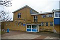
Here on the vilage green was an ancient maze 50 feet across with a circular cenrtre but basically Chartre design. When the local school was built in 1846, the maze became situated outside the entrance became very worn. The paths were re made very 3 years and the site had a trust to protect it. As a result of the damage caused by the location, in 1908 it was re-cut in the playground and existed until 1926 although in a very worn state when it was covered in tarmac. Strangly the drawing of its pattern which resided in the school was burnt at the same time. It is said in cold weather for years to come the ghostly imprint of the maze could be seen. It is said that the Maze at nearby Hilton was copied from this older one as the owner of the manor there had relations in the village.
You may be viewing yesterday's version of this page. To see the most up to date information please register for a free account.
Do not use the above information on other web sites or publications without permission of the contributor.
Nearby Images from Geograph Britain and Ireland:
©2016(licence)
©2008(licence)
©2008(licence)
©2021(licence)
©2009(licence)
The above images may not be of the site on this page, they are loaded from Geograph.
Please Submit an Image of this site or go out and take one for us!
Click here to see more info for this site
Nearby sites
Key: Red: member's photo, Blue: 3rd party photo, Yellow: other image, Green: no photo - please go there and take one, Grey: site destroyed
Download sites to:
KML (Google Earth)
GPX (GPS waypoints)
CSV (Garmin/Navman)
CSV (Excel)
To unlock full downloads you need to sign up as a Contributory Member. Otherwise downloads are limited to 50 sites.
Turn off the page maps and other distractions
Nearby sites listing. In the following links * = Image available
7.5km ENE 76° Cambridge Fitzwilliam Museum* Museum (TL44955790)
7.6km ENE 75° Cambridge Museum of Archaeology & Anthropology* Museum (TL450581)
8.1km NNW 333° Knapwell* Holy Well or Sacred Spring (TL33816300)
8.7km ESE 121° Little Shelford Crosses* Ancient Cross (TL453516)
8.7km ESE 103° Nine wells* Holy Well or Sacred Spring (TL46305420)
8.9km S 171° Shepreth Cursus (TL393471)
9.1km S 175° Shepreth Cursus (TL387468)
10.0km S 187° Mettle Hill Misc. Earthwork (TL3678245915)
10.3km NNE 16° St Michael's Well (Cambridge)* Holy Well or Sacred Spring (TL40326584)
10.5km S 182° Meldreth Hoard Ancient Mine, Quarry or other Industry (TL3761845415)
10.8km E 94° East Pit Nature Reserve* Ancient Village or Settlement (TL485555)
10.9km E 90° The Kingship Stone, Cherry Hinton Natural Stone / Erratic / Other Natural Feature (TL486562)
11.2km SE 145° Thriplow Round Barrow(s) (TL4431646901)
11.2km SE 140° Chronicle Hills Barrow Cemetery (TL452475)
11.7km ESE 104° Gog and Magog Giants Hill Figures* Hill Figure or Geoglyph (TL492534)
11.8km ESE 104° Wandlebury* Hillfort (TL493534)
11.9km S 179° Chalk Hill Barrow Round Barrow(s) (TL3833943972)
12.2km S 182° Melbourn Long Barrow* Long Barrow (TL3751343664)
12.4km ESE 106° Wormwood Hill* Round Barrow(s) (TL497528)
12.7km SSE 148° Thriplow Ring Ditch Misc. Earthwork (TL44784537)
12.7km WNW 303° Nill Well* Holy Well or Sacred Spring (TL26786248)
13.2km SSE 149° Thriplow Heath 1 Round Barrow(s) (TL4479044782)
13.3km SSW 203° Bassingbourn Village College ditches Misc. Earthwork (TL3293643488)
13.3km NW 323° Hilton (Cambridgeshire)* Turf Maze (TL293663)
13.5km ESE 104° Copley Hill* Round Barrow(s) (TL509530)
View more nearby sites and additional images


 We would like to know more about this location. Please feel free to add a brief description and any relevant information in your own language.
 Wir möchten mehr über diese Stätte erfahren. Bitte zögern Sie nicht, eine kurze Beschreibung und relevante Informationen in Deutsch hinzuzufügen.
 Nous aimerions en savoir encore un peu sur les lieux. S'il vous plaît n'hesitez pas à ajouter une courte description et tous les renseignements pertinents dans votre propre langue.
 Quisieramos informarnos un poco más de las lugares. No dude en añadir una breve descripción y otros datos relevantes en su propio idioma.