<< Text Pages >> Hall Farm, Bradfeld St George - Artificial Mound in England in Suffolk
Submitted by Andy B on Monday, 03 June 2024 Page Views: 14
Multi-periodSite Name: Hall Farm, Bradfeld St GeorgeCountry: England County: Suffolk Type: Artificial Mound
Nearest Village: Bradfeld St George
Map Ref: TL908599
Latitude: 52.204291N Longitude: 0.790794E
Condition:
| 5 | Perfect |
| 4 | Almost Perfect |
| 3 | Reasonable but with some damage |
| 2 | Ruined but still recognisable as an ancient site |
| 1 | Pretty much destroyed, possibly visible as crop marks |
| 0 | No data. |
| -1 | Completely destroyed |
| 5 | Superb |
| 4 | Good |
| 3 | Ordinary |
| 2 | Not Good |
| 1 | Awful |
| 0 | No data. |
| 5 | Can be driven to, probably with disabled access |
| 4 | Short walk on a footpath |
| 3 | Requiring a bit more of a walk |
| 2 | A long walk |
| 1 | In the middle of nowhere, a nightmare to find |
| 0 | No data. |
| 5 | co-ordinates taken by GPS or official recorded co-ordinates |
| 4 | co-ordinates scaled from a detailed map |
| 3 | co-ordinates scaled from a bad map |
| 2 | co-ordinates of the nearest village |
| 1 | co-ordinates of the nearest town |
| 0 | no data |
Be the first person to rate this site - see the 'Contribute!' box in the right hand menu.
Internal Links:
External Links:
Artificial Mound in Suffolk
A mound proposed as part of the puddingstone trail by Dr Rudge. It would have had a marker stone on top of it.
You may be viewing yesterday's version of this page. To see the most up to date information please register for a free account.
Do not use the above information on other web sites or publications without permission of the contributor.
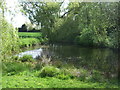
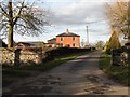
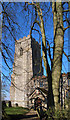
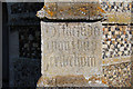
Nearby Images from Geograph Britain and Ireland:
©2017(licence)
©2011(licence)
©2013(licence)
©2013(licence)
©2013(licence)
The above images may not be of the site on this page, they are loaded from Geograph.
Please Submit an Image of this site or go out and take one for us!
Click here to see more info for this site
Nearby sites
Key: Red: member's photo, Blue: 3rd party photo, Yellow: other image, Green: no photo - please go there and take one, Grey: site destroyed
Download sites to:
KML (Google Earth)
GPX (GPS waypoints)
CSV (Garmin/Navman)
CSV (Excel)
To unlock full downloads you need to sign up as a Contributory Member. Otherwise downloads are limited to 50 sites.
Turn off the page maps and other distractions
Nearby sites listing. In the following links * = Image available
6.0km NNW 340° Cattishall Tumulus Artificial Mound (TL885654)
7.1km NW 311° Moyse's Hall Museum Museum (TL8530264367)
7.1km ENE 71° Woolpit Cross* Ancient Cross (TL974625)
7.2km NNW 347° St. John's Well (Suffolk)* Holy Well or Sacred Spring (TL889669)
7.3km NNW 331° Plum Pudding Covert Artificial Mound (TL870662)
7.4km ENE 70° Lady Well, Woolpit* Holy Well or Sacred Spring (TL9763362676)
8.5km NNW 331° Hall Farm Puddingstone Marker Stone (TL864672)
8.7km WSW 258° Baal Stone* Natural Stone / Erratic / Other Natural Feature (TL82375776)
9.4km NNE 22° Pakenham Cursus Cursus (TL940688)
9.9km NW 320° Fornham All Saints A Cursus Cursus (TL841672)
10.5km NW 320° Fornham All Saints C Cursus Cursus (TL83636765)
10.6km NNW 334° Timworth Puddingstone* Marker Stone (TL8580969281)
10.8km SE 133° Cross Green Puddingstone Natural Stone / Erratic / Other Natural Feature (TL990528)
10.9km NW 319° Fornham All Saints B Cursus Cursus (TL83346794)
11.9km NW 321° Fornham All Saints A Cursus Cursus (TL829688)
12.1km NNW 337° Ingham Puddingstone* Marker Stone (TL8556770828)
12.9km SE 135° Wattisham Stone* Natural Stone / Erratic / Other Natural Feature (TM0027151103)
13.5km SE 143° Bildeston Puddingstone Natural Stone / Erratic / Other Natural Feature (TL9928649436)
13.5km NNW 330° The Hill of Health* Round Barrow(s) (TL8365171319)
13.8km NW 316° Flempton Cursus Cursus (TL808695)
14.1km NE 34° Artificial Mound near Wrenshall Farm Artificial Mound (TL9836071843)
14.2km N 357° Troston Mount* Round Barrow(s) (TL896741)
14.5km N 353° Black Hill-Suffolk* Round Barrow(s) (TL886742)
14.5km NNW 344° Seven hills, Rymer Barrow Cemetery (TL863737)
14.8km SSE 151° Chelsworth Puddingstone Natural Stone / Erratic / Other Natural Feature (TL9860947248)
View more nearby sites and additional images


 We would like to know more about this location. Please feel free to add a brief description and any relevant information in your own language.
 Wir möchten mehr über diese Stätte erfahren. Bitte zögern Sie nicht, eine kurze Beschreibung und relevante Informationen in Deutsch hinzuzufügen.
 Nous aimerions en savoir encore un peu sur les lieux. S'il vous plaît n'hesitez pas à ajouter une courte description et tous les renseignements pertinents dans votre propre langue.
 Quisieramos informarnos un poco más de las lugares. No dude en añadir una breve descripción y otros datos relevantes en su propio idioma.