<< Other Photo Pages >> Bedford Museum - Museum in England in Bedfordshire
Submitted by vicky on Saturday, 30 November 2002 Page Views: 6290
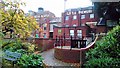
MuseumsSite Name: Bedford MuseumCountry: England County: Bedfordshire Type: Museum
Nearest Town: Bedford
Map Ref: TL0522349738 Landranger Map Number: 153
Latitude: 52.135932N Longitude: 0.464021W
Condition:
| 5 | Perfect |
| 4 | Almost Perfect |
| 3 | Reasonable but with some damage |
| 2 | Ruined but still recognisable as an ancient site |
| 1 | Pretty much destroyed, possibly visible as crop marks |
| 0 | No data. |
| -1 | Completely destroyed |
| 5 | Superb |
| 4 | Good |
| 3 | Ordinary |
| 2 | Not Good |
| 1 | Awful |
| 0 | No data. |
| 5 | Can be driven to, probably with disabled access |
| 4 | Short walk on a footpath |
| 3 | Requiring a bit more of a walk |
| 2 | A long walk |
| 1 | In the middle of nowhere, a nightmare to find |
| 0 | No data. |
| 5 | co-ordinates taken by GPS or official recorded co-ordinates |
| 4 | co-ordinates scaled from a detailed map |
| 3 | co-ordinates scaled from a bad map |
| 2 | co-ordinates of the nearest village |
| 1 | co-ordinates of the nearest town |
| 0 | no data |
Internal Links:
External Links:
Museum in Bedfordshire
Human settlement from the Old Stone Age to post-medieval Bedford is illustrated in the Archaeology Gallery.
Address: Castle Lane, MK40 3XD
Phone: 01234 353323
Opening Hours: Tues-Sat 11 am to 5 pm, Sun and Bank Hol Mon 2 pm to 5 pm, Closed on Mondays, Good Friday and Christmas.
Admission:
Visit their web site
You may be viewing yesterday's version of this page. To see the most up to date information please register for a free account.
Do not use the above information on other web sites or publications without permission of the contributor.
Andy B has found this location on Google Street View:
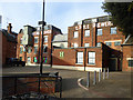
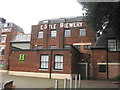
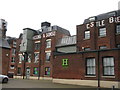
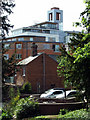
Nearby Images from Geograph Britain and Ireland:
©2017(licence)
©2015(licence)
©2015(licence)
©2010(licence)
©2015(licence)
The above images may not be of the site on this page, they are loaded from Geograph.
Please Submit an Image of this site or go out and take one for us!
Click here to see more info for this site
Nearby sites
Key: Red: member's photo, Blue: 3rd party photo, Yellow: other image, Green: no photo - please go there and take one, Grey: site destroyed
Download sites to:
KML (Google Earth)
GPX (GPS waypoints)
CSV (Garmin/Navman)
CSV (Excel)
To unlock full downloads you need to sign up as a Contributory Member. Otherwise downloads are limited to 50 sites.
Turn off the page maps and other distractions
Nearby sites listing. In the following links * = Image available
2.4km WSW 251° Kempston Cursus Cursus (TL030489)
2.7km ENE 76° Goldington* Timber Circle (TL0784050440)
2.9km W 281° Biddenham Bridge Holy Well* Holy Well or Sacred Spring (TL024502)
3.7km E 92° Cardington B Cursus Cursus (TL089497)
3.7km E 89° Cardington E Cursus Cursus (TL089499)
3.7km NNE 23° Mowsbury Hill Hillfort (TL066532)
3.8km E 92° Cardington C Cursus Cursus (TL090497)
3.9km E 90° Cardington E Cursus Cursus (TL091498)
4.1km E 88° Cople Cursus Cursus (TL09325000)
4.2km E 88° Willington N/W cursus Cursus (TL094500)
6.1km ESE 103° Willington Cursus (TL112485)
6.6km ESE 102° Willington Cursus (TL117485)
7.3km WNW 304° Holywell (Bedfordshire)* Holy Well or Sacred Spring (SP9907753646)
9.2km S 179° Houghton Conquest Long Barrow (TL055405)
10.3km NNW 333° Felmersham Cursus Cursus (TL004588)
10.3km SSW 212° The Devil's stone (Bedfordshire)* Standing Stone (Menhir) (SP9989840865)
10.4km NNE 19° Bolnhurst Earthwork Misc. Earthwork (TL084597)
11.0km ENE 62° Roundhill Barrow* Round Barrow(s) (TL1487755016)
11.4km WNW 284° Nell's Well* Holy Well or Sacred Spring (SP941523)
11.7km SW 232° Holywell (Cranfield)* Holy Well or Sacred Spring (SP961424)
12.0km ENE 67° Willow Row Barrow* Barrow Cemetery (TL162546)
12.3km NW 307° Harrold Barrows* Barrow Cemetery (SP95245702)
12.8km E 95° Caesar's Camp (Bedfordshire)* Hillfort (TL180490)
13.4km ENE 74° Eynesbury Hodwick 2 Long Barrow (TL181537)
13.6km E 99° Sandy Lodge Promontory Fort / Cliff Castle (TL187478)
View more nearby sites and additional images


 We would like to know more about this location. Please feel free to add a brief description and any relevant information in your own language.
 Wir möchten mehr über diese Stätte erfahren. Bitte zögern Sie nicht, eine kurze Beschreibung und relevante Informationen in Deutsch hinzuzufügen.
 Nous aimerions en savoir encore un peu sur les lieux. S'il vous plaît n'hesitez pas à ajouter une courte description et tous les renseignements pertinents dans votre propre langue.
 Quisieramos informarnos un poco más de las lugares. No dude en añadir una breve descripción y otros datos relevantes en su propio idioma.