<< Text Pages >> Castell Nadolig - Hillfort in Wales in Ceredigion
Submitted by PAB on Thursday, 08 October 2015 Page Views: 2199
Iron Age and Later PrehistorySite Name: Castell NadoligCountry: Wales
NOTE: This site is 1.947 km away from the location you searched for.
County: Ceredigion Type: Hillfort
Nearest Town: Cardigan
Map Ref: SN29855040
Latitude: 52.125648N Longitude: 4.486993W
Condition:
| 5 | Perfect |
| 4 | Almost Perfect |
| 3 | Reasonable but with some damage |
| 2 | Ruined but still recognisable as an ancient site |
| 1 | Pretty much destroyed, possibly visible as crop marks |
| 0 | No data. |
| -1 | Completely destroyed |
| 5 | Superb |
| 4 | Good |
| 3 | Ordinary |
| 2 | Not Good |
| 1 | Awful |
| 0 | No data. |
| 5 | Can be driven to, probably with disabled access |
| 4 | Short walk on a footpath |
| 3 | Requiring a bit more of a walk |
| 2 | A long walk |
| 1 | In the middle of nowhere, a nightmare to find |
| 0 | No data. |
| 5 | co-ordinates taken by GPS or official recorded co-ordinates |
| 4 | co-ordinates scaled from a detailed map |
| 3 | co-ordinates scaled from a bad map |
| 2 | co-ordinates of the nearest village |
| 1 | co-ordinates of the nearest town |
| 0 | no data |
Be the first person to rate this site - see the 'Contribute!' box in the right hand menu.
Internal Links:
External Links:
Hillfort in Ceredigion
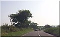
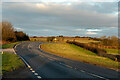
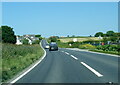
Castell Nadolig, or ‘Castle Christmas’, is a prominent feature when driving on the A487 just north of the town of Cardigan.
The hillfort is described on Coflein as 'an oval concentric enclosure, measuring about 220m by 170m overall, the inner circuit being about 120m by 70m, both defined by banks and ditches some standing to 2-3m high'.
Significant finds include a pair of bronze ‘spoons’ unearthed in the 1820s, and 3 urns containing cremated remains unearthed next to the hillfort around 1859. Copies of the spoons can be seen in the Ceredigion Museum in Aberystwyth, the originals being in the Ashmolean Museum, Oxford.
(Source: Coflein: https://www.coflein.gov.uk/en/site/304136 )
You may be viewing yesterday's version of this page. To see the most up to date information please register for a free account.
Do not use the above information on other web sites or publications without permission of the contributor.
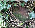
Nearby Images from Geograph Britain and Ireland:
©2024(licence)
©2013(licence)
©2015(licence)
©2023(licence)
©2023(licence)
The above images may not be of the site on this page, they are loaded from Geograph.
Please Submit an Image of this site or go out and take one for us!
Click here to see more info for this site
Nearby sites
Key: Red: member's photo, Blue: 3rd party photo, Yellow: other image, Green: no photo - please go there and take one, Grey: site destroyed
Download sites to:
KML (Google Earth)
GPX (GPS waypoints)
CSV (Garmin/Navman)
CSV (Excel)
To unlock full downloads you need to sign up as a Contributory Member. Otherwise downloads are limited to 50 sites.
Turn off the page maps and other distractions
Nearby sites listing. In the following links * = Image available
1.3km SSW 211° Caer Pwntan Hillfort (SN29164933)
1.4km NW 314° Corbalengi Stone* Sculptured Stone (SN2890151375)
2.0km N 6° Gaer Lwyd Hillfort (SN30145240)
2.8km N 10° Garreg Standing Stones Standing Stones (SN304531)
4.8km NNE 19° Pendinas Lochtyn* Hillfort (SN31565486)
5.4km NNE 16° Ynys Lochtyn* Ancient Village or Settlement (SN31475552)
5.4km ESE 118° Pensarngerrig* Standing Stones (SN346477)
5.6km SSW 195° Pant-Llech-Clawdd Burnt Mound Artificial Mound (SN28264505)
6.0km ENE 64° Castell Crugiau Ancient Village or Settlement (SN35395285)
6.3km E 97° Caerau Promontory Fort / Cliff Castle (SN36054940)
7.6km NE 37° Gaer Wen Hillfort (SN34635630)
7.7km E 91° Crug-Bach Barrow Round Barrow(s) (SN37554995)
8.2km E 88° Crug Du* Ring Cairn (SN38075039)
8.4km WSW 255° Llech Yr Ast Standing Stone (Menhir) (SN216485)
8.5km NE 51° Felin Llwyn-Dafydd Promontory Fort / Cliff Castle (SN36685553)
9.0km E 81° Crug Las Round Cairn (SN38805154)
9.0km ENE 71° Ffynnon Dewi (Plwmp)* Holy Well or Sacred Spring (SN3854452988)
9.1km WSW 244° Pant y Butler round barrows* Round Barrow(s) (SN21464672)
9.3km SSW 198° Cenarth Churchyard* Standing Stone (Menhir) (SN267416)
9.3km SSW 196° Cenarth Inscribed Stone Early Christian Sculptured Stone (SN27024149)
9.4km SSW 197° Ffynnon Llawddog* Holy Well or Sacred Spring (SN268415)
9.8km WSW 251° Banc-y-Warren Hillfort (SN20414750)
9.9km NE 37° Castell Bach (Pen y Graig)* Ancient Village or Settlement (SN36045809)
10.1km E 82° Blaengowonfawr Round Barrow(s) (SN39905142)
10.6km SSW 196° Cilfod Fach Maen Hir Standing Stone (Menhir) (SN265403)
View more nearby sites and additional images


 We would like to know more about this location. Please feel free to add a brief description and any relevant information in your own language.
 Wir möchten mehr über diese Stätte erfahren. Bitte zögern Sie nicht, eine kurze Beschreibung und relevante Informationen in Deutsch hinzuzufügen.
 Nous aimerions en savoir encore un peu sur les lieux. S'il vous plaît n'hesitez pas à ajouter une courte description et tous les renseignements pertinents dans votre propre langue.
 Quisieramos informarnos un poco más de las lugares. No dude en añadir una breve descripción y otros datos relevantes en su propio idioma.