<< Our Photo Pages >> Spreeuwenstein Castle hill - Ancient Village or Settlement in Netherlands in Zuid-Holland
Submitted by Maatje on Monday, 12 June 2023 Page Views: 825
Multi-periodSite Name: Spreeuwenstein Castle hill Alternative Name: Motte SpreeuwensteinCountry: Netherlands Province: Zuid-Holland Type: Ancient Village or Settlement
Nearest Town: Ouddorp Nearest Village: Ouddorp
Latitude: 51.802881N Longitude: 3.941833E
Condition:
| 5 | Perfect |
| 4 | Almost Perfect |
| 3 | Reasonable but with some damage |
| 2 | Ruined but still recognisable as an ancient site |
| 1 | Pretty much destroyed, possibly visible as crop marks |
| 0 | No data. |
| -1 | Completely destroyed |
| 5 | Superb |
| 4 | Good |
| 3 | Ordinary |
| 2 | Not Good |
| 1 | Awful |
| 0 | No data. |
| 5 | Can be driven to, probably with disabled access |
| 4 | Short walk on a footpath |
| 3 | Requiring a bit more of a walk |
| 2 | A long walk |
| 1 | In the middle of nowhere, a nightmare to find |
| 0 | No data. |
| 5 | co-ordinates taken by GPS or official recorded co-ordinates |
| 4 | co-ordinates scaled from a detailed map |
| 3 | co-ordinates scaled from a bad map |
| 2 | co-ordinates of the nearest village |
| 1 | co-ordinates of the nearest town |
| 0 | no data |
Internal Links:
External Links:

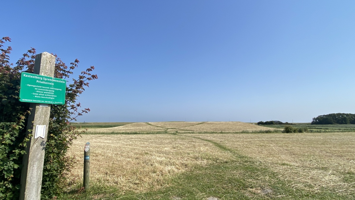
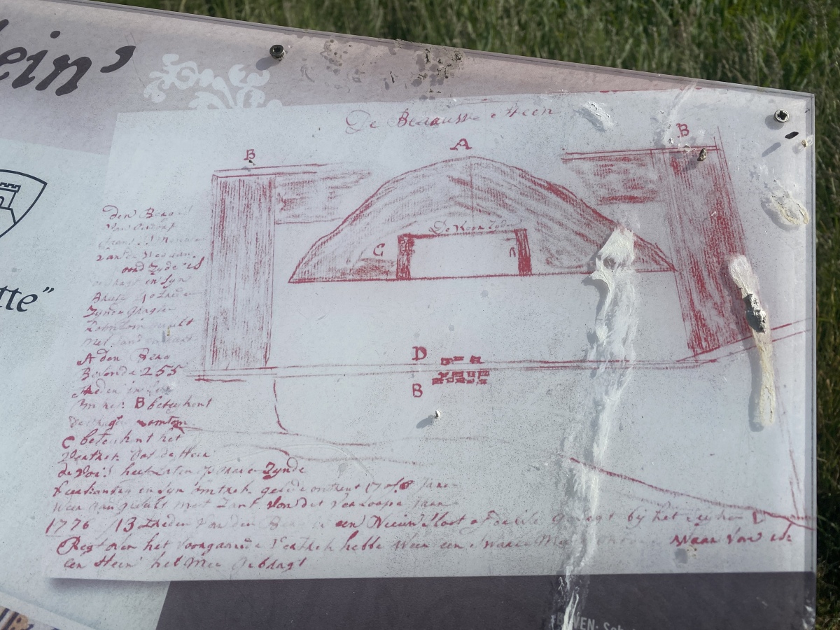
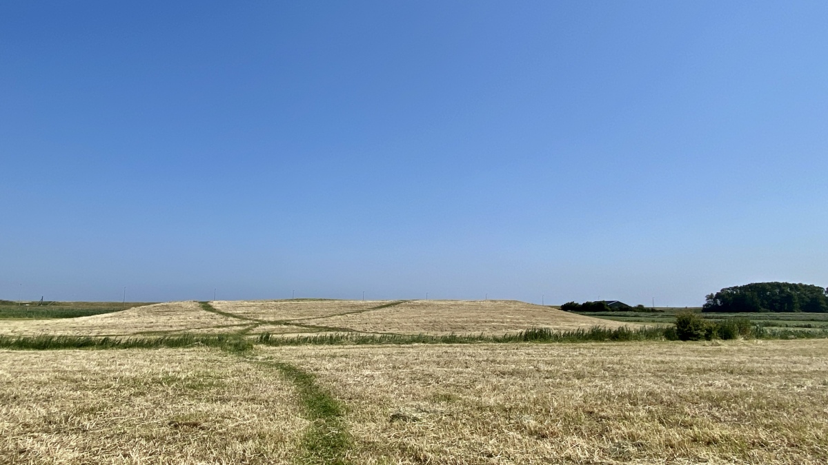
After the 17th century till now a large hill is left, used to give shelter to cattle during floods.
The word "motte" comes from the French chateau a motte and it means castle on a hill. Around the year 1000, nobles started building their fortified houses on a hill. Much of the earth from the hill comes from the moat around it. Initially these were wooden buildings, later they are built of stone. At the bottom of the hill were several buildings, including farms, a forecourt. In case of emergency, people could retreat to the hill. Soon it turns out that this setup is not safe and new castle forms were developed.
You may be viewing yesterday's version of this page. To see the most up to date information please register for a free account.


Do not use the above information on other web sites or publications without permission of the contributor.
Nearby Images from Flickr


The above images may not be of the site on this page, but were taken nearby. They are loaded from Flickr so please click on them for image credits.
Click here to see more info for this site
Nearby sites
Click here to view sites on an interactive map of the areaKey: Red: member's photo, Blue: 3rd party photo, Yellow: other image, Green: no photo - please go there and take one, Grey: site destroyed
Download sites to:
KML (Google Earth)
GPX (GPS waypoints)
CSV (Garmin/Navman)
CSV (Excel)
To unlock full downloads you need to sign up as a Contributory Member. Otherwise downloads are limited to 50 sites.
Turn off the page maps and other distractions
Nearby sites listing. In the following links * = Image available
17.0km S 185° Stadhuismuseum Zierikzee* Museum
20.9km SW 233° Haamstede (46170) Ancient Village or Settlement
23.3km SSW 197° Temple of Nehalennia* Ancient Temple
30.1km ENE 62° Masamuda Educatief archeologisch erf, Vlaardingen Museum
35.3km NE 47° Schipluiden* Ancient Village or Settlement
38.1km E 83° Gaatkensplas (529084) Ancient Village or Settlement
39.0km SW 228° Terra Maris* Museum
39.6km ENE 71° DeTijdTrap* Museum
44.0km S 186° Castle of Hellenburg* Ancient Village or Settlement
45.6km SW 226° Bos Boudewijnskerke* Misc. Earthwork
46.2km SW 224° Willibrordusput (Zoutelande)* Holy Well or Sacred Spring
50.6km WSW 247° Castellum of Aardenburg* Museum
54.3km NE 43° Rijksmuseum van Oudheden* Museum
59.7km NE 54° Archeologiehuis Zuid-Holland, Archeon Museum
60.6km E 86° Vindplaats Trijntje* Ancient Village or Settlement
62.3km E 87° Museum de Koperen Knop Museum
68.2km SSW 210° Roman walls of Porta Sinatra* Ancient Village or Settlement
71.0km E 87° Zwerfkei Plusminus* Natural Stone / Erratic / Other Natural Feature
73.4km S 187° Penitentiesteen van H. Bavo* Early Christian Sculptured Stone
77.5km ESE 116° Willibrordusput en -kapel (Alphen) Holy Well or Sacred Spring
78.1km ESE 118° Grafheuvel Alphen* Round Barrow(s)
78.5km ESE 117° Oudheidkundig Streekmuseum Museum
79.9km NE 36° Archeologisch Museum Haarlem* Museum
81.7km ESE 114° Regte Heide* Barrow Cemetery
81.8km ESE 114° Grafheuvel Goirle (45427)* Round Barrow(s)
View more nearby sites and additional images


 We would like to know more about this location. Please feel free to add a brief description and any relevant information in your own language.
 Wir möchten mehr über diese Stätte erfahren. Bitte zögern Sie nicht, eine kurze Beschreibung und relevante Informationen in Deutsch hinzuzufügen.
 Nous aimerions en savoir encore un peu sur les lieux. S'il vous plaît n'hesitez pas à ajouter une courte description et tous les renseignements pertinents dans votre propre langue.
 Quisieramos informarnos un poco más de las lugares. No dude en añadir una breve descripción y otros datos relevantes en su propio idioma.