<< Our Photo Pages >> Loher Stone Fort - Hillfort in Ireland (Republic of) in Co. Kerry
Submitted by Rua on Tuesday, 09 August 2022 Page Views: 4175
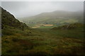
Iron Age and Later PrehistorySite Name: Loher Stone FortCountry: Ireland (Republic of)
NOTE: This site is 1.318 km away from the location you searched for.
County: Co. Kerry Type: Hillfort
Nearest Town: Loher
Latitude: 51.786084N Longitude: 10.165624W
Condition:
| 5 | Perfect |
| 4 | Almost Perfect |
| 3 | Reasonable but with some damage |
| 2 | Ruined but still recognisable as an ancient site |
| 1 | Pretty much destroyed, possibly visible as crop marks |
| 0 | No data. |
| -1 | Completely destroyed |
| 5 | Superb |
| 4 | Good |
| 3 | Ordinary |
| 2 | Not Good |
| 1 | Awful |
| 0 | No data. |
| 5 | Can be driven to, probably with disabled access |
| 4 | Short walk on a footpath |
| 3 | Requiring a bit more of a walk |
| 2 | A long walk |
| 1 | In the middle of nowhere, a nightmare to find |
| 0 | No data. |
| 5 | co-ordinates taken by GPS or official recorded co-ordinates |
| 4 | co-ordinates scaled from a detailed map |
| 3 | co-ordinates scaled from a bad map |
| 2 | co-ordinates of the nearest village |
| 1 | co-ordinates of the nearest town |
| 0 | no data |
Internal Links:
External Links:
I have visited· I would like to visit
jurassic_john visited on 1st Oct 2013 - their rating: Cond: 4 Amb: 4 Access: 4
")
"Although called a fort, this monument was really a defended farmstead which would originally have contained houses and farm buildings" - from the site information board.
On the N70 travelling south from Waterville, take the right hand road leading down to the shoreline at Ardkeragh, through Toor. Follow the road between the N70 and the one heading directly to the shoreline. About 2 kilometres along, before the hairpin bend, you will clearly see first the pair of standing stones to the left in a yard with white fencing. These could possibly be modern.
Downhill on the right is a ring fort in excellent condition - possibly modern and is fenced off, possibly for preservation? Found using Google Street View at the above coordinates. I have been able to get screen captures if required.
You may be viewing yesterday's version of this page. To see the most up to date information please register for a free account.
")
")
")
")
Do not use the above information on other web sites or publications without permission of the contributor.
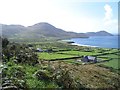
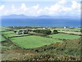
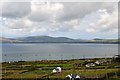
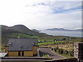
Nearby Images from Geograph Britain and Ireland:
©2006(licence)
©2006(licence)
©2018(licence)
©2014(licence)
©2014(licence)
The above images may not be of the site on this page, they are loaded from Geograph.
Please Submit an Image of this site or go out and take one for us!
Click here to see more info for this site
Nearby sites
Click here to view sites on an interactive map of the areaKey: Red: member's photo, Blue: 3rd party photo, Yellow: other image, Green: no photo - please go there and take one, Grey: site destroyed
Download sites to:
KML (Google Earth)
GPX (GPS waypoints)
CSV (Garmin/Navman)
CSV (Excel)
To unlock full downloads you need to sign up as a Contributory Member. Otherwise downloads are limited to 50 sites.
Turn off the page maps and other distractions
Nearby sites listing. In the following links * = Image available
1.3km S 172° Coomatloukane* Wedge Tomb (V5074660179)
3.2km N 9° Eightercua* Stone Row / Alignment (V51206465)
3.9km SE 129° The Derrynane Stone* Standing Stone (Menhir) (V5356258932)
4.1km ESE 115° Caherdaniel Fort (2)* Stone Fort or Dun (V5425059627)
4.1km ESE 115° Caherdaniel Fort (1)* Stone Fort or Dun (V5434559619)
5.1km E 96° Coomnahorna* Standing Stones
5.8km NNW 342° Spuncane Stone Circle (V490670)
7.8km NNE 25° Dromkeare Stone Row / Alignment
8.8km NNE 24° Dromod* Stone Circle (V545694)
9.8km NNE 32° Cahersavane* Standing Stones (V5605769610)
9.9km WNW 281° Kildreelig* Stone Row / Alignment
9.9km E 97° White Strand Modern Stone Circle and Dolmen* Modern Stone Circle etc (V6046959977)
10.0km NNE 26° Dromod Stone Row* Stone Row / Alignment
10.2km NNE 20° Doory row Stone Row / Alignment
10.3km NNE 21° Doory standing stone Standing Stone (Menhir)
10.5km ENE 78° Staigue* Stone Fort or Dun (V6103463272)
11.0km WNW 292° Coom Wedge Tomb* Wedge Tomb
11.1km W 276° Bolus Standing Stones (V396630)
11.7km NNE 30° Derrineden W Stone Row / Alignment
12.1km NNW 332° Fermoyle Stone Row / Alignment (V453724)
12.2km NW 306° Leabaleaha Stone Circle (V410690)
12.2km NNE 31° Derrineden E Stone Row / Alignment
12.7km E 83° Derreenauliff Stone Row / Alignment
13.2km NW 305° St Buonia's Cross (Killabuonia) Early Christian Sculptured Stone (V4002269422)
13.6km ESE 123° Kilcatherine wedge tomb* Wedge Tomb
View more nearby sites and additional images


 We would like to know more about this location. Please feel free to add a brief description and any relevant information in your own language.
 Wir möchten mehr über diese Stätte erfahren. Bitte zögern Sie nicht, eine kurze Beschreibung und relevante Informationen in Deutsch hinzuzufügen.
 Nous aimerions en savoir encore un peu sur les lieux. S'il vous plaît n'hesitez pas à ajouter une courte description et tous les renseignements pertinents dans votre propre langue.
 Quisieramos informarnos un poco más de las lugares. No dude en añadir una breve descripción y otros datos relevantes en su propio idioma.