<< Text Pages >> Grodzisko Witów - Hillfort in Poland in Lodzkie
Submitted by SolarMegalith on Saturday, 27 October 2018 Page Views: 832
Iron Age and Later PrehistorySite Name: Grodzisko WitówCountry: Poland
NOTE: This site is 14.401 km away from the location you searched for.
Voivodeship: Lodzkie Type: Hillfort
Nearest Village: Witów
Latitude: 51.470825N Longitude: 18.834161E
Condition:
| 5 | Perfect |
| 4 | Almost Perfect |
| 3 | Reasonable but with some damage |
| 2 | Ruined but still recognisable as an ancient site |
| 1 | Pretty much destroyed, possibly visible as crop marks |
| 0 | No data. |
| -1 | Completely destroyed |
| 5 | Superb |
| 4 | Good |
| 3 | Ordinary |
| 2 | Not Good |
| 1 | Awful |
| 0 | No data. |
| 5 | Can be driven to, probably with disabled access |
| 4 | Short walk on a footpath |
| 3 | Requiring a bit more of a walk |
| 2 | A long walk |
| 1 | In the middle of nowhere, a nightmare to find |
| 0 | No data. |
| 5 | co-ordinates taken by GPS or official recorded co-ordinates |
| 4 | co-ordinates scaled from a detailed map |
| 3 | co-ordinates scaled from a bad map |
| 2 | co-ordinates of the nearest village |
| 1 | co-ordinates of the nearest town |
| 0 | no data |
Internal Links:
External Links:
Hillfort in Lodzkie
Remains of an early medieval hillfort are located immediately east of the village if Witów. Most of the earthwork is under plough and heavily damaged, except for the northern sector of the fort which is covered by trees.
Read more at atlasgrodzisk.pl
You may be viewing yesterday's version of this page. To see the most up to date information please register for a free account.
Do not use the above information on other web sites or publications without permission of the contributor.
Nearby Images from Flickr

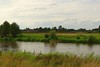

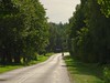
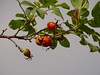
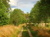
The above images may not be of the site on this page, but were taken nearby. They are loaded from Flickr so please click on them for image credits.
Click here to see more info for this site
Nearby sites
Click here to view sites on an interactive map of the areaKey: Red: member's photo, Blue: 3rd party photo, Yellow: other image, Green: no photo - please go there and take one, Grey: site destroyed
Download sites to:
KML (Google Earth)
GPX (GPS waypoints)
CSV (Garmin/Navman)
CSV (Excel)
To unlock full downloads you need to sign up as a Contributory Member. Otherwise downloads are limited to 50 sites.
Turn off the page maps and other distractions
Nearby sites listing. In the following links * = Image available
18.6km S 186° Kurhany Krzętle* Barrow Cemetery
38.3km S 191° Przywóz Bronze Age Settlement Ancient Village or Settlement
38.5km S 190° Kurhany Przywóz* Barrow Cemetery
52.1km WSW 247° Grodzisko Podzamcze* Hillfort
54.7km NE 51° Muzeum Archeologiczne i Etnograficzne w Łodzi* Museum
70.2km NNE 22° Grodzisko Tum* Hillfort
74.1km SSE 161° Wyczerpy Górne Bronze Age Settlement Ancient Village or Settlement
77.1km SSE 158° Grodzisko Gąszczyk* Hillfort
78.2km SE 125° Grodzisko Chełmo Hillfort
80.7km NNE 25° Kurhan Ględzianówek Round Barrow(s)
83.5km SSW 193° Kopiec Dzielna Round Barrow(s)
84.0km SSE 159° Jaskinia Towarna Cave or Rock Shelter
88.2km SSE 158° Jaskinia Komarowa Cave or Rock Shelter
90.2km WSW 254° Kurhany Jemielna* Barrow Cemetery
94.0km W 265° Kurhany Goszcz Barrow Cemetery
95.7km SSE 155° Grodzisko Wały - Potok Złoty* Hillfort
98.7km NNE 25° Mnich Stone Circle* Stone Circle
101.2km N 358° Wólka Komorowska Long Barrows Long Barrow
101.4km N 357° Gaj Long Barrow* Long Barrow
104.4km N 1° Wietrzychowice Long Barrows* Long Barrow
105.5km SSW 212° Grodzisko Lędziny Hillfort
105.5km N 0° Obałki Long Barrows Long Barrow
108.7km W 267° Kurhan Łazy Wielkie Round Barrow(s)
110.4km W 262° Kurhany Ludgierzowice* Barrow Cemetery
110.6km SSE 152° Grodzisko Góra Słupsko* Hillfort
View more nearby sites and additional images


 We would like to know more about this location. Please feel free to add a brief description and any relevant information in your own language.
 Wir möchten mehr über diese Stätte erfahren. Bitte zögern Sie nicht, eine kurze Beschreibung und relevante Informationen in Deutsch hinzuzufügen.
 Nous aimerions en savoir encore un peu sur les lieux. S'il vous plaît n'hesitez pas à ajouter une courte description et tous les renseignements pertinents dans votre propre langue.
 Quisieramos informarnos un poco más de las lugares. No dude en añadir una breve descripción y otros datos relevantes en su propio idioma.