<< Our Photo Pages >> King Alfred's Well - Holy Well or Sacred Spring in England in Oxfordshire
Submitted by HOLYWELL on Saturday, 16 February 2008 Page Views: 7963
Springs and Holy WellsSite Name: King Alfred's WellCountry: England
NOTE: This site is 0.736 km away from the location you searched for.
County: Oxfordshire Type: Holy Well or Sacred Spring
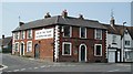
Nearest Town: Wantage
Map Ref: SU399878
Latitude: 51.587648N Longitude: 1.425482W
Condition:
| 5 | Perfect |
| 4 | Almost Perfect |
| 3 | Reasonable but with some damage |
| 2 | Ruined but still recognisable as an ancient site |
| 1 | Pretty much destroyed, possibly visible as crop marks |
| 0 | No data. |
| -1 | Completely destroyed |
| 5 | Superb |
| 4 | Good |
| 3 | Ordinary |
| 2 | Not Good |
| 1 | Awful |
| 0 | No data. |
| 5 | Can be driven to, probably with disabled access |
| 4 | Short walk on a footpath |
| 3 | Requiring a bit more of a walk |
| 2 | A long walk |
| 1 | In the middle of nowhere, a nightmare to find |
| 0 | No data. |
| 5 | co-ordinates taken by GPS or official recorded co-ordinates |
| 4 | co-ordinates scaled from a detailed map |
| 3 | co-ordinates scaled from a bad map |
| 2 | co-ordinates of the nearest village |
| 1 | co-ordinates of the nearest town |
| 0 | no data |
Internal Links:
External Links:
")
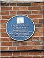
This site is associated with an ancient stronghold of the Saxons. It arises in a woody area which is a public space. In the 1000th Jubilee anniversary of King Alfred's association with the town, a procession went from the town to the well where festivities were held.
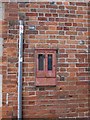
The well itself is a boggy morase with only remnants of the structure which are probably only Victorian.
You may be viewing yesterday's version of this page. To see the most up to date information please register for a free account.
Do not use the above information on other web sites or publications without permission of the contributor.
Nearby Images from Geograph Britain and Ireland:
©2006(licence)

©2016(licence)
©2011(licence)
©2010(licence)
©2011(licence)
The above images may not be of the site on this page, they are loaded from Geograph.
Please Submit an Image of this site or go out and take one for us!
Click here to see more info for this site
Nearby sites
Key: Red: member's photo, Blue: 3rd party photo, Yellow: other image, Green: no photo - please go there and take one, Grey: site destroyed
Download sites to:
KML (Google Earth)
GPX (GPS waypoints)
CSV (Garmin/Navman)
CSV (Excel)
To unlock full downloads you need to sign up as a Contributory Member. Otherwise downloads are limited to 50 sites.
Turn off the page maps and other distractions
Nearby sites listing. In the following links * = Image available
3.6km SSW 203° Segsbury Camp* Hillfort (SU385845)
3.8km SSE 164° Pewit Farm Round Barrow(s) (SU40968412)
4.2km SSE 149° Yew Down Round Barrow Round Barrow(s) (SU42088426)
4.4km SSE 158° Grim's Ditch 1 (Oxfordshire) Misc. Earthwork (SU41618374)
4.5km SE 145° Yew Down Round Barrow(s) (SU42528416)
4.8km SE 127° Grim's Ditch 2 (Oxfordshire) Misc. Earthwork (SU43768499)
6.1km WSW 245° Sincombe Farm Bowl Barrow* Round Barrow(s) (SU34368521)
6.4km ESE 116° Skutchamer Knob Round Barrow(s) (SU4565585038)
7.4km S 180° South Fawley* Barrow Cemetery (SU39908039)
7.5km W 265° The Blowing Stone* Holed Stone (SU324871)
7.6km W 272° Fawler Modern Stone Circle* Modern Stone Circle etc (SU323880)
8.5km SW 235° Lambourn Seven Barrows* Barrow Cemetery (SU32898288)
8.6km W 260° Rams Hill* Causewayed Enclosure (SU314863)
8.8km WSW 240° Lambourn Long Barrow* Long Barrow (SU32328338)
8.9km NNW 344° Cherbury Camp* Hillfort (SU374963)
9.4km NNE 27° Iron Age and Roman Complex at Frilford Ancient Village or Settlement (SU441962)
9.8km W 264° Uffington White Horse* Hill Figure or Geoglyph (SU30128662)
9.8km W 265° Dragon Hill* Natural Stone / Erratic / Other Natural Feature (SU30078687)
10.0km W 263° Uffington Castle Neolithic long barrow* Long Barrow (SU30008652)
10.1km W 262° Uffington Castle* Hillfort (SU299864)
10.1km WSW 253° Idlebush Barrow* Ancient Village or Settlement (SU302848)
10.3km SW 230° Hangman's Stone - Upper Lambourn* Standing Stone (Menhir) (SU320812)
10.4km ENE 57° Drayton South Cursus Cursus (SU486935)
11.0km NE 55° Drayton South Cursus Cursus (SU489941)
11.0km WSW 245° Knighton Bushes* Ancient Village or Settlement (SU300830)
View more nearby sites and additional images


 We would like to know more about this location. Please feel free to add a brief description and any relevant information in your own language.
 Wir möchten mehr über diese Stätte erfahren. Bitte zögern Sie nicht, eine kurze Beschreibung und relevante Informationen in Deutsch hinzuzufügen.
 Nous aimerions en savoir encore un peu sur les lieux. S'il vous plaît n'hesitez pas à ajouter une courte description et tous les renseignements pertinents dans votre propre langue.
 Quisieramos informarnos un poco más de las lugares. No dude en añadir una breve descripción y otros datos relevantes en su propio idioma.