<< Text Pages >> Broken Cross (Westminster) - Ancient Cross in England in Greater London
Submitted by Anne T on Friday, 05 May 2017 Page Views: 1935
Early Medieval (Dark Age)Site Name: Broken Cross (Westminster)Country: England
NOTE: This site is 0.176 km away from the location you searched for.
County: Greater London Type: Ancient Cross
Nearest Town: Westminster
Map Ref: TQ322812
Latitude: 51.514265N Longitude: 0.096226W
Condition:
| 5 | Perfect |
| 4 | Almost Perfect |
| 3 | Reasonable but with some damage |
| 2 | Ruined but still recognisable as an ancient site |
| 1 | Pretty much destroyed, possibly visible as crop marks |
| 0 | No data. |
| -1 | Completely destroyed |
| 5 | Superb |
| 4 | Good |
| 3 | Ordinary |
| 2 | Not Good |
| 1 | Awful |
| 0 | No data. |
| 5 | Can be driven to, probably with disabled access |
| 4 | Short walk on a footpath |
| 3 | Requiring a bit more of a walk |
| 2 | A long walk |
| 1 | In the middle of nowhere, a nightmare to find |
| 0 | No data. |
| 5 | co-ordinates taken by GPS or official recorded co-ordinates |
| 4 | co-ordinates scaled from a detailed map |
| 3 | co-ordinates scaled from a bad map |
| 2 | co-ordinates of the nearest village |
| 1 | co-ordinates of the nearest town |
| 0 | no data |
Be the first person to rate this site - see the 'Contribute!' box in the right hand menu.
Internal Links:
External Links:
Ancient Cross in Greater London
Details of this intriguing cross, which might have been placed on the site of standing stone which previously stood there, can be found on The Northern Antiquarian (TNA) - see their entry for Broken Cross, Westminster, London, Middlesex.
TNA tell us that this cross was destroyed way back in the 14th century, but was “erected by the Earl of Gloucester in the reign of Henry III (1216-1272), but it did not stand very long. Its site is said to have been ‘the place of the meeting of the Folkmote…near St. Martin’s-le-Grand, about midway between the Northgate of the precinct (of St. Paul’s) and the church of St. Vedast.’ On 5th September 1379, agreements were drawn up for letting the stations about the Broken Cross to five divers persons. The cross was bodily taken down in 1390 (and would have been very close to Cheapside)."
Note: Have you come across any historical references to this cross, or the site on which it stood? If so, would you contribute any notes or references you might have?
You may be viewing yesterday's version of this page. To see the most up to date information please register for a free account.
Do not use the above information on other web sites or publications without permission of the contributor.
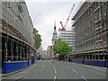
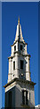
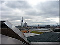
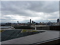
Nearby Images from Geograph Britain and Ireland:
©2007(licence)
©2010(licence)
©2011(licence)
©2011(licence)
©2023(licence)
The above images may not be of the site on this page, they are loaded from Geograph.
Please Submit an Image of this site or go out and take one for us!
Click here to see more info for this site
Nearby sites
Key: Red: member's photo, Blue: 3rd party photo, Yellow: other image, Green: no photo - please go there and take one, Grey: site destroyed
Download sites to:
KML (Google Earth)
GPX (GPS waypoints)
CSV (Garmin/Navman)
CSV (Excel)
To unlock full downloads you need to sign up as a Contributory Member. Otherwise downloads are limited to 50 sites.
Turn off the page maps and other distractions
Nearby sites listing. In the following links * = Image available
316m NNW 343° Museum of London* Museum (TQ321815)
362m ESE 119° Mithras Temple (London)* Ancient Temple (TQ3252181031)
560m ESE 124° London Stone* Standing Stone (Menhir) (TQ3267680903)
698m W 271° Bridewell (Fleet Street) Holy Well or Sacred Spring (TQ315812)
740m NNW 327° Cow Cross (Finsbury) Ancient Cross (TQ31788181)
1.2km NW 323° Clerk's Well (Farringdon Lane) Holy Well or Sacred Spring (TQ3145282134)
1.3km ESE 115° All Hallows by the Tower* Museum (TQ3337380695)
1.3km NW 320° Skinner's Well (Finsbury) Holy Well or Sacred Spring (TQ313822)
1.4km ESE 113° St Olave's Well* Holy Well or Sacred Spring (TQ335807)
1.8km WSW 249° Cleopatra's Needle (London)* Standing Stone (Menhir) (TQ3054380516)
2.2km WNW 282° British Museum* Museum (TQ300816)
2.6km S 181° Cuming Museum Museum (TQ322786)
2.7km WNW 292° Petrie Museum of Egyptian Archaeology* Museum (TQ2962882172)
3.0km W 280° The One and The Many* Modern Stone Circle etc (TQ2926981650)
3.6km SW 214° Mesolithic structure near Vauxhall bridge* Timber Circle (TQ30217814)
5.1km WSW 238° Tutankhamun: Treasures of the Golden Pharaoh exhibition, Saatchi Gallery* Museum (TQ279784)
5.9km WSW 252° London Natural History Museum* Museum (TQ266792)
6.3km W 259° St Govor's Well* Holy Well or Sacred Spring (TQ2605079887)
6.3km N 358° Finsbury Park earthworks* Artificial Mound (TQ3186087537)
7.2km NW 319° Hampstead Heath Barrow* Round Barrow(s) (TQ2738286518)
7.3km NW 313° Chalybeate Well* Holy Well or Sacred Spring (TQ2671986055)
7.8km ESE 123° Greenwich Park Barrows* Barrow Cemetery (TQ3883677128)
7.9km SE 141° Hilly Fields Stone Circle* Modern Stone Circle etc (TQ374752)
8.4km NNE 12° St. Eloy's Well* Holy Well or Sacred Spring (TQ338895)
9.0km W 279° Kensal Green* Modern Stone Circle etc (TQ233824)
View more nearby sites and additional images


 We would like to know more about this location. Please feel free to add a brief description and any relevant information in your own language.
 Wir möchten mehr über diese Stätte erfahren. Bitte zögern Sie nicht, eine kurze Beschreibung und relevante Informationen in Deutsch hinzuzufügen.
 Nous aimerions en savoir encore un peu sur les lieux. S'il vous plaît n'hesitez pas à ajouter une courte description et tous les renseignements pertinents dans votre propre langue.
 Quisieramos informarnos un poco más de las lugares. No dude en añadir una breve descripción y otros datos relevantes en su propio idioma.