<< Our Photo Pages >> Quellheiligtum Klemensborn - Holy Well or Sacred Spring in Germany in North Rhine-Westphalia
Submitted by Harald_Platta on Saturday, 21 May 2022 Page Views: 706
Springs and Holy WellsSite Name: Quellheiligtum Klemensborn Alternative Name: Klemenspüttchen, Clemenskirche, St.-Clemens-KircheCountry: Germany
NOTE: This site is 0.562 km away from the location you searched for.
Land: North Rhine-Westphalia Type: Holy Well or Sacred Spring
Nearest Town: Essen Nearest Village: Heidhausen
Latitude: 51.383057N Longitude: 7.005916E
Condition:
| 5 | Perfect |
| 4 | Almost Perfect |
| 3 | Reasonable but with some damage |
| 2 | Ruined but still recognisable as an ancient site |
| 1 | Pretty much destroyed, possibly visible as crop marks |
| 0 | No data. |
| -1 | Completely destroyed |
| 5 | Superb |
| 4 | Good |
| 3 | Ordinary |
| 2 | Not Good |
| 1 | Awful |
| 0 | No data. |
| 5 | Can be driven to, probably with disabled access |
| 4 | Short walk on a footpath |
| 3 | Requiring a bit more of a walk |
| 2 | A long walk |
| 1 | In the middle of nowhere, a nightmare to find |
| 0 | No data. |
| 5 | co-ordinates taken by GPS or official recorded co-ordinates |
| 4 | co-ordinates scaled from a detailed map |
| 3 | co-ordinates scaled from a bad map |
| 2 | co-ordinates of the nearest village |
| 1 | co-ordinates of the nearest town |
| 0 | no data |
Internal Links:
External Links:
I have visited· I would like to visit
Harald_Platta visited on 20th May 2022 - their rating: Cond: 4 Amb: 4 Access: 4
Janek visited - their rating: Cond: 3 Amb: 4 Access: 4
Average ratings for this site from all visit loggers: Condition: 3.5 Ambience: 4 Access: 4
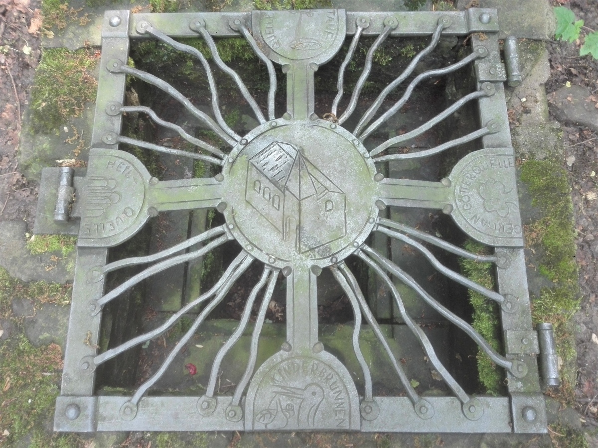
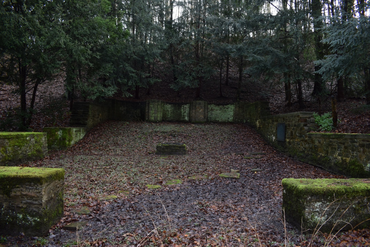
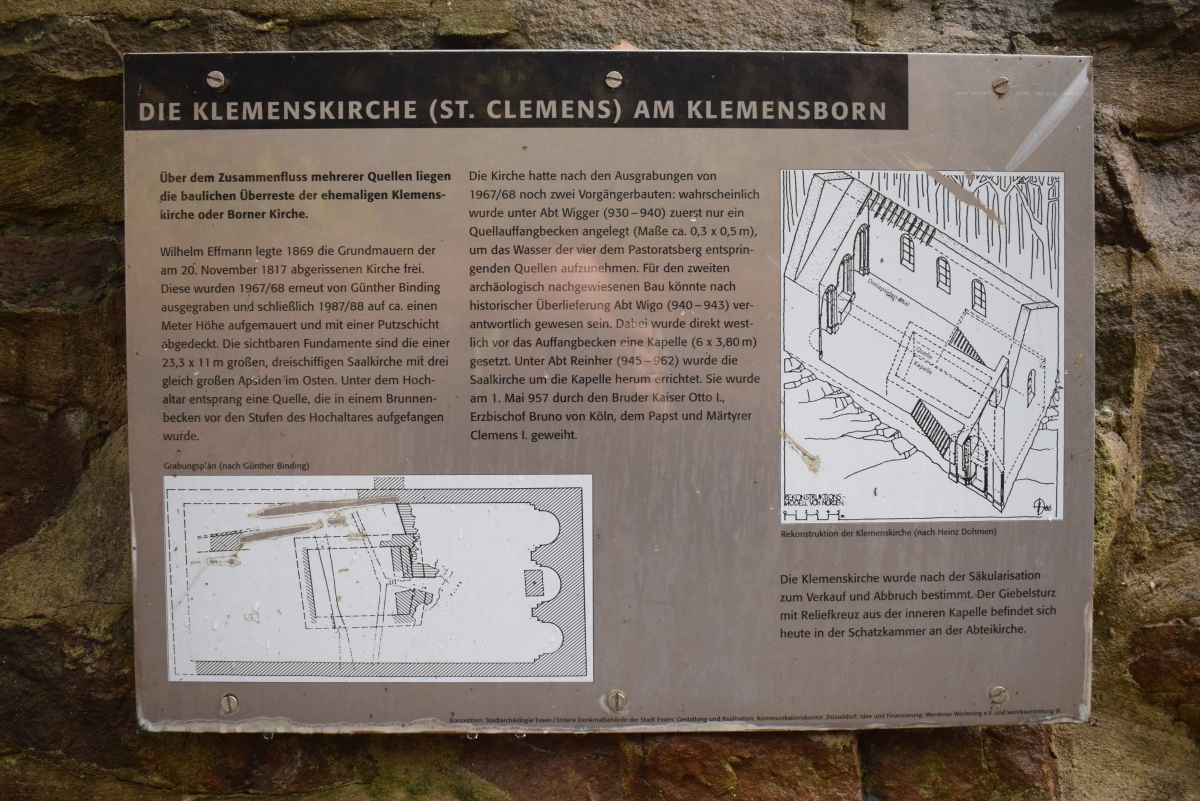
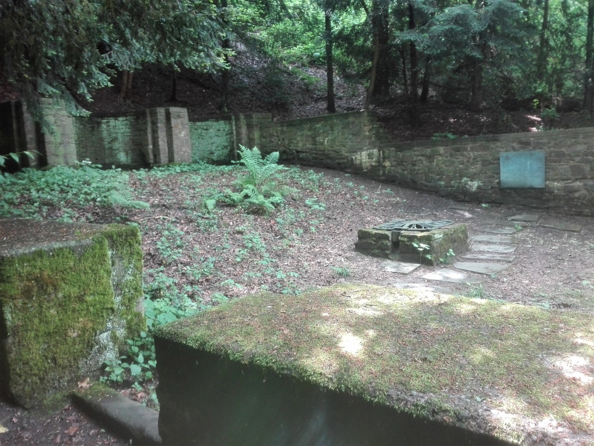
The chapel was extended to a church building and consecrated to the martyr Clemens by the Cologne archbishop Bruno, the brother of Emperor Otto the Great, in 957. The church was altered several times in the 12th century and was finally demolished in 1817. After excavations, the foundation walls were built up in 1987/88 and secured with a layer of plaster.
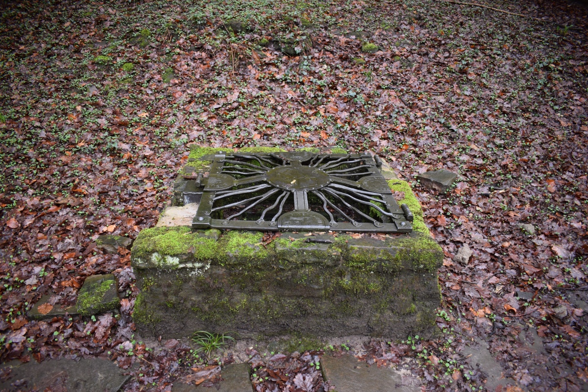
Today, the well basin can be visited in the middle of the church ruins. It is covered with a modern metal grid that exhibits the inscriptions Germanische Götterquelle ("Germanic gods well"), Heilquelle ("healing well"), Kinderquelle ("children well"), Taufquelle ("baptismal well").
References
[01] Binding, Günter (1975): Quellen, Brunnen und Reliquiengräber in Kirchen. In: Zeitschrift zur Archäologie des Mittelalters 3, S. 37-56, o. O.
[02] Binding, Günter (1969): St. Klemens in Essen-Werden (Klemensborn). In: Führer zu vor- und frühgeschichtlichen Denkmälern, 15, S. 187-188. Mainz.
[03] Burghard, Hermann (2001): Werden. (Rheinischer Städteatlas, Lieferung XIV, Nr. 78.) S. 251 f., Köln, Weimar, Wien.
[04] Effmann, Wilhelm (Bearb.) / Hohmann, E. (1922): Die karolingisch-ottonischen Bauten zu Werden 2. S. 1-19, Berlin.
[05] Leenen, Stefan (2005): St. Clemens. Quellheiligtum und Kirche. In: Hopp, Detlef (Hrsg.): Unter unseren Füßen. Ein archäologischer Streifzug durch Werden, S. 21-23. Essen.
[06] „Kirchenwüstung Sankt Clemens in Werden”. In: KuLaDig, Kultur.Landschaft.Digital. URL: https://www.kuladig.de/Objektansicht/A-CW-20090514-0003 (Abgerufen: 21. Mai 2022)
You may be viewing yesterday's version of this page. To see the most up to date information please register for a free account.
Do not use the above information on other web sites or publications without permission of the contributor.
Click here to see more info for this site
Nearby sites
Click here to view sites on an interactive map of the areaKey: Red: member's photo, Blue: 3rd party photo, Yellow: other image, Green: no photo - please go there and take one, Grey: site destroyed
Download sites to:
KML (Google Earth)
GPX (GPS waypoints)
CSV (Garmin/Navman)
CSV (Excel)
To unlock full downloads you need to sign up as a Contributory Member. Otherwise downloads are limited to 50 sites.
Turn off the page maps and other distractions
Nearby sites listing. In the following links * = Image available
89m SW 226° Herrenburg (Essen)* Hillfort
1.0km SW 216° Alteburg (Essen)* Hillfort
3.8km NW 309° Galgenhügel Schuir* Artificial Mound
4.0km WSW 242° Bilstein* Rock Outcrop
4.2km NNE 33° Summstein Schellenberg* Modern Stone Circle etc
4.4km WNW 301° Gräberfeld Lilienthalstraße* Barrow Cemetery
4.8km E 91° Kupferdreh Steinkiste* Cist
5.2km NW 307° Dellberg* Artificial Mound
5.3km SSE 158° Summstein Herminghauspark* Modern Stone Circle etc
5.4km E 79° Mineralien-Museum Essen-Kupferdreh* Museum
7.3km WNW 292° Summstein Holthausen* Modern Stone Circle etc
9.3km E 84° Heiliger Spring (Hattingen)* Holy Well or Sacred Spring
9.5km NE 55° Ruhrkämpfer-Denkmal* Modern Stone Circle etc
9.5km NE 54° Vryburg* Hillfort
9.7km E 81° Heidenstein (Hattingen)* Natural Stone / Erratic / Other Natural Feature
10.1km E 87° Isenberg Höhlung* Cave or Rock Shelter
10.3km NNW 331° Borbecke Quelle* Holy Well or Sacred Spring
10.4km WNW 300° Summstein im Stadthallengarten* Modern Stone Circle etc
10.9km ENE 71° Grotenberg* Rock Outcrop
11.4km ENE 63° Krampenstein* Natural Stone / Erratic / Other Natural Feature
11.7km NNE 12° Ruhr Museum* Museum
11.8km WNW 286° Hünengrab Uhlenhorst* Modern Stone Circle etc
12.2km E 82° Horkenstein* Rock Art
13.0km E 98° Wodantalquelle* Holy Well or Sacred Spring
13.3km E 85° Augenquelle* Holy Well or Sacred Spring
View more nearby sites and additional images


 We would like to know more about this location. Please feel free to add a brief description and any relevant information in your own language.
 Wir möchten mehr über diese Stätte erfahren. Bitte zögern Sie nicht, eine kurze Beschreibung und relevante Informationen in Deutsch hinzuzufügen.
 Nous aimerions en savoir encore un peu sur les lieux. S'il vous plaît n'hesitez pas à ajouter une courte description et tous les renseignements pertinents dans votre propre langue.
 Quisieramos informarnos un poco más de las lugares. No dude en añadir una breve descripción y otros datos relevantes en su propio idioma.