

<< Text Pages >> Tumble Beacon - Round Barrow(s) in England in Surrey
Submitted by Andy B on Wednesday, 23 April 2025 Page Views: 980
Neolithic and Bronze AgeSite Name: Tumble BeaconCountry: England County: Surrey Type: Round Barrow(s)
Nearest Town: Banstead
Map Ref: TQ24325902
Latitude: 51.316715N Longitude: 0.217496W
Condition:
| 5 | Perfect |
| 4 | Almost Perfect |
| 3 | Reasonable but with some damage |
| 2 | Ruined but still recognisable as an ancient site |
| 1 | Pretty much destroyed, possibly visible as crop marks |
| 0 | No data. |
| -1 | Completely destroyed |
| 5 | Superb |
| 4 | Good |
| 3 | Ordinary |
| 2 | Not Good |
| 1 | Awful |
| 0 | No data. |
| 5 | Can be driven to, probably with disabled access |
| 4 | Short walk on a footpath |
| 3 | Requiring a bit more of a walk |
| 2 | A long walk |
| 1 | In the middle of nowhere, a nightmare to find |
| 0 | No data. |
| 5 | co-ordinates taken by GPS or official recorded co-ordinates |
| 4 | co-ordinates scaled from a detailed map |
| 3 | co-ordinates scaled from a bad map |
| 2 | co-ordinates of the nearest village |
| 1 | co-ordinates of the nearest town |
| 0 | no data |
Internal Links:
External Links:
A bowl barrow standing more than 3.5m (12 ft tall), 35m (38 yds) east-west and 40m (44 yds) north-south. The name of the site indicates its later usage, with the ‘beacon’ element from 1594 when a fire was lit upon it to tell of the arrival of the Spanish Armada. Whether it was used as a beacon prior to this is not known.
Historic England highlight that the addition of further material to increase the height of the original barrow mound will have helped to preserve the archaeological and environmental evidence it contains and protected the monument from the attentions of the later antiquarians who examined many similar barrows.
One of the early archaeological descriptions comes from the pen of the old historian and folklorist, Walter Johnson (1903), who writes:
“About a mile South-west of Banstead Church, in a field close by Tumble Farm, on the outskirts of Nork Park, is an eminence marked on the map as Tumble Beacon. A picturesque clump of pines stands on the mound, which, from its general character, and from the flint scraps we have found there, we have every reason to believe is a round barrow, despite the local tradition that it is a ‘sea-mark.’ The Scotch pines, in such positions as we find here, may probably, Mr. Grant Allen thought, be the descendants of trees put in by human hands when the barrow was first raised.”
Whilst this latter idea might be very hard to prove, the assertion that it’s prehistoric certainly gained favour as more antiquarians examined the site. Johnson later told that when examining this and other sites nearby (sadly destroyed) he came across a variety of prehistoric stone utensils in the area.
Read more at The Northern Antiquarian: megalithix.wordpress.com/2019/05/18/tumble-beacon/
Listing entry: historicengland.org.uk/listing/the-list/list-entry/1009804?section=official-list-entry
ACCESS: The mound is in a private garden so permission would be required, however it is visible from the road.
You may be viewing yesterday's version of this page. To see the most up to date information please register for a free account.
Do not use the above information on other web sites or publications without permission of the contributor.
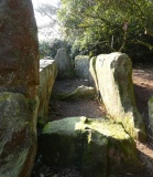
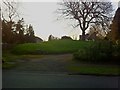
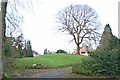
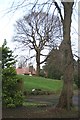
Nearby Images from Geograph Britain and Ireland:
©2013(licence)
©2013(licence)
©2013(licence)
©2013(licence)
©2013(licence)
The above images may not be of the site on this page, they are loaded from Geograph.
Please Submit an Image of this site or go out and take one for us!
Click here to see more info for this site
Nearby sites
Key: Red: member's photo, Blue: 3rd party photo, Yellow: other image, Green: no photo - please go there and take one, Grey: site destroyed
Download sites to:
KML (Google Earth)
GPX (GPS waypoints)
CSV (Garmin/Navman)
CSV (Excel)
To unlock full downloads you need to sign up as a Contributory Member. Otherwise downloads are limited to 50 sites.
Turn off the page maps and other distractions
Nearby sites listing. In the following links * = Image available
1.8km NNE 20° Gally Hills Barrow Cemetery (TQ249607)
4.0km SSE 160° St. Margaret's Well (Mugswell)* Holy Well or Sacred Spring (TQ258553)
4.0km NNW 331° Hatch Furlong Ritual Shafts* Misc. Earthwork (TQ223625)
4.1km SE 124° Chipstead Well Holy Well or Sacred Spring (TQ278568)
4.4km NNW 328° Ewell Springs (Surrey)* Holy Well or Sacred Spring (TQ219627)
4.5km NNW 327° Bourne Hall Museum* Museum (TQ218627)
5.8km ESE 104° Farthing Downs* Barrow Cemetery (TQ300578)
6.0km WSW 239° Thirty Acre Barn Barrows Round Barrow(s) (TQ192558)
6.5km NE 34° Queen Anne's Well (Carshalton)* Holy Well or Sacred Spring (TQ279645)
6.8km W 280° Ashtead Common Earthwork* Misc. Earthwork (TQ176600)
6.9km SSE 158° Gatton Park, The Millennium Stones* Modern Stone Circle etc (TQ271527)
7.3km ESE 118° St Peter and St Paul's Church (Chaldon)* Ancient Cross (TQ3087455694)
7.3km SW 235° Cherkley Court Barrows* Round Barrow(s) (TQ18385467)
8.1km E 80° Riddlesdown Newe Ditch* Misc. Earthwork (TQ3230460572)
8.3km WSW 248° Thorncroft Spring (Leatherhead)* Holy Well or Sacred Spring (TQ167558)
8.4km N 3° Morden Park* Artificial Mound (TQ245674)
8.6km S 185° Reigate Heath Barrows* Barrow Cemetery (TQ23725042)
9.3km SSE 163° Waterslade Spring Holy Well or Sacred Spring (TQ272502)
9.4km SSE 163° Whitepost Hill Spring Holy Well or Sacred Spring (TQ273501)
9.6km SW 218° Box Hill Bowl Barrow 2* Round Barrow(s) (TQ18575132)
9.8km SE 129° Spring Bottom* Holy Well or Sacred Spring (TQ321531)
9.9km SSE 163° Redhill Common* Round Barrow(s) (TQ274496)
10.0km SW 220° Box Hill Bowl Barrow 1* Round Barrow(s) (TQ18065121)
10.3km ENE 68° Croham Hurst* Round Barrow(s) (TQ338632)
10.4km SE 125° War Coppice Camp Hillfort (TQ32985326)
View more nearby sites and additional images


 We would like to know more about this location. Please feel free to add a brief description and any relevant information in your own language.
 Wir möchten mehr über diese Stätte erfahren. Bitte zögern Sie nicht, eine kurze Beschreibung und relevante Informationen in Deutsch hinzuzufügen.
 Nous aimerions en savoir encore un peu sur les lieux. S'il vous plaît n'hesitez pas à ajouter une courte description et tous les renseignements pertinents dans votre propre langue.
 Quisieramos informarnos un poco más de las lugares. No dude en añadir una breve descripción y otros datos relevantes en su propio idioma.