<< Our Photo Pages >> Tumulus, Boyke Lane - Round Barrow(s) in England in Kent
Submitted by SolarMegalith on Tuesday, 29 April 2008 Page Views: 7241
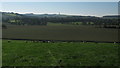
Neolithic and Bronze AgeSite Name: Tumulus, Boyke LaneCountry: England County: Kent Type: Round Barrow(s)
Nearest Town: Folkestone Nearest Village: Lyminge
Map Ref: TR15944290
Latitude: 51.144616N Longitude: 1.085854E
Condition:
| 5 | Perfect |
| 4 | Almost Perfect |
| 3 | Reasonable but with some damage |
| 2 | Ruined but still recognisable as an ancient site |
| 1 | Pretty much destroyed, possibly visible as crop marks |
| 0 | No data. |
| -1 | Completely destroyed |
| 5 | Superb |
| 4 | Good |
| 3 | Ordinary |
| 2 | Not Good |
| 1 | Awful |
| 0 | No data. |
| 5 | Can be driven to, probably with disabled access |
| 4 | Short walk on a footpath |
| 3 | Requiring a bit more of a walk |
| 2 | A long walk |
| 1 | In the middle of nowhere, a nightmare to find |
| 0 | No data. |
| 5 | co-ordinates taken by GPS or official recorded co-ordinates |
| 4 | co-ordinates scaled from a detailed map |
| 3 | co-ordinates scaled from a bad map |
| 2 | co-ordinates of the nearest village |
| 1 | co-ordinates of the nearest town |
| 0 | no data |
Internal Links:
External Links:
I have visited· I would like to visit
SolarMegalith visited on 4th Oct 2008 - their rating: Cond: 3 Amb: 3 Access: 4
")
You may be viewing yesterday's version of this page. To see the most up to date information please register for a free account.
")
")
Do not use the above information on other web sites or publications without permission of the contributor.
Nearby Images from Geograph Britain and Ireland:
©2010(licence)
©2016(licence)
©2015(licence)
©2015(licence)
©2010(licence)
The above images may not be of the site on this page, they are loaded from Geograph.
Please Submit an Image of this site or go out and take one for us!
Click here to see more info for this site
Nearby sites
Key: Red: member's photo, Blue: 3rd party photo, Yellow: other image, Green: no photo - please go there and take one, Grey: site destroyed
Download sites to:
KML (Google Earth)
GPX (GPS waypoints)
CSV (Garmin/Navman)
CSV (Excel)
To unlock full downloads you need to sign up as a Contributory Member. Otherwise downloads are limited to 50 sites.
Turn off the page maps and other distractions
Nearby sites listing. In the following links * = Image available
1.2km SSE 155° Lyminge Barrow Round Barrow(s) (TR16504181)
1.9km S 175° Lyminge Anglo Saxon Feasting Hall* Ancient Palace (TR1620440970)
2.0km S 176° St. Eadburg's Well Holy Well or Sacred Spring (TR16174088)
2.0km WNW 296° Mockbegger Farm Barrow Round Barrow(s) (TR14074372)
2.1km S 178° St. Ethelburga's Well (Lyminge)* Holy Well or Sacred Spring (TR161408)
2.3km W 275° West Wood Barrows Barrow Cemetery (TR136430)
2.5km W 260° Tumulus farm Barrow* Round Barrow(s) (TR1348742346)
2.6km W 264° Stone Street Barrow Round Barrow(s) (TR13354250)
2.7km N 7° Elhampark Wood Barrows* Round Barrow(s) (TR16154558)
3.2km W 266° Swinyard's Hill Tumulus Round Barrow(s) (TR12784255)
4.2km WSW 255° Stowting Court Barrow Round Barrow(s) (TR11904161)
4.3km S 182° Tolsford Hill Barrows Round Barrow(s) (TR160386)
5.0km SSE 154° Elm Gardens Mound Artificial Mound (TR183385)
5.3km E 98° Little Foxholt Barrows Round Barrow(s) (TR21284239)
6.7km WNW 299° Shrub's Wood Long Barrow* Long Barrow (TR09914587)
6.8km S 190° Willow Wood Barrow Round Barrow(s) (TR15023612)
6.9km SE 137° Cherry Garden Hill Barrow* Round Barrow(s) (TR20833801)
7.3km E 84° St John's Well (Swingfield) Holy Well or Sacred Spring (TR23224401)
7.4km SE 135° Caesar's Camp (Folkstone)* Hillfort (TR214379)
7.5km N 5° Bursted Wood Barrow Round Barrow(s) (TR16345036)
7.6km SE 133° Castle Hill Barrows Round Barrow(s) (TR21723798)
7.7km NE 40° Breach Downs Barrows* Round Barrow(s) (TR20674900)
7.8km SE 129° Sugerloaf Hill Holy Well Holy Well or Sacred Spring (TR222382)
8.0km S 181° Holywelle Holy Well or Sacred Spring (TR161349)
8.2km WNW 289° Broad Downs Bowl Barrow* Round Barrow(s) (TR08004520)
View more nearby sites and additional images


 We would like to know more about this location. Please feel free to add a brief description and any relevant information in your own language.
 Wir möchten mehr über diese Stätte erfahren. Bitte zögern Sie nicht, eine kurze Beschreibung und relevante Informationen in Deutsch hinzuzufügen.
 Nous aimerions en savoir encore un peu sur les lieux. S'il vous plaît n'hesitez pas à ajouter une courte description et tous les renseignements pertinents dans votre propre langue.
 Quisieramos informarnos un poco más de las lugares. No dude en añadir una breve descripción y otros datos relevantes en su propio idioma.