<< Our Photo Pages >> Graylingwell Earthwork - Misc. Earthwork in England in West Sussex
Submitted by jfarrar on Wednesday, 28 June 2017 Page Views: 1850
Multi-periodSite Name: Graylingwell EarthworkCountry: England
NOTE: This site is 0.391 km away from the location you searched for.
County: West Sussex Type: Misc. Earthwork
Nearest Town: Chichester
Map Ref: SU863062
Latitude: 50.848893N Longitude: 0.775486W
Condition:
| 5 | Perfect |
| 4 | Almost Perfect |
| 3 | Reasonable but with some damage |
| 2 | Ruined but still recognisable as an ancient site |
| 1 | Pretty much destroyed, possibly visible as crop marks |
| 0 | No data. |
| -1 | Completely destroyed |
| 5 | Superb |
| 4 | Good |
| 3 | Ordinary |
| 2 | Not Good |
| 1 | Awful |
| 0 | No data. |
| 5 | Can be driven to, probably with disabled access |
| 4 | Short walk on a footpath |
| 3 | Requiring a bit more of a walk |
| 2 | A long walk |
| 1 | In the middle of nowhere, a nightmare to find |
| 0 | No data. |
| 5 | co-ordinates taken by GPS or official recorded co-ordinates |
| 4 | co-ordinates scaled from a detailed map |
| 3 | co-ordinates scaled from a bad map |
| 2 | co-ordinates of the nearest village |
| 1 | co-ordinates of the nearest town |
| 0 | no data |
Internal Links:
External Links:
")
One of 15 similar earthworks across the gravel plain between Chichester Harbour and the foot of the South Downs. Often known as the ‘Chichester Dykes’, taken together as a single complex, these are thought to have marked out a high status, proto- urban tribal settlement (or oppidum) preceding the Roman
invasion.
The dyke stretching across the park was much more pronounced before the park was ploughed up in the second World War,
You may be viewing yesterday's version of this page. To see the most up to date information please register for a free account.
Do not use the above information on other web sites or publications without permission of the contributor.
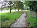
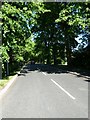
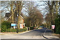
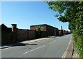
Nearby Images from Geograph Britain and Ireland:
©2008(licence)

©2010(licence)
©2010(licence)
©2010(licence)
©2010(licence)
The above images may not be of the site on this page, they are loaded from Geograph.
Please Submit an Image of this site or go out and take one for us!
Click here to see more info for this site
Nearby sites
Key: Red: member's photo, Blue: 3rd party photo, Yellow: other image, Green: no photo - please go there and take one, Grey: site destroyed
Download sites to:
KML (Google Earth)
GPX (GPS waypoints)
CSV (Garmin/Navman)
CSV (Excel)
To unlock full downloads you need to sign up as a Contributory Member. Otherwise downloads are limited to 50 sites.
Turn off the page maps and other distractions
Nearby sites listing. In the following links * = Image available
983m WNW 295° Brandy Hole Earthwork* Misc. Earthwork (SU854066)
1.3km SSW 198° The Novium* Museum (SU8590604914)
2.6km SW 231° Fishbourne Roman Palace and Gardens* Ancient Palace (SU8430504531)
3.7km NNE 16° Lavant Down Earthworks Misc. Earthwork (SU873098)
3.9km NNE 22° Lavant Down Flint Mines Ancient Mine, Quarry or other Industry (SU877098)
4.6km ENE 63° Devils Ditch* Misc. Earthwork (SU904084)
5.2km NNE 17° The Trundle* Hillfort (SU877112)
5.2km NNE 13° St Roche's Gate Cross Dyke* Misc. Earthwork (SU874113)
6.0km NW 318° Kingley Vale Settlements Ancient Village or Settlement (SU822106)
6.2km NW 313° Yew Tree Grove Cross Dyke Misc. Earthwork (SU817104)
6.3km NE 39° Molecomb Peak Tumulus Round Barrow(s) (SU902112)
6.5km NW 320° Devil's Humps Barrows* Barrow Cemetery (SU820111)
6.5km NW 325° Bow Hill Cross Dykes and Earthwork Misc. Earthwork (SU825115)
6.5km ENE 69° Boxgrove* Ancient Mine, Quarry or other Industry (SU924086)
6.7km ENE 59° Halnaker Hill* Causewayed Enclosure (SU920097)
6.8km NW 318° Bow Hill Cross Dykes* Misc. Earthwork (SU817112)
7.1km NNW 328° Stoughton Down Tumulus Round Barrow(s) (SU824121)
7.1km NNW 327° Stoughton Long Barrows* Long Barrow (SU823121)
7.2km NW 310° Adsdean Down Tumuli* Barrow Cemetery (SU80751075)
7.2km NNW 334° Goosehill Camp* Hillfort (SU830126)
7.5km ENE 67° Long Down Flint Mines* Ancient Mine, Quarry or other Industry (SU932093)
7.8km WSW 244° St. Cuthman's Stone Standing Stone (Menhir) (SU793027)
8.2km NNE 25° Court Hill Causewayed Enclosure (SU897137)
10.4km N 352° West Dean Woods Barrow Round Barrow(s) (SU8473916465)
10.5km ENE 61° Stane Street standing stones Standing Stones (SU954114)
View more nearby sites and additional images


 We would like to know more about this location. Please feel free to add a brief description and any relevant information in your own language.
 Wir möchten mehr über diese Stätte erfahren. Bitte zögern Sie nicht, eine kurze Beschreibung und relevante Informationen in Deutsch hinzuzufügen.
 Nous aimerions en savoir encore un peu sur les lieux. S'il vous plaît n'hesitez pas à ajouter une courte description et tous les renseignements pertinents dans votre propre langue.
 Quisieramos informarnos un poco más de las lugares. No dude en añadir una breve descripción y otros datos relevantes en su propio idioma.