<< Our Photo Pages >> Poppy Pond - Round Barrow(s) in England in Hampshire
Submitted by slynch on Sunday, 21 December 2014 Page Views: 2443
Neolithic and Bronze AgeSite Name: Poppy PondCountry: England
NOTE: This site is 3.242 km away from the location you searched for.
County: Hampshire Type: Round Barrow(s)
Nearest Town: Blackfield
Map Ref: SU45920174
Latitude: 50.813396N Longitude: 1.34958W
Condition:
| 5 | Perfect |
| 4 | Almost Perfect |
| 3 | Reasonable but with some damage |
| 2 | Ruined but still recognisable as an ancient site |
| 1 | Pretty much destroyed, possibly visible as crop marks |
| 0 | No data. |
| -1 | Completely destroyed |
| 5 | Superb |
| 4 | Good |
| 3 | Ordinary |
| 2 | Not Good |
| 1 | Awful |
| 0 | No data. |
| 5 | Can be driven to, probably with disabled access |
| 4 | Short walk on a footpath |
| 3 | Requiring a bit more of a walk |
| 2 | A long walk |
| 1 | In the middle of nowhere, a nightmare to find |
| 0 | No data. |
| 5 | co-ordinates taken by GPS or official recorded co-ordinates |
| 4 | co-ordinates scaled from a detailed map |
| 3 | co-ordinates scaled from a bad map |
| 2 | co-ordinates of the nearest village |
| 1 | co-ordinates of the nearest town |
| 0 | no data |
Internal Links:
External Links:
")
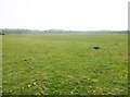
It remains flooded for large parts of the year and needs further investigation and subsquent listing as there is foresting and quarrying in the area.
You may be viewing yesterday's version of this page. To see the most up to date information please register for a free account.
")
Do not use the above information on other web sites or publications without permission of the contributor.
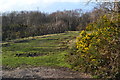
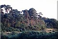
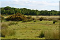
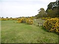
Nearby Images from Geograph Britain and Ireland:
©2020(licence)
©2005(licence)
©2013(licence)
©2015(licence)
©2015(licence)
The above images may not be of the site on this page, they are loaded from Geograph.
Please Submit an Image of this site or go out and take one for us!
Click here to see more info for this site
Nearby sites
Key: Red: member's photo, Blue: 3rd party photo, Yellow: other image, Green: no photo - please go there and take one, Grey: site destroyed
Download sites to:
KML (Google Earth)
GPX (GPS waypoints)
CSV (Garmin/Navman)
CSV (Excel)
To unlock full downloads you need to sign up as a Contributory Member. Otherwise downloads are limited to 50 sites.
Turn off the page maps and other distractions
Nearby sites listing. In the following links * = Image available
481m SE 139° Talia's Torque* Round Barrow(s) (SU46240138)
5.0km SW 233° Exbury Promontory Fort / Cliff Castle (SZ419987)
5.1km WNW 285° Beaulieu Heath (East)* Round Barrow(s) (SU4103)
8.0km NW 307° Darcy Island* Round Barrow(s) (SU39520654)
8.6km WNW 301° Dibden Bottom* Barrow Cemetery (SU385061)
8.6km NW 307° The Dibden-Lynch Bottom Ring Henge
8.8km WNW 289° Culverley Farm Bowl Barrow Round Barrow(s) (SU37530461)
9.2km NW 308° Ipley Cross* Round Barrow(s) (SU38670735)
11.1km WNW 296° Yew Tree Heath* Round Barrow(s) (SU3589506556)
11.6km NW 305° Longdown (New Forest) tumuli* Round Barrow(s) (SU363083)
11.9km S 180° Vittlefields Farm Bowl Barrow* Round Barrow(s) (SZ4592389814)
12.0km W 259° Laurences Barrow* Round Barrow(s) (SZ34139937)
12.0km W 262° Beaulieu Heath (West)* Round Barrow(s) (SU3400)
12.3km W 271° Pudding Barrow* Round Barrow(s) (SU336018)
13.9km WNW 298° Matley Heath* Round Barrow(s) (SU336082)
14.0km WNW 299° Ashurst Lodge Earthworks* Misc. Earthwork (SU336085)
14.1km SE 136° Firestone Copse* Round Barrow(s) (SZ5587091731)
14.5km S 185° Round Copse* Round Barrow(s) (SZ447873)
14.5km S 180° Bowcombe Down* Round Barrow(s) (SZ461872)
14.9km SW 219° Bouldnor Underwater Settlement and Wooden Structure* Ancient Trackway (SZ367900)
15.2km WSW 252° Buckland Rings* Ancient Village or Settlement (SZ315968)
15.8km S 189° Newbarn Combe Enclosures Ancient Village or Settlement (SZ435861)
15.9km NNW 344° Chilworth Ring* Hillfort (SU413170)
16.1km NNW 341° Castle Hill (Southampton)* Misc. Earthwork (SU40571688)
16.2km S 191° Pitts Down Field System* Ancient Village or Settlement (SZ4301885795)
View more nearby sites and additional images


 We would like to know more about this location. Please feel free to add a brief description and any relevant information in your own language.
 Wir möchten mehr über diese Stätte erfahren. Bitte zögern Sie nicht, eine kurze Beschreibung und relevante Informationen in Deutsch hinzuzufügen.
 Nous aimerions en savoir encore un peu sur les lieux. S'il vous plaît n'hesitez pas à ajouter une courte description et tous les renseignements pertinents dans votre propre langue.
 Quisieramos informarnos un poco más de las lugares. No dude en añadir una breve descripción y otros datos relevantes en su propio idioma.