<< Text Pages >> Maiden's Well (Launceston) - Holy Well or Sacred Spring in England in Cornwall
Submitted by coldrum on Monday, 05 December 2011 Page Views: 4581
Springs and Holy WellsSite Name: Maiden's Well (Launceston)Country: England County: Cornwall Type: Holy Well or Sacred Spring
Nearest Town: Launceston
Map Ref: SX32858477
Latitude: 50.638590N Longitude: 4.365193W
Condition:
| 5 | Perfect |
| 4 | Almost Perfect |
| 3 | Reasonable but with some damage |
| 2 | Ruined but still recognisable as an ancient site |
| 1 | Pretty much destroyed, possibly visible as crop marks |
| 0 | No data. |
| -1 | Completely destroyed |
| 5 | Superb |
| 4 | Good |
| 3 | Ordinary |
| 2 | Not Good |
| 1 | Awful |
| 0 | No data. |
| 5 | Can be driven to, probably with disabled access |
| 4 | Short walk on a footpath |
| 3 | Requiring a bit more of a walk |
| 2 | A long walk |
| 1 | In the middle of nowhere, a nightmare to find |
| 0 | No data. |
| 5 | co-ordinates taken by GPS or official recorded co-ordinates |
| 4 | co-ordinates scaled from a detailed map |
| 3 | co-ordinates scaled from a bad map |
| 2 | co-ordinates of the nearest village |
| 1 | co-ordinates of the nearest town |
| 0 | no data |
Be the first person to rate this site - see the 'Contribute!' box in the right hand menu.
Internal Links:
External Links:
Holy Well or Sacred Spring in Cornwall
"'Mayden Well' found to be in decay in 1582. King and Sheppard record extant remains."
Read More at Pastscape.
You may be viewing yesterday's version of this page. To see the most up to date information please register for a free account.
Do not use the above information on other web sites or publications without permission of the contributor.
Nearby Images from Geograph Britain and Ireland:
©2009(licence)
©2009(licence)
©2009(licence)
©2009(licence)
©2019(licence)
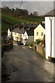
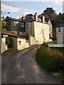
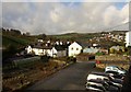
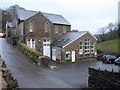
The above images may not be of the site on this page, they are loaded from Geograph.
Please Submit an Image of this site or go out and take one for us!
Click here to see more info for this site
Nearby sites
Key: Red: member's photo, Blue: 3rd party photo, Yellow: other image, Green: no photo - please go there and take one, Grey: site destroyed
Download sites to:
KML (Google Earth)
GPX (GPS waypoints)
CSV (Garmin/Navman)
CSV (Excel)
To unlock full downloads you need to sign up as a Contributory Member. Otherwise downloads are limited to 50 sites.
Turn off the page maps and other distractions
Nearby sites listing. In the following links * = Image available
1.3km NW 316° St Stephen's Well* Holy Well or Sacred Spring (SX320857)
5.6km SE 141° Longstone Farm* Stone Row / Alignment (SX36218033)
5.6km SSE 156° St Brigid's Well Holy Well or Sacred Spring (SX350796)
5.7km SSE 168° St Michael's Well (Lezant)* Holy Well or Sacred Spring
5.9km WNW 285° Egloskerry* Holy Well or Sacred Spring (SX272865)
6.0km E 88° Lifton Holy Well Holy Well or Sacred Spring (SX389848)
6.1km WSW 244° Polyphant Cross* Ancient Cross (SX2727882324)
6.7km SW 231° Lewannick* Sculptured Stone (SX275807)
6.8km SW 231° Blaunder's Well* Holy Well or Sacred Spring (SX274807)
7.0km NW 316° St Paternus's Well* Holy Well or Sacred Spring (SX2813889895)
7.8km W 276° Bury Down Fort Hillfort (SX251859)
7.8km SSE 154° Rezare Holy Well* Holy Well or Sacred Spring (SX3607977615)
9.3km ENE 60° Broadwoodwidger Cross Ancient Cross (SX4112589159)
9.9km W 264° Laneast* Ancient Cross (SX229840)
10.0km W 263° Jordan's Well* Holy Well or Sacred Spring (SX229839)
10.1km SW 233° Upton Castle* Artificial Mound (SX2454178961)
10.3km SSW 213° St Torney's Holy Well* Holy Well or Sacred Spring (SX27037631)
10.6km SW 220° Allabury Hillfort (SX257769)
10.8km SW 226° Bowda Stone Circle* Stone Circle (SX24757757)
10.9km WSW 251° St Nonna's Well* Holy Well or Sacred Spring (SX2243981533)
10.9km SW 231° Clitters Cairn* Cairn (SX24157821)
10.9km WSW 252° Altarnun Cross B* Ancient Cross (SX22318170)
11.0km SW 229° The Ridge Cairn* Cairn (SX24337785)
11.0km S 183° Linkinhorne Round* Misc. Earthwork (SX31927376)
11.1km WSW 250° Altarnun Cross* Ancient Cross (SX223813)
View more nearby sites and additional images


 We would like to know more about this location. Please feel free to add a brief description and any relevant information in your own language.
 Wir möchten mehr über diese Stätte erfahren. Bitte zögern Sie nicht, eine kurze Beschreibung und relevante Informationen in Deutsch hinzuzufügen.
 Nous aimerions en savoir encore un peu sur les lieux. S'il vous plaît n'hesitez pas à ajouter une courte description et tous les renseignements pertinents dans votre propre langue.
 Quisieramos informarnos un poco más de las lugares. No dude en añadir una breve descripción y otros datos relevantes en su propio idioma.