<< Our Photo Pages >> Hügelgräberfeld Kleiner Lindenberg - Barrow Cemetery in Germany in Bavaria
Submitted by KaiHofmann on Wednesday, 04 October 2017 Page Views: 632
Neolithic and Bronze AgeSite Name: Hügelgräberfeld Kleiner LindenbergCountry: Germany
NOTE: This site is 9.844 km away from the location you searched for.
Land: Bavaria Type: Barrow Cemetery
Nearest Town: Ostheim vor der Rhön
Latitude: 50.448567N Longitude: 10.225008E
Condition:
| 5 | Perfect |
| 4 | Almost Perfect |
| 3 | Reasonable but with some damage |
| 2 | Ruined but still recognisable as an ancient site |
| 1 | Pretty much destroyed, possibly visible as crop marks |
| 0 | No data. |
| -1 | Completely destroyed |
| 5 | Superb |
| 4 | Good |
| 3 | Ordinary |
| 2 | Not Good |
| 1 | Awful |
| 0 | No data. |
| 5 | Can be driven to, probably with disabled access |
| 4 | Short walk on a footpath |
| 3 | Requiring a bit more of a walk |
| 2 | A long walk |
| 1 | In the middle of nowhere, a nightmare to find |
| 0 | No data. |
| 5 | co-ordinates taken by GPS or official recorded co-ordinates |
| 4 | co-ordinates scaled from a detailed map |
| 3 | co-ordinates scaled from a bad map |
| 2 | co-ordinates of the nearest village |
| 1 | co-ordinates of the nearest town |
| 0 | no data |
Internal Links:
External Links:
I have visited· I would like to visit
Klingon visited on 7th Oct 2022 - their rating: Cond: 5 Amb: 5 Access: 5
")
A barrow cemetery from the Hallstatt culture (800-450 BCE). The 16 burial mounds were discovered in 1989. Of these, 13 are still visible and 8 have been reconstructed. Each mound was dedicated to a single deceased. Only one barrow contained the remains of four dead people. The dead person was burnt on a funeral pyre, dressed in ceremonial robes and jewellery, directly on the site of the later burial mound. The bone remains were collected in an urn. The urn was placed in a wooden chamber at ground level with various other vessels and a meat offering. Earth and stones were piled up around the wooden burial chamber to form the barrow, which was surrounded by a stone ring.
You may be viewing yesterday's version of this page. To see the most up to date information please register for a free account.
")
")
")
Do not use the above information on other web sites or publications without permission of the contributor.
Nearby Images from Flickr
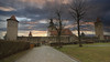
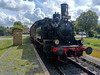

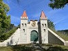


The above images may not be of the site on this page, but were taken nearby. They are loaded from Flickr so please click on them for image credits.
Click here to see more info for this site
Nearby sites
Click here to view sites on an interactive map of the areaKey: Red: member's photo, Blue: 3rd party photo, Yellow: other image, Green: no photo - please go there and take one, Grey: site destroyed
Download sites to:
KML (Google Earth)
GPX (GPS waypoints)
CSV (Garmin/Navman)
CSV (Excel)
To unlock full downloads you need to sign up as a Contributory Member. Otherwise downloads are limited to 50 sites.
Turn off the page maps and other distractions
Nearby sites listing. In the following links * = Image available
5.9km SSE 156° Eiersberg Hillfort
9.2km WSW 242° Wiesenthal Barrow Cemetery
19.2km N 355° Riederholz Barrow Cemetery
19.6km N 355° Fuchshügel Artificial Mound
19.6km NNW 337° Weiber Wetzstein Marker Stone
22.1km NNW 342° Kaltennordheim (2) Barrow Cemetery
22.5km NNW 348° Kaltennordheim (1) Causewayed Enclosure
23.7km N 351° Fischbach Artificial Mound
24.4km NNW 342° Fischberg Causewayed Enclosure
24.5km ESE 106° Gräberfeld Merzelbachwald (2)* Round Barrow(s)
24.7km ESE 106° Gräberfeld Merzelbachwald (1)* Round Barrow(s)
25.4km ESE 101° Steinsburg Grabhügel (1) Round Barrow(s)
25.5km WNW 295° Milseburg Hillfort
26.1km E 96° Grabhügel am Schwarzen Stock (1)* Round Barrow(s)
26.1km E 101° Steinsburg Grabhügel (2) Round Barrow(s)
26.2km E 97° Grabhügel am Schwarzen Stock (2)* Round Barrow(s)
26.4km E 96° Steinsburg Grabhügel (3) Round Barrow(s)
26.4km E 99° Steinsburg* Hillfort
26.4km E 97° Steinsburg Grabhügel (4) Round Barrow(s)
26.5km ESE 102° Steinsburgmuseum* Museum
28.9km ENE 57° Herrnausleite Artificial Mound
29.0km NE 54° Rodeland* Barrow Cemetery
29.1km ENE 57° Silbachshöhe (1) Artificial Mound
29.2km NE 54° Schulzenkopf (1)* Artificial Mound
29.3km NE 53° Streitschlag (1) Artificial Mound
View more nearby sites and additional images


 We would like to know more about this location. Please feel free to add a brief description and any relevant information in your own language.
 Wir möchten mehr über diese Stätte erfahren. Bitte zögern Sie nicht, eine kurze Beschreibung und relevante Informationen in Deutsch hinzuzufügen.
 Nous aimerions en savoir encore un peu sur les lieux. S'il vous plaît n'hesitez pas à ajouter une courte description et tous les renseignements pertinents dans votre propre langue.
 Quisieramos informarnos un poco más de las lugares. No dude en añadir una breve descripción y otros datos relevantes en su propio idioma.