<< Our Photo Pages >> Crathach Thiar standing stone - Standing Stone (Menhir) in Ireland (Republic of) in Co. Cork
Submitted by GaelicLaird on Thursday, 30 March 2023 Page Views: 1011
Neolithic and Bronze AgeSite Name: Crathach Thiar standing stoneCountry: Ireland (Republic of) County: Co. Cork Type: Standing Stone (Menhir)
Nearest Town: Baltimore
Latitude: 51.437368N Longitude: 9.487529W
Condition:
| 5 | Perfect |
| 4 | Almost Perfect |
| 3 | Reasonable but with some damage |
| 2 | Ruined but still recognisable as an ancient site |
| 1 | Pretty much destroyed, possibly visible as crop marks |
| 0 | No data. |
| -1 | Completely destroyed |
| 5 | Superb |
| 4 | Good |
| 3 | Ordinary |
| 2 | Not Good |
| 1 | Awful |
| 0 | No data. |
| 5 | Can be driven to, probably with disabled access |
| 4 | Short walk on a footpath |
| 3 | Requiring a bit more of a walk |
| 2 | A long walk |
| 1 | In the middle of nowhere, a nightmare to find |
| 0 | No data. |
| 5 | co-ordinates taken by GPS or official recorded co-ordinates |
| 4 | co-ordinates scaled from a detailed map |
| 3 | co-ordinates scaled from a bad map |
| 2 | co-ordinates of the nearest village |
| 1 | co-ordinates of the nearest town |
| 0 | no data |
Internal Links:
External Links:
")
A solitary standing stone on Cape Clear island, officially recorded as site CO153-021----
Tall, flat-topped (H 2.65m; 0.80m x 0.23m); long axis N-S. Shallow cup-mark on E face c. 1.55m from top of stone.
The above description is derived from the published 'Archaeological Inventory of County Cork. Volume 1: West Cork' (Dublin: Stationery Office, 1992).
Easily found just off the roadside in a field behind a house.
You may be viewing yesterday's version of this page. To see the most up to date information please register for a free account.
")
")
Do not use the above information on other web sites or publications without permission of the contributor.
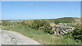
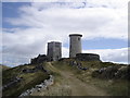
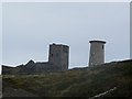
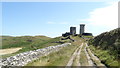
Nearby Images from Geograph Britain and Ireland:
©2018(licence)
©2007(licence)
©2011(licence)
©2018(licence)
©2018(licence)
The above images may not be of the site on this page, they are loaded from Geograph.
Please Submit an Image of this site or go out and take one for us!
Click here to see more info for this site
Nearby sites
Click here to view sites on an interactive map of the areaKey: Red: member's photo, Blue: 3rd party photo, Yellow: other image, Green: no photo - please go there and take one, Grey: site destroyed
Download sites to:
KML (Google Earth)
GPX (GPS waypoints)
CSV (Garmin/Navman)
CSV (Excel)
To unlock full downloads you need to sign up as a Contributory Member. Otherwise downloads are limited to 50 sites.
Turn off the page maps and other distractions
Nearby sites listing. In the following links * = Image available
867m NE 45° Killickaforavane Passage Tomb* Passage Grave
1.8km NE 37° Comillane* Stone Row / Alignment (V977229)
12.0km NNW 346° Rathcool Standing Stones (V93993325)
12.6km NNW 329° Gubbeen megalithic tomb* Passage Grave
13.5km NW 314° Arderawinny* Portal Tomb (V870310)
13.8km NW 308° Altar Wedge Tomb* Wedge Tomb (V8592530224)
14.3km ENE 58° Lough Hyne St. Brigit's wells Holy Well or Sacred Spring
14.5km NW 309° Toormore Wedge Tomb* Wedge Tomb (V855308)
14.9km NE 34° Aghadown Standing Stone* Standing Stone (Menhir) (W0525533607)
15.0km N 358° Rathruane More boulder burial* Burial Chamber or Dolmen
16.1km NW 312° Dún Mánais Thoir standing stone* Standing Stone (Menhir)
16.3km NNE 22° Murrahin North* Stone Row / Alignment (W029365)
16.4km NW 316° Dunmanus East boulder burial* Burial Chamber or Dolmen
16.8km NNE 24° Lissaclarig West Stone Row / Alignment (W039367)
16.9km NNE 25° Lissaclarig East Stone Row / Alignment (W04013670)
16.9km NNE 33° Foherlagh Standing Stones (W06173547)
17.3km WNW 286° Castlemehigan cupmarked stone* Rock Art
17.4km ENE 61° Drishanemore Wedge Tomb
17.9km NNE 16° Ballybane* Rock Art (W0183738669)
18.1km NNW 346° Dunbeacon* Stone Circle (V9270639202)
18.1km NNW 348° Coolcoulaghta* Standing Stones (V9310639301)
18.2km WNW 283° An Tuairín wedge tomb* Wedge Tomb
18.2km WNW 283° Arduslough wedge tomb* Wedge Tomb
18.2km WNW 282° Leenane wedge tomb* Wedge Tomb
18.3km ENE 74° Toe Head Fort Promontory Fort / Cliff Castle
View more nearby sites and additional images


 We would like to know more about this location. Please feel free to add a brief description and any relevant information in your own language.
 Wir möchten mehr über diese Stätte erfahren. Bitte zögern Sie nicht, eine kurze Beschreibung und relevante Informationen in Deutsch hinzuzufügen.
 Nous aimerions en savoir encore un peu sur les lieux. S'il vous plaît n'hesitez pas à ajouter une courte description et tous les renseignements pertinents dans votre propre langue.
 Quisieramos informarnos un poco más de las lugares. No dude en añadir una breve descripción y otros datos relevantes en su propio idioma.