<< Text Pages >> Studenne Earthwork - Misc. Earthwork in Poland in Podkarpackie
Submitted by SolarMegalith on Tuesday, 07 December 2010 Page Views: 4005
Multi-periodSite Name: Studenne EarthworkCountry: Poland
NOTE: This site is 16.791 km away from the location you searched for.
Voivodeship: Podkarpackie Type: Misc. Earthwork
Nearest Town: Lesko Nearest Village: Studenne
Latitude: 49.280000N Longitude: 22.450000E
Condition:
| 5 | Perfect |
| 4 | Almost Perfect |
| 3 | Reasonable but with some damage |
| 2 | Ruined but still recognisable as an ancient site |
| 1 | Pretty much destroyed, possibly visible as crop marks |
| 0 | No data. |
| -1 | Completely destroyed |
| 5 | Superb |
| 4 | Good |
| 3 | Ordinary |
| 2 | Not Good |
| 1 | Awful |
| 0 | No data. |
| 5 | Can be driven to, probably with disabled access |
| 4 | Short walk on a footpath |
| 3 | Requiring a bit more of a walk |
| 2 | A long walk |
| 1 | In the middle of nowhere, a nightmare to find |
| 0 | No data. |
| 5 | co-ordinates taken by GPS or official recorded co-ordinates |
| 4 | co-ordinates scaled from a detailed map |
| 3 | co-ordinates scaled from a bad map |
| 2 | co-ordinates of the nearest village |
| 1 | co-ordinates of the nearest town |
| 0 | no data |
Internal Links:
External Links:
Misc. Earthwork in Podkarpackie
500 m from ruins of Orthodox church in abandoned village of Studenne there is a ditch and bank – remains of the early medieval (probably 7th – 9th century AD) sacred place of the Slavs. The perimeter of this circular bank is 43 m.
You may be viewing yesterday's version of this page. To see the most up to date information please register for a free account.
Do not use the above information on other web sites or publications without permission of the contributor.
Nearby Images from Flickr
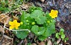
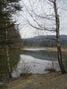

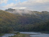
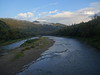
The above images may not be of the site on this page, but were taken nearby. They are loaded from Flickr so please click on them for image credits.
Click here to see more info for this site
Nearby sites
Click here to view sites on an interactive map of the areaKey: Red: member's photo, Blue: 3rd party photo, Yellow: other image, Green: no photo - please go there and take one, Grey: site destroyed
Download sites to:
KML (Google Earth)
GPX (GPS waypoints)
CSV (Garmin/Navman)
CSV (Excel)
To unlock full downloads you need to sign up as a Contributory Member. Otherwise downloads are limited to 50 sites.
Turn off the page maps and other distractions
Nearby sites listing. In the following links * = Image available
18.4km NNW 332° Grodzisko Hoczew* Hillfort
21.5km N 351° Kurhan Uherce Mineralne Round Barrow(s)
23.1km NNW 333° Kurhany Huzele Barrow Cemetery
46.0km NNE 17° Grodzisko Kopyśno Hillfort
47.3km NNE 23° Grodzisko Aksmanice Hillfort
62.5km N 6° Kurhan Średnia 5* Round Barrow(s)
62.7km N 7° Kurhan Średnia 1* Round Barrow(s)
62.7km N 7° Kurhan Średnia 4* Round Barrow(s)
62.7km N 7° Kurhan Średnia 3* Round Barrow(s)
62.7km N 7° Kurhan Średnia 2* Round Barrow(s)
64.9km NW 305° Grodzisko Wietrzno* Promontory Fort / Cliff Castle
65.6km N 9° Grodzisko Tuligłowy* Hillfort
71.1km NW 318° Kurhany Czarnorzeki Barrow Cemetery
77.8km WNW 295° Grodzisko Walik - Brzezowa* Hillfort
79.4km NNE 28° Kopiec Gaje Round Barrow(s)
85.3km NW 312° Kurhany Bierówka* Barrow Cemetery
89.0km NW 305° Trzcinica - Ekspozycja Archeologiczna* Museum
89.2km NW 305° Grodzisko Trzcinica* Hillfort
90.0km NNW 339° Muzeum Okręgowe w Rzeszowie* Museum
103.8km NNW 326° Kurhan Witkowice Round Barrow(s)
104.9km NNW 338° Grodzisko Budy Głogowskie* Hillfort
105.8km NW 311° Grodzisko Przeczyca* Hillfort
126.3km WSW 256° Spišský hrad* Ancient Village or Settlement
130.4km NW 307° Grodzisko Zawada (Tarnów)* Hillfort
134.3km NNE 22° Grodzisko Susiec Hillfort
View more nearby sites and additional images


 We would like to know more about this location. Please feel free to add a brief description and any relevant information in your own language.
 Wir möchten mehr über diese Stätte erfahren. Bitte zögern Sie nicht, eine kurze Beschreibung und relevante Informationen in Deutsch hinzuzufügen.
 Nous aimerions en savoir encore un peu sur les lieux. S'il vous plaît n'hesitez pas à ajouter une courte description et tous les renseignements pertinents dans votre propre langue.
 Quisieramos informarnos un poco más de las lugares. No dude en añadir una breve descripción y otros datos relevantes en su propio idioma.