<< Text Pages >> Schluepfelberg - Hillfort in Germany in Bavaria
Submitted by zersli on Thursday, 21 August 2014 Page Views: 1116
Iron Age and Later PrehistorySite Name: SchluepfelbergCountry: Germany
NOTE: This site is 1.742 km away from the location you searched for.
Land: Bavaria Type: Hillfort
Nearest Town: Neumarkt i.d. Opf Nearest Village: Muehlhausen
Latitude: 49.168530N Longitude: 11.429640E
Condition:
| 5 | Perfect |
| 4 | Almost Perfect |
| 3 | Reasonable but with some damage |
| 2 | Ruined but still recognisable as an ancient site |
| 1 | Pretty much destroyed, possibly visible as crop marks |
| 0 | No data. |
| -1 | Completely destroyed |
| 5 | Superb |
| 4 | Good |
| 3 | Ordinary |
| 2 | Not Good |
| 1 | Awful |
| 0 | No data. |
| 5 | Can be driven to, probably with disabled access |
| 4 | Short walk on a footpath |
| 3 | Requiring a bit more of a walk |
| 2 | A long walk |
| 1 | In the middle of nowhere, a nightmare to find |
| 0 | No data. |
| 5 | co-ordinates taken by GPS or official recorded co-ordinates |
| 4 | co-ordinates scaled from a detailed map |
| 3 | co-ordinates scaled from a bad map |
| 2 | co-ordinates of the nearest village |
| 1 | co-ordinates of the nearest town |
| 0 | no data |
Internal Links:
External Links:
Hillfort in Bavaria
A Celtic hillfort located on the top of a steep hill. The ramparts are partly recognizable but are covered by earth and forest. Its hardly not understandable, that there are no signs to tell the public, what lies under the ground, because the dimensions are quite impressive.
The whole area must have been an important Celtic settlement site in the past.
5 km to the southeast was an important settlement called Pollanten, which is now archaeologically well described. 9 km to the north lies another hillfort called Buchberg.
You may be viewing yesterday's version of this page. To see the most up to date information please register for a free account.
Do not use the above information on other web sites or publications without permission of the contributor.
Nearby Images from Flickr

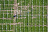


The above images may not be of the site on this page, but were taken nearby. They are loaded from Flickr so please click on them for image credits.
Click here to see more info for this site
Nearby sites
Click here to view sites on an interactive map of the areaKey: Red: member's photo, Blue: 3rd party photo, Yellow: other image, Green: no photo - please go there and take one, Grey: site destroyed
Download sites to:
KML (Google Earth)
GPX (GPS waypoints)
CSV (Garmin/Navman)
CSV (Excel)
To unlock full downloads you need to sign up as a Contributory Member. Otherwise downloads are limited to 50 sites.
Turn off the page maps and other distractions
Nearby sites listing. In the following links * = Image available
3.1km SSE 149° Pollanten Ancient Village or Settlement
7.9km N 1° Buchberg Hillfort
14.2km SSE 166° Wodansburg Natural Stone / Erratic / Other Natural Feature
14.4km NNE 18° Krähentisch Natural Stone / Erratic / Other Natural Feature
16.9km SW 229° Gräberfeld Thalmässing Barrow Cemetery
17.0km WSW 237° Thalmässing Grabhügelfeld Artificial Mound
17.6km WSW 240° Thalmässing Vor-und Frühgeschichtliches Museum Museum
17.7km SW 229° Geschichtsdorf Landersdorf Museum
19.8km S 188° Kindinger Klause Cave or Rock Shelter
19.8km S 186° Hügelgräberfeld Kinding Barrow Cemetery
19.9km SSW 193° Schellenburg Ringwall Hillfort
23.2km SSW 203° Mallburg Ancient Village or Settlement
28.6km SE 139° Grabhuegel Haidhof Round Barrow(s)
28.7km SSE 158° Pondorf Keltenschanze Misc. Earthwork
29.3km SE 140° Summstein Harlanden Modern Stone Circle etc
30.9km SE 139° Opferplattform Emmerthal Artificial Mound
31.7km NNE 27° Frühkeltische Siedlung Burkartshof* Ancient Village or Settlement
32.2km W 280° Druidenstein Mäbenberg Natural Stone / Erratic / Other Natural Feature
32.4km S 186° Böhmfelder Keltenschanze A Ancient Village or Settlement
32.7km S 184° Böhmfelder Keltenschanze C Ancient Village or Settlement
32.7km S 185° Böhmfelder Keltenschanze B Ancient Village or Settlement
32.9km SE 138° Klammhöhlen Cave or Rock Shelter
33.0km SE 138° Wallanlage Einthal Ancient Village or Settlement
35.1km SE 137° Kastlhaenghoehle Cave or Rock Shelter
35.2km SSW 203° Steinbruch Pfünz Ancient Mine, Quarry or other Industry
View more nearby sites and additional images


 We would like to know more about this location. Please feel free to add a brief description and any relevant information in your own language.
 Wir möchten mehr über diese Stätte erfahren. Bitte zögern Sie nicht, eine kurze Beschreibung und relevante Informationen in Deutsch hinzuzufügen.
 Nous aimerions en savoir encore un peu sur les lieux. S'il vous plaît n'hesitez pas à ajouter une courte description et tous les renseignements pertinents dans votre propre langue.
 Quisieramos informarnos un poco más de las lugares. No dude en añadir una breve descripción y otros datos relevantes en su propio idioma.