<< Our Photo Pages >> Stampede Site - Ancient Mine, Quarry or other Industry in Canada
Submitted by bat400 on Saturday, 18 November 2006 Page Views: 10641
Multi-periodSite Name: Stampede SiteCountry: Canada Type: Ancient Mine, Quarry or other Industry
Nearest Village: Elkwater, Alberta
Latitude: 49.663000N Longitude: 110.203W
Condition:
| 5 | Perfect |
| 4 | Almost Perfect |
| 3 | Reasonable but with some damage |
| 2 | Ruined but still recognisable as an ancient site |
| 1 | Pretty much destroyed, possibly visible as crop marks |
| 0 | No data. |
| -1 | Completely destroyed |
| 5 | Superb |
| 4 | Good |
| 3 | Ordinary |
| 2 | Not Good |
| 1 | Awful |
| 0 | No data. |
| 5 | Can be driven to, probably with disabled access |
| 4 | Short walk on a footpath |
| 3 | Requiring a bit more of a walk |
| 2 | A long walk |
| 1 | In the middle of nowhere, a nightmare to find |
| 0 | No data. |
| 5 | co-ordinates taken by GPS or official recorded co-ordinates |
| 4 | co-ordinates scaled from a detailed map |
| 3 | co-ordinates scaled from a bad map |
| 2 | co-ordinates of the nearest village |
| 1 | co-ordinates of the nearest town |
| 0 | no data |
Be the first person to rate this site - see the 'Contribute!' box in the right hand menu.
Internal Links:
External Links:
")
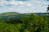
A site of rich resources for over 8000 years, this area was a kill and butchering site as well as a quarrying and tool "workshop" site.
The location is approximate for the north slopes of the Cypress Hills Park area.
Note: See the article with photo from Canadian Geographic.
You may be viewing yesterday's version of this page. To see the most up to date information please register for a free account.
")
")
")
Do not use the above information on other web sites or publications without permission of the contributor.
Nearby Images from Flickr

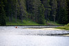
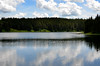
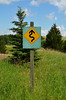
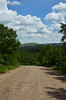
The above images may not be of the site on this page, but were taken nearby. They are loaded from Flickr so please click on them for image credits.
Click here to see more info for this site
Nearby sites
Click here to view sites on an interactive map of the areaKey: Red: member's photo, Blue: 3rd party photo, Yellow: other image, Green: no photo - please go there and take one, Grey: site destroyed
Download sites to:
KML (Google Earth)
GPX (GPS waypoints)
CSV (Garmin/Navman)
CSV (Excel)
To unlock full downloads you need to sign up as a Contributory Member. Otherwise downloads are limited to 50 sites.
Turn off the page maps and other distractions
Nearby sites listing. In the following links * = Image available
53.0km NW 319° Saami Giant Teepee* Ancient Village or Settlement
121.1km WSW 238° Writing-on-Stone Provincial Park* Rock Art
124.4km WNW 284° Fincastle Grazing Reserve Bison Kill* Ancient Mine, Quarry or other Industry
187.8km NW 304° Majorville Medicine Wheel* Round Cairn
189.0km WNW 286° Sundial Medicine Wheel* Ring Cairn
248.3km W 272° Head-Smashed-In Buffalo Jump* Ancient Mine, Quarry or other Industry
261.6km SSW 202° First Peoples Buffalo Jump* Natural Stone / Erratic / Other Natural Feature
299.1km WNW 294° Big Rock (Alberta) Rock Art
319.1km WNW 302° Ootssip'tomowa Look Out Hill* Hill Figure or Geoglyph
353.9km WSW 256° Crystal Lakes Golf Course Stonehenge* Modern Stone Circle etc
370.6km SSW 201° Megaliths Of Helena* Natural Stone / Erratic / Other Natural Feature
380.6km NE 40° Wanuskewin Heritage Park* Museum
456.2km SSE 162° Pictograph Caves* Rock Art
489.9km SSE 168° Valley of the Shields* Rock Art
500.0km WSW 258° Priest Lake Pictographs Rock Art
533.5km SSE 165° Petroglyph Canyon (Cowley)* Rock Art
539.7km S 184° Obsidian Cliff* Ancient Mine, Quarry or other Industry
543.0km WNW 303° Cataract Creek Petroglyphs* Rock Art
564.7km SSE 161° Bighorn Medicine Wheel* Stone Circle
574.1km WSW 251° Indian Painted Rocks (Spokane) Rock Art
579.5km S 176° Mummy Cave* Cave or Rock Shelter
580.2km S 181° Yellowstone Lake* Ancient Village or Settlement
584.9km SSE 159° Falling Block* Natural Stone / Erratic / Other Natural Feature
623.1km SW 230° Cooper's Ferry Archaeological Site* Ancient Village or Settlement
628.3km WSW 237° Red Elk Rock Shelter* Rock Art
View more nearby sites and additional images


 We would like to know more about this location. Please feel free to add a brief description and any relevant information in your own language.
 Wir möchten mehr über diese Stätte erfahren. Bitte zögern Sie nicht, eine kurze Beschreibung und relevante Informationen in Deutsch hinzuzufügen.
 Nous aimerions en savoir encore un peu sur les lieux. S'il vous plaît n'hesitez pas à ajouter une courte description et tous les renseignements pertinents dans votre propre langue.
 Quisieramos informarnos un poco más de las lugares. No dude en añadir una breve descripción y otros datos relevantes en su propio idioma.