<< Text Pages >> Opferstein Saldenburg - Natural Stone / Erratic / Other Natural Feature in Germany in Bavaria
Submitted by KaiHofmann on Saturday, 23 January 2016 Page Views: 937
Natural PlacesSite Name: Opferstein SaldenburgCountry: Germany
NOTE: This site is 7.897 km away from the location you searched for.
Land: Bavaria Type: Natural Stone / Erratic / Other Natural Feature
Nearest Town: Passau Nearest Village: Saldenburg
Latitude: 48.775640N Longitude: 13.353248E
Condition:
| 5 | Perfect |
| 4 | Almost Perfect |
| 3 | Reasonable but with some damage |
| 2 | Ruined but still recognisable as an ancient site |
| 1 | Pretty much destroyed, possibly visible as crop marks |
| 0 | No data. |
| -1 | Completely destroyed |
| 5 | Superb |
| 4 | Good |
| 3 | Ordinary |
| 2 | Not Good |
| 1 | Awful |
| 0 | No data. |
| 5 | Can be driven to, probably with disabled access |
| 4 | Short walk on a footpath |
| 3 | Requiring a bit more of a walk |
| 2 | A long walk |
| 1 | In the middle of nowhere, a nightmare to find |
| 0 | No data. |
| 5 | co-ordinates taken by GPS or official recorded co-ordinates |
| 4 | co-ordinates scaled from a detailed map |
| 3 | co-ordinates scaled from a bad map |
| 2 | co-ordinates of the nearest village |
| 1 | co-ordinates of the nearest town |
| 0 | no data |
Internal Links:
External Links:
Natural Stone / Erratic / Other Natural Feature in Bavaria
Large boulder with big bowls on its surface. The bowls are called Opferschalen (in english: offering cups). Not sure if they are natural or partly human-made.
You may be viewing yesterday's version of this page. To see the most up to date information please register for a free account.
Do not use the above information on other web sites or publications without permission of the contributor.
Nearby Images from Flickr

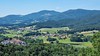


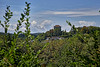
The above images may not be of the site on this page, but were taken nearby. They are loaded from Flickr so please click on them for image credits.
Click here to see more info for this site
Nearby sites
Click here to view sites on an interactive map of the areaKey: Red: member's photo, Blue: 3rd party photo, Yellow: other image, Green: no photo - please go there and take one, Grey: site destroyed
Download sites to:
KML (Google Earth)
GPX (GPS waypoints)
CSV (Garmin/Navman)
CSV (Excel)
To unlock full downloads you need to sign up as a Contributory Member. Otherwise downloads are limited to 50 sites.
Turn off the page maps and other distractions
Nearby sites listing. In the following links * = Image available
9.7km NE 44° Neudorf Monolith Standing Stone (Menhir)
10.1km ENE 64° Ringelai Stone Circle Stone Circle
23.4km WSW 240° Museum Quintana* Museum
23.9km WSW 240° Künzing-Bruck Siedlung Ancient Village or Settlement
23.9km SSE 162° Summstein Klostergarten* Modern Stone Circle etc
25.2km WSW 244° Künzing-Unternberg Kultanlage Henge
26.1km NNE 22° Modrava Menhir* Standing Stone (Menhir)
27.0km WSW 249° Osterhofen Siedlung Ancient Village or Settlement
28.8km WSW 251° Linzing Siedlung Ancient Village or Settlement
29.2km W 261° Langenisarhofen Ancient Village or Settlement
30.2km NNE 17° Roklansky Creek Menhir* Standing Stone (Menhir)
30.8km WSW 258° Ottmaring-Nindorf Siedlung Ancient Village or Settlement
31.7km SW 234° Galgweis Siedlung Ancient Village or Settlement
33.1km W 279° Natternberg Siedlung Ancient Village or Settlement
33.5km NNE 14° Hauswald chapel* Holy Well or Sacred Spring
37.0km SSW 197° Bad Griesbach Teufelsstein Rock Art
39.7km WSW 254° Gneiding Ringheiligtum Henge
42.1km ENE 68° Volary Menhirs* Modern Stone Circle etc
45.6km WSW 257° Kothingeichendorf Settlement 2 Ancient Village or Settlement
45.7km WSW 258° Kothingeichendorf Ringheiligtum Henge
45.7km WSW 257° Kothingeichendorf Settlement 1 Ancient Village or Settlement
46.1km NNE 27° Lightning* Standing Stone (Menhir)
46.5km NNE 28° Sage (Mudrc)* Standing Stone (Menhir)
46.5km NNE 27° Dvojčata* Standing Stones
47.2km WSW 257° Oberframmering Siedlung Ancient Village or Settlement
View more nearby sites and additional images


 We would like to know more about this location. Please feel free to add a brief description and any relevant information in your own language.
 Wir möchten mehr über diese Stätte erfahren. Bitte zögern Sie nicht, eine kurze Beschreibung und relevante Informationen in Deutsch hinzuzufügen.
 Nous aimerions en savoir encore un peu sur les lieux. S'il vous plaît n'hesitez pas à ajouter une courte description et tous les renseignements pertinents dans votre propre langue.
 Quisieramos informarnos un poco más de las lugares. No dude en añadir una breve descripción y otros datos relevantes en su propio idioma.