<< Our Photo Pages >> Sermaise menhir - Standing Stone (Menhir) in France in Ile-de-France:Essonne (91)
Submitted by Sleb on Friday, 04 September 2015 Page Views: 1306
Neolithic and Bronze AgeSite Name: Sermaise menhirCountry: France
NOTE: This site is 14.368 km away from the location you searched for.
Département: Ile-de-France:Essonne (91) Type: Standing Stone (Menhir)
Nearest Town: Dourdan Nearest Village: Sermaise
Latitude: 48.535525N Longitude: 2.069946E
Condition:
| 5 | Perfect |
| 4 | Almost Perfect |
| 3 | Reasonable but with some damage |
| 2 | Ruined but still recognisable as an ancient site |
| 1 | Pretty much destroyed, possibly visible as crop marks |
| 0 | No data. |
| -1 | Completely destroyed |
| 5 | Superb |
| 4 | Good |
| 3 | Ordinary |
| 2 | Not Good |
| 1 | Awful |
| 0 | No data. |
| 5 | Can be driven to, probably with disabled access |
| 4 | Short walk on a footpath |
| 3 | Requiring a bit more of a walk |
| 2 | A long walk |
| 1 | In the middle of nowhere, a nightmare to find |
| 0 | No data. |
| 5 | co-ordinates taken by GPS or official recorded co-ordinates |
| 4 | co-ordinates scaled from a detailed map |
| 3 | co-ordinates scaled from a bad map |
| 2 | co-ordinates of the nearest village |
| 1 | co-ordinates of the nearest town |
| 0 | no data |
Internal Links:
External Links:
")
A small menhir in the railway station car park.
You may be viewing yesterday's version of this page. To see the most up to date information please register for a free account.
Do not use the above information on other web sites or publications without permission of the contributor.
Nearby Images from Flickr
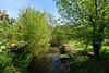
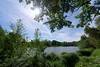
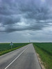
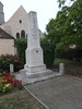


The above images may not be of the site on this page, but were taken nearby. They are loaded from Flickr so please click on them for image credits.
Click here to see more info for this site
Nearby sites
Click here to view sites on an interactive map of the areaKey: Red: member's photo, Blue: 3rd party photo, Yellow: other image, Green: no photo - please go there and take one, Grey: site destroyed
Download sites to:
KML (Google Earth)
GPX (GPS waypoints)
CSV (Garmin/Navman)
CSV (Excel)
To unlock full downloads you need to sign up as a Contributory Member. Otherwise downloads are limited to 50 sites.
Turn off the page maps and other distractions
Nearby sites listing. In the following links * = Image available
9.7km S 186° Dolmen de Boutervilliers Burial Chamber or Dolmen
10.5km S 181° Les Boutards Passage Grave
10.7km ENE 62° Menhir dit la Pierre Beaumirault* Standing Stone (Menhir)
12.2km SSE 167° Pierrefitte Menhir Standing Stone (Menhir)
12.3km SE 135° Polissoir de Villemartin Polissoir
12.8km E 99° Roche qui Tourne* Burial Chamber or Dolmen
14.5km ESE 102° La Pierre Levée (Janville)* Burial Chamber or Dolmen
17.6km SSW 200° La Grosse Pierre Passage Grave
18.9km E 98° La Roche à Gentil* Standing Stone (Menhir)
19.5km SSW 198° Dolmen des Grès de Linas* Burial Chamber or Dolmen
23.6km WSW 251° Auneau tumulus Chambered Tomb
27.0km W 265° La Mère aux Cailles* Standing Stone (Menhir)
27.0km W 265° Chantecoq dolmen* Burial Chamber or Dolmen
27.2km W 266° Menhir dit la Roche Burial Chamber or Dolmen
27.5km NE 54° Le Cimitiere des Ladres Passage Grave
27.9km SE 126° Grotte de Tramerolles Cave or Rock Shelter
28.0km W 266° Pont sous Gallardon menhir Standing Stone (Menhir)
28.2km NE 43° Wissous* Ancient Village or Settlement
29.2km ESE 111° Roche Grenolet Polissoir
29.5km E 97° Menhir de Champcueil Standing Stone (Menhir)
29.5km SE 131° Menhir de la Pierre Droite (Prunay)* Standing Stone (Menhir)
30.2km ESE 112° Roche à glissade du Gros Mahaux Polissoir
30.3km NNE 28° Dolmens du Plessis-Robinson Burial Chamber or Dolmen
30.6km NNE 19° Chêne des Missions* Standing Stone (Menhir)
30.6km SE 130° Buno-Bonnevaux polissoir Polissoir
View more nearby sites and additional images


 We would like to know more about this location. Please feel free to add a brief description and any relevant information in your own language.
 Wir möchten mehr über diese Stätte erfahren. Bitte zögern Sie nicht, eine kurze Beschreibung und relevante Informationen in Deutsch hinzuzufügen.
 Nous aimerions en savoir encore un peu sur les lieux. S'il vous plaît n'hesitez pas à ajouter une courte description et tous les renseignements pertinents dans votre propre langue.
 Quisieramos informarnos un poco más de las lugares. No dude en añadir una breve descripción y otros datos relevantes en su propio idioma.