<< Text Pages >> Renac dolmen - Burial Chamber or Dolmen in France in Bretagne:Ille-et-Vilaine (35)
Submitted by davidmorgan on Wednesday, 23 March 2016 Page Views: 993
Neolithic and Bronze AgeSite Name: Renac dolmen Alternative Name: Ensemble mégalithique du château du BrossayCountry: France
NOTE: This site is 3.508 km away from the location you searched for.
Département: Bretagne:Ille-et-Vilaine (35) Type: Burial Chamber or Dolmen
Nearest Town: Redon Nearest Village: Renac
Latitude: 47.721407N Longitude: 1.968879W
Condition:
| 5 | Perfect |
| 4 | Almost Perfect |
| 3 | Reasonable but with some damage |
| 2 | Ruined but still recognisable as an ancient site |
| 1 | Pretty much destroyed, possibly visible as crop marks |
| 0 | No data. |
| -1 | Completely destroyed |
| 5 | Superb |
| 4 | Good |
| 3 | Ordinary |
| 2 | Not Good |
| 1 | Awful |
| 0 | No data. |
| 5 | Can be driven to, probably with disabled access |
| 4 | Short walk on a footpath |
| 3 | Requiring a bit more of a walk |
| 2 | A long walk |
| 1 | In the middle of nowhere, a nightmare to find |
| 0 | No data. |
| 5 | co-ordinates taken by GPS or official recorded co-ordinates |
| 4 | co-ordinates scaled from a detailed map |
| 3 | co-ordinates scaled from a bad map |
| 2 | co-ordinates of the nearest village |
| 1 | co-ordinates of the nearest town |
| 0 | no data |
Be the first person to rate this site - see the 'Contribute!' box in the right hand menu.
Internal Links:
External Links:
Burial Chamber (Dolmen) in Bretagne:Ille-et-Vilaine (35)
A dolmen or tumulus in the grounds of the Château du Brossay.
You may be viewing yesterday's version of this page. To see the most up to date information please register for a free account.
Do not use the above information on other web sites or publications without permission of the contributor.
Nearby Images from Flickr
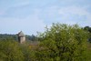
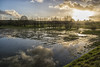

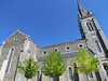

The above images may not be of the site on this page, but were taken nearby. They are loaded from Flickr so please click on them for image credits.
Click here to see more info for this site
Nearby sites
Click here to view sites on an interactive map of the areaKey: Red: member's photo, Blue: 3rd party photo, Yellow: other image, Green: no photo - please go there and take one, Grey: site destroyed
Download sites to:
KML (Google Earth)
GPX (GPS waypoints)
CSV (Garmin/Navman)
CSV (Excel)
To unlock full downloads you need to sign up as a Contributory Member. Otherwise downloads are limited to 50 sites.
Turn off the page maps and other distractions
Nearby sites listing. In the following links * = Image available
4.2km N 7° Dolmens de Gremel Burial Chamber or Dolmen
4.6km NNE 13° Menhir des Landes de Gremel* Modern Stone Circle etc
4.8km N 0° Croix Madame* Barrow Cemetery
4.8km NW 316° Roche à Cupules de Trohinat Rock Art
4.8km N 354° Alignements du Moulin W* Stone Row / Alignment
4.8km N 353° Alignement des Petites Roches Piquées* Stone Row / Alignment
4.8km N 356° Alignements du Moulin S* Stone Row / Alignment
4.8km N 356° Alignements du Moulin N* Stone Row / Alignment
4.9km NNW 348° Demoiselles Piquées* Stone Row / Alignment
5.0km NNW 346° Château Bû* Chambered Cairn
5.1km NNW 342° Le Tribunal* Stone Circle
5.1km NNW 343° Croix St Pierre east* Chambered Cairn
5.1km NNW 343° Croix St Pierre tertre* Long Barrow
5.1km NNE 23° Sévéroué menhir* Standing Stone (Menhir)
5.1km N 7° Cimetière St. Just* Stone Row / Alignment
5.1km NNW 343° Ciste de Croix Saint-Pierre* Cist
5.1km NNW 343° Dolmen Ouest de la Croix de Saint-Pierre* Burial Chamber or Dolmen
5.2km NNW 341° Tombe nord-ouest de Croix St Pierre Burial Chamber or Dolmen
5.2km NNW 342° Cupules de la Grée de Cojoux Rock Art
5.2km NNW 341° Le Four Sarrazin* Burial Chamber or Dolmen
5.3km NNW 340° Monument du Four Sarrazin Ouest Burial Chamber or Dolmen
5.3km NNE 19° Alignement dit le Rocher* Stone Row / Alignment
5.4km NNW 334° Debout-et-Bloc menhir Standing Stone (Menhir)
5.6km NW 326° Rocher de Bocadève Standing Stone (Menhir)
5.6km NNW 331° Bocadeve Alignements Stone Row / Alignment
View more nearby sites and additional images


 We would like to know more about this location. Please feel free to add a brief description and any relevant information in your own language.
 Wir möchten mehr über diese Stätte erfahren. Bitte zögern Sie nicht, eine kurze Beschreibung und relevante Informationen in Deutsch hinzuzufügen.
 Nous aimerions en savoir encore un peu sur les lieux. S'il vous plaît n'hesitez pas à ajouter une courte description et tous les renseignements pertinents dans votre propre langue.
 Quisieramos informarnos un poco más de las lugares. No dude en añadir una breve descripción y otros datos relevantes en su propio idioma.