<< Text Pages >> Aquincumi Museum - Museum in Hungary
Submitted by durhamnature on Friday, 18 January 2013 Page Views: 6177
MuseumsSite Name: Aquincumi MuseumCountry: Hungary Type: Museum
Nearest Town: Budapest
Latitude: 47.565631N Longitude: 19.049817E
Condition:
| 5 | Perfect |
| 4 | Almost Perfect |
| 3 | Reasonable but with some damage |
| 2 | Ruined but still recognisable as an ancient site |
| 1 | Pretty much destroyed, possibly visible as crop marks |
| 0 | No data. |
| -1 | Completely destroyed |
| 5 | Superb |
| 4 | Good |
| 3 | Ordinary |
| 2 | Not Good |
| 1 | Awful |
| 0 | No data. |
| 5 | Can be driven to, probably with disabled access |
| 4 | Short walk on a footpath |
| 3 | Requiring a bit more of a walk |
| 2 | A long walk |
| 1 | In the middle of nowhere, a nightmare to find |
| 0 | No data. |
| 5 | co-ordinates taken by GPS or official recorded co-ordinates |
| 4 | co-ordinates scaled from a detailed map |
| 3 | co-ordinates scaled from a bad map |
| 2 | co-ordinates of the nearest village |
| 1 | co-ordinates of the nearest town |
| 0 | no data |
Internal Links:
External Links:
Museum in Hungary
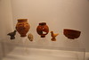
Modern museum with prehistoric and Roman displays, including a Mithraeum. There is an outdoor archaeological park.
Opening Times: The park is open from mid-April to the end of September, the museum is open all year. Both are closed on Mondays.
Address: 1031 Budapest, Szentendrei, UT 135.
Telephone: +36 1 250 1650
Website: Aquincumi Múzeum
You may be viewing yesterday's version of this page. To see the most up to date information please register for a free account.
Do not use the above information on other web sites or publications without permission of the contributor.
Nearby Images from Flickr


The above images may not be of the site on this page, but were taken nearby. They are loaded from Flickr so please click on them for image credits.
Click here to see more info for this site
Nearby sites
Click here to view sites on an interactive map of the areaKey: Red: member's photo, Blue: 3rd party photo, Yellow: other image, Green: no photo - please go there and take one, Grey: site destroyed
Download sites to:
KML (Google Earth)
GPX (GPS waypoints)
CSV (Garmin/Navman)
CSV (Excel)
To unlock full downloads you need to sign up as a Contributory Member. Otherwise downloads are limited to 50 sites.
Turn off the page maps and other distractions
Nearby sites listing. In the following links * = Image available
26.8km SSW 198° Százhalombatta Tell* Ancient Village or Settlement
26.9km SSW 198° Százhalombatta Barrow Barrow Cemetery
50.3km W 278° Vértesszőlősi Kő* Modern Stone Circle etc
55.3km W 280° Tatai Kő* Modern Stone Circle etc
69.4km S 186° Dunaujvaros-Koziderpadlas Tell Ancient Village or Settlement
70.6km E 87° Jaszdozsa-Kapolnahalom Tell Ancient Village or Settlement
71.0km SW 222° Gorsium Ancient Village or Settlement
73.4km SSW 192° Baracs-Földvar Tell Ancient Village or Settlement
77.8km SE 137° Nagykőrös-Földvar Tell Ancient Village or Settlement
84.0km NW 312° Nitriansky Hrádok Ancient Village or Settlement
89.6km S 184° Bölcske-Vörösgyuru Tell Ancient Village or Settlement
97.6km ESE 123° Tószeg-Laposhalom Tell Ancient Village or Settlement
100.2km N 353° Štiavnické Menhiry* Standing Stone (Menhir)
103.4km ENE 79° Füzesabony-Öregdomb Tell Ancient Village or Settlement
108.3km SE 129° Nagyrev Zsidohalom Tell Ancient Village or Settlement
109.6km SE 136° Tiszaug-Kemenyteto Tell Ancient Village or Settlement
110.3km N 2° Pusty Hrad* Ancient Village or Settlement
130.5km E 86° Tiszafüred Asotthalom Tell Ancient Village or Settlement
134.3km S 178° Érsekhalmi Földvár* Artificial Mound
134.6km SE 128° Gödény-halom* Ancient Village or Settlement
143.5km E 82° Ároktõ-Dongóhalom Tell Ancient Village or Settlement
146.5km NE 46° Domica* Cave or Rock Shelter
152.0km WNW 292° Gerulata Ancient Village or Settlement
160.2km ENE 78° Polgár Archeopark Ancient Village or Settlement
165.6km NNW 334° Roman inscription in Trenčín* Carving
View more nearby sites and additional images


 We would like to know more about this location. Please feel free to add a brief description and any relevant information in your own language.
 Wir möchten mehr über diese Stätte erfahren. Bitte zögern Sie nicht, eine kurze Beschreibung und relevante Informationen in Deutsch hinzuzufügen.
 Nous aimerions en savoir encore un peu sur les lieux. S'il vous plaît n'hesitez pas à ajouter une courte description et tous les renseignements pertinents dans votre propre langue.
 Quisieramos informarnos un poco más de las lugares. No dude en añadir una breve descripción y otros datos relevantes en su propio idioma.