<< Text Pages >> Musée Archéologique Marcel de Marchéville - Museum in France in Centre:Loire-et-Cher (41)
Submitted by TheCaptain on Saturday, 16 April 2005 Page Views: 2540
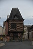
MuseumsSite Name: Musée Archéologique Marcel de MarchévilleCountry: France
NOTE: This site is 16.055 km away from the location you searched for.
Département: Centre:Loire-et-Cher (41) Type: Museum
Nearest Town: Romorantin-Lanthenay
Latitude: 47.358696N Longitude: 1.746164E
Condition:
| 5 | Perfect |
| 4 | Almost Perfect |
| 3 | Reasonable but with some damage |
| 2 | Ruined but still recognisable as an ancient site |
| 1 | Pretty much destroyed, possibly visible as crop marks |
| 0 | No data. |
| -1 | Completely destroyed |
| 5 | Superb |
| 4 | Good |
| 3 | Ordinary |
| 2 | Not Good |
| 1 | Awful |
| 0 | No data. |
| 5 | Can be driven to, probably with disabled access |
| 4 | Short walk on a footpath |
| 3 | Requiring a bit more of a walk |
| 2 | A long walk |
| 1 | In the middle of nowhere, a nightmare to find |
| 0 | No data. |
| 5 | co-ordinates taken by GPS or official recorded co-ordinates |
| 4 | co-ordinates scaled from a detailed map |
| 3 | co-ordinates scaled from a bad map |
| 2 | co-ordinates of the nearest village |
| 1 | co-ordinates of the nearest town |
| 0 | no data |
Be the first person to rate this site - see the 'Contribute!' box in the right hand menu.
Internal Links:
External Links:
Museum in Loire-et-Cher
Phone: 02 54 76 22 06
Address: Le Carroir Doré, 21 Rue de la Pierre
You may be viewing yesterday's version of this page. To see the most up to date information please register for a free account.
Do not use the above information on other web sites or publications without permission of the contributor.
Nearby Images from Flickr

The above images may not be of the site on this page, but were taken nearby. They are loaded from Flickr so please click on them for image credits.
Click here to see more info for this site
Nearby sites
Click here to view sites on an interactive map of the areaKey: Red: member's photo, Blue: 3rd party photo, Yellow: other image, Green: no photo - please go there and take one, Grey: site destroyed
Download sites to:
KML (Google Earth)
GPX (GPS waypoints)
CSV (Garmin/Navman)
CSV (Excel)
To unlock full downloads you need to sign up as a Contributory Member. Otherwise downloads are limited to 50 sites.
Turn off the page maps and other distractions
Nearby sites listing. In the following links * = Image available
16.6km NNW 343° les Châteliers Oppidum Ancient Village or Settlement
17.2km SW 233° Prieuré Saint Eusice dolmen Burial Chamber or Dolmen
17.7km WNW 290° Les Montanjons tumuli Chambered Tomb
17.7km WNW 290° Tertre tumulus Chambered Tomb
19.6km S 174° Pierre Levée de Boisy Standing Stone (Menhir)
20.2km S 175° Pierre Couverte de Bué* Burial Chamber or Dolmen
20.6km S 177° Tréfoux deux menhirs* Standing Stones
21.1km WSW 244° Dolmen de Châtillon-sur-Cher Burial Chamber or Dolmen
26.8km SSE 158° La Pierre Levée (Graçay)* Burial Chamber or Dolmen
27.3km WSW 251° La Pierre-Frite de Grandmont Standing Stone (Menhir)
30.4km NNE 24° Lamotte-Beuvron Chambered Tomb
30.5km NNE 21° Menhir de Chaumont-Sur-Tharonne Standing Stone (Menhir)
31.5km NNE 15° Yvoy-le-Marron Tumulus Chambered Tomb
31.6km SSE 156° Dolmen de l'Ormeau Burial Chamber or Dolmen
33.3km SSE 156° Dolmen de la Pierre-Folle (Le Creuset)* Burial Chamber or Dolmen
33.4km NNE 24° Motte des Aunaies Chambered Tomb
34.4km ENE 71° Coursangeon Tumulus Chambered Tomb
34.5km ENE 63° Falaze Tumulus Chambered Tomb
34.8km ENE 61° Menhir du Champ de la Foire Standing Stone (Menhir)
34.9km ENE 61° Pierrefitte Tumulus Chambered Tomb
35.0km S 186° Dolmen des Pierres Folles (Bouges-le-Château) Burial Chamber or Dolmen
35.1km NW 316° Menhir des Grotteaux Standing Stone (Menhir)
35.9km S 178° Liniez Tumulus elliptique Chambered Tomb
36.0km W 273° Dolmen dit de la Pierre de Minuit* Burial Chamber or Dolmen
36.8km S 179° Pierre Levée (Liniez)* Passage Grave
View more nearby sites and additional images


 We would like to know more about this location. Please feel free to add a brief description and any relevant information in your own language.
 Wir möchten mehr über diese Stätte erfahren. Bitte zögern Sie nicht, eine kurze Beschreibung und relevante Informationen in Deutsch hinzuzufügen.
 Nous aimerions en savoir encore un peu sur les lieux. S'il vous plaît n'hesitez pas à ajouter une courte description et tous les renseignements pertinents dans votre propre langue.
 Quisieramos informarnos un poco más de las lugares. No dude en añadir una breve descripción y otros datos relevantes en su propio idioma.