<< Our Photo Pages >> Tschengla - Modern Stone Circle etc in Austria
Submitted by Klingon on Wednesday, 08 June 2005 Page Views: 9045
Modern SitesSite Name: TschenglaCountry: Austria Type: Modern Stone Circle etc
Nearest Town: Bludenz Nearest Village: Bürserberg
Latitude: 47.156500N Longitude: 9.752900E
Condition:
| 5 | Perfect |
| 4 | Almost Perfect |
| 3 | Reasonable but with some damage |
| 2 | Ruined but still recognisable as an ancient site |
| 1 | Pretty much destroyed, possibly visible as crop marks |
| 0 | No data. |
| -1 | Completely destroyed |
| 5 | Superb |
| 4 | Good |
| 3 | Ordinary |
| 2 | Not Good |
| 1 | Awful |
| 0 | No data. |
| 5 | Can be driven to, probably with disabled access |
| 4 | Short walk on a footpath |
| 3 | Requiring a bit more of a walk |
| 2 | A long walk |
| 1 | In the middle of nowhere, a nightmare to find |
| 0 | No data. |
| 5 | co-ordinates taken by GPS or official recorded co-ordinates |
| 4 | co-ordinates scaled from a detailed map |
| 3 | co-ordinates scaled from a bad map |
| 2 | co-ordinates of the nearest village |
| 1 | co-ordinates of the nearest town |
| 0 | no data |
Be the first person to rate this site - see the 'Contribute!' box in the right hand menu.
Internal Links:
External Links:
I have visited· I would like to visit
blackfox Lavive would like to visit
")
Co-ordinates estimated.
You may be viewing yesterday's version of this page. To see the most up to date information please register for a free account.
")
")
Do not use the above information on other web sites or publications without permission of the contributor.
Nearby Images from Flickr
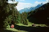
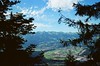
The above images may not be of the site on this page, but were taken nearby. They are loaded from Flickr so please click on them for image credits.
Click here to see more info for this site
Nearby sites
Click here to view sites on an interactive map of the areaKey: Red: member's photo, Blue: 3rd party photo, Yellow: other image, Green: no photo - please go there and take one, Grey: site destroyed
Download sites to:
KML (Google Earth)
GPX (GPS waypoints)
CSV (Garmin/Navman)
CSV (Excel)
To unlock full downloads you need to sign up as a Contributory Member. Otherwise downloads are limited to 50 sites.
Turn off the page maps and other distractions
Nearby sites listing. In the following links * = Image available
17.1km WNW 301° Borscht Prehistoric Settlements* Ancient Village or Settlement
17.3km WNW 292° Opferplatz von Mauren Holy Well or Sacred Spring
17.4km W 269° Summstein Vaduz Modern Stone Circle etc
17.5km W 264° Liechtensteinisches Landesmuseum* Museum
17.6km WSW 252° Triesen Prehistoric Settlements Ancient Village or Settlement
20.5km NNW 336° Kultstein Kirche St. Arbogast* Holed Stone
21.7km WSW 242° Gutenberg Prehistoric Settlements* Ancient Village or Settlement
26.6km WSW 246° Oberprod Schalenstein Rock Art
28.9km SW 214° Untervaz Druidenstein Rock Art
34.2km NNW 334° Rasplen Chindlistein* Rock Art
34.4km NNW 335° Holed Stone / Schalenstein Strich* Holed Stone
34.5km NNW 334° Holed Stone / Schalenstein Unter-Altenstein* Holed Stone
38.1km SSW 206° Rätisches Museum Museum
38.1km SSW 206° Davesco-Soragno Lepontische Stelen* Sculptured Stone
38.1km SSW 206° Stabio Lepontische Stelen Sculptured Stone
38.1km SSW 206° Urmein Schalensteine* Rock Art
38.1km SSW 206° Präz Lepontische Stele Sculptured Stone
38.1km SSW 206° Sietschen Lepontische Stele* Sculptured Stone
38.1km SSW 206° Mesocco-Benabbia Lepontische Stele* Sculptured Stone
39.0km WSW 258° Seebenalp Hinkelstein * Standing Stone (Menhir)
40.7km S 173° Davos Schalensteine Rock Art
46.4km NNW 329° Fussstein* Rock Art
49.6km WNW 284° Summstein Eich Modern Stone Circle etc
50.7km SE 126° Heidelberg Hut Ancient Village or Settlement
53.3km SSW 208° Cazis Petrushügel* Ancient Village or Settlement
View more nearby sites and additional images

")
 We would like to know more about this location. Please feel free to add a brief description and any relevant information in your own language.
 Wir möchten mehr über diese Stätte erfahren. Bitte zögern Sie nicht, eine kurze Beschreibung und relevante Informationen in Deutsch hinzuzufügen.
 Nous aimerions en savoir encore un peu sur les lieux. S'il vous plaît n'hesitez pas à ajouter une courte description et tous les renseignements pertinents dans votre propre langue.
 Quisieramos informarnos un poco más de las lugares. No dude en añadir una breve descripción y otros datos relevantes en su propio idioma.