<< Text Pages >> Veszto-Magor Tell - Ancient Village or Settlement in Hungary
Submitted by AlexHunger on Monday, 29 December 2008 Page Views: 4791
Multi-periodSite Name: Veszto-Magor Tell Alternative Name: Vésztő-Mágor TellCountry: Hungary
NOTE: This site is 29.721 km away from the location you searched for.
Type: Ancient Village or Settlement
Nearest Town: Budapest Nearest Village: Vésztő
Latitude: 46.939451N Longitude: 21.214879E
Condition:
| 5 | Perfect |
| 4 | Almost Perfect |
| 3 | Reasonable but with some damage |
| 2 | Ruined but still recognisable as an ancient site |
| 1 | Pretty much destroyed, possibly visible as crop marks |
| 0 | No data. |
| -1 | Completely destroyed |
| 5 | Superb |
| 4 | Good |
| 3 | Ordinary |
| 2 | Not Good |
| 1 | Awful |
| 0 | No data. |
| 5 | Can be driven to, probably with disabled access |
| 4 | Short walk on a footpath |
| 3 | Requiring a bit more of a walk |
| 2 | A long walk |
| 1 | In the middle of nowhere, a nightmare to find |
| 0 | No data. |
| 5 | co-ordinates taken by GPS or official recorded co-ordinates |
| 4 | co-ordinates scaled from a detailed map |
| 3 | co-ordinates scaled from a bad map |
| 2 | co-ordinates of the nearest village |
| 1 | co-ordinates of the nearest town |
| 0 | no data |
Internal Links:
External Links:
Ancient Village or Settlement in Hungary
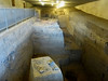
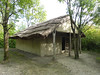
Hungarian Bronze Age Tell along Koros River. There is an earlier wattle-and-daub Tiszapolgar culture settlement at Veszto-Bikeri south of the tell.
You may be viewing yesterday's version of this page. To see the most up to date information please register for a free account.
Do not use the above information on other web sites or publications without permission of the contributor.
Nearby Images from Flickr
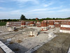

The above images may not be of the site on this page, but were taken nearby. They are loaded from Flickr so please click on them for image credits.
Click here to see more info for this site
Nearby sites
Click here to view sites on an interactive map of the areaKey: Red: member's photo, Blue: 3rd party photo, Yellow: other image, Green: no photo - please go there and take one, Grey: site destroyed
Download sites to:
KML (Google Earth)
GPX (GPS waypoints)
CSV (Garmin/Navman)
CSV (Excel)
To unlock full downloads you need to sign up as a Contributory Member. Otherwise downloads are limited to 50 sites.
Turn off the page maps and other distractions
Nearby sites listing. In the following links * = Image available
23.9km S 179° Dobozi Kő* Modern Stone Circle etc
30.5km SSW 199° Kevermesi sztélé* Standing Stones
32.7km NNE 32° Bakonszeg-Kadarbomb Tell Ancient Village or Settlement
33.2km NNE 32° Konyár* Round Barrow(s)
39.9km NE 41° Berettyoujfalu-Szilhalom Tell Ancient Village or Settlement
40.9km NE 42° Berettyoujfalu-Herpaly-Földwar Tell Ancient Village or Settlement
43.7km NNE 20° Ördögárok* Misc. Earthwork
60.1km WSW 257° Gödény-halom* Ancient Village or Settlement
70.5km NNE 24° Deri Museum Museum
80.7km W 271° Nagyrev Zsidohalom Tell Ancient Village or Settlement
82.8km NNW 337° Tiszafüred Asotthalom Tell Ancient Village or Settlement
83.6km WNW 282° Tószeg-Laposhalom Tell Ancient Village or Settlement
89.2km SSW 191° Ziridava Ancient Village or Settlement
89.4km W 264° Tiszaug-Kemenyteto Tell Ancient Village or Settlement
90.2km NNW 347° Ároktõ-Dongóhalom Tell Ancient Village or Settlement
97.3km SSW 206° Bekai halom Ancient Village or Settlement
101.0km N 357° Polgár Archeopark Ancient Village or Settlement
101.9km N 6° Fürj-halom Round Barrow(s)
107.9km NW 326° Füzesabony-Öregdomb Tell Ancient Village or Settlement
111.7km ESE 112° Bears Cave Cave or Rock Shelter
112.0km W 277° Nagykőrös-Földvar Tell Ancient Village or Settlement
112.0km S 179° Cornesti-Iarcuri Bronze Age Fortification Misc. Earthwork
117.6km NW 309° Jaszdozsa-Kapolnahalom Tell Ancient Village or Settlement
131.2km S 178° Timisoara Modern Stone Circle Modern Stone Circle etc
131.9km S 180° Museum of Banat Museum
View more nearby sites and additional images


 We would like to know more about this location. Please feel free to add a brief description and any relevant information in your own language.
 Wir möchten mehr über diese Stätte erfahren. Bitte zögern Sie nicht, eine kurze Beschreibung und relevante Informationen in Deutsch hinzuzufügen.
 Nous aimerions en savoir encore un peu sur les lieux. S'il vous plaît n'hesitez pas à ajouter une courte description et tous les renseignements pertinents dans votre propre langue.
 Quisieramos informarnos un poco más de las lugares. No dude en añadir una breve descripción y otros datos relevantes en su propio idioma.