<< Text Pages >> Olbia - Ancient Village or Settlement in Ukraine
Submitted by AlexHunger on Sunday, 07 October 2007 Page Views: 7618
Roman, Greek and ClassicalSite Name: OlbiaCountry: Ukraine Type: Ancient Village or Settlement
Nearest Town: Odessa Nearest Village: Parutino
Latitude: 46.688800N Longitude: 31.905800E
Condition:
| 5 | Perfect |
| 4 | Almost Perfect |
| 3 | Reasonable but with some damage |
| 2 | Ruined but still recognisable as an ancient site |
| 1 | Pretty much destroyed, possibly visible as crop marks |
| 0 | No data. |
| -1 | Completely destroyed |
| 5 | Superb |
| 4 | Good |
| 3 | Ordinary |
| 2 | Not Good |
| 1 | Awful |
| 0 | No data. |
| 5 | Can be driven to, probably with disabled access |
| 4 | Short walk on a footpath |
| 3 | Requiring a bit more of a walk |
| 2 | A long walk |
| 1 | In the middle of nowhere, a nightmare to find |
| 0 | No data. |
| 5 | co-ordinates taken by GPS or official recorded co-ordinates |
| 4 | co-ordinates scaled from a detailed map |
| 3 | co-ordinates scaled from a bad map |
| 2 | co-ordinates of the nearest village |
| 1 | co-ordinates of the nearest town |
| 0 | no data |
Internal Links:
External Links:
Ancient Village or Settlement in Ukraine
Remains of ancient Greek city dating from 650 BCE to 200 CE, including foundations of 3rd century BCE temple of Apollo Delphinios which measured 34 metres by 17 metres and had 13 by 6 Columns.
You may be viewing yesterday's version of this page. To see the most up to date information please register for a free account.
Do not use the above information on other web sites or publications without permission of the contributor.
Nearby Images from Flickr
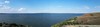
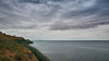
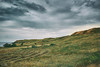
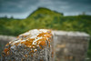
The above images may not be of the site on this page, but were taken nearby. They are loaded from Flickr so please click on them for image credits.
Click here to see more info for this site
Nearby sites
Click here to view sites on an interactive map of the areaKey: Red: member's photo, Blue: 3rd party photo, Yellow: other image, Green: no photo - please go there and take one, Grey: site destroyed
Download sites to:
KML (Google Earth)
GPX (GPS waypoints)
CSV (Garmin/Navman)
CSV (Excel)
To unlock full downloads you need to sign up as a Contributory Member. Otherwise downloads are limited to 50 sites.
Turn off the page maps and other distractions
Nearby sites listing. In the following links * = Image available
20.0km ESE 123° Kherson Cliffs* Natural Stone / Erratic / Other Natural Feature
33.0km N 10° Dykyi Sad Ancient Village or Settlement
39.1km WSW 256° Borysthenes Ancient Village or Settlement
91.5km W 262° Kuyalnik Temple Ancient Temple
125.8km WSW 244° Nikonion Ancient Village or Settlement
130.9km WSW 246° Tira (Ukraine) Ancient Village or Settlement
141.6km NNW 336° Yuzhnoukrainsk Cromlech* Chambered Cairn
144.4km SSE 154° Kalos Limen Ancient Village or Settlement
169.7km N 3° Mezhovi Kameni Standing Stones
177.2km NNW 331° Mohyla Blyzniuky Burial Mound Round Barrow(s)
177.9km SSE 150° Modern Stonehenge on the beach at Popovka Modern Stone Circle etc
178.3km NNW 333° Mohyla-Hostra Burial Mound Round Barrow(s)
192.7km E 80° Kozel Burial Mound Round Barrow(s)
193.7km E 83° Oguz Burial Mound Round Barrow(s)
197.5km ENE 64° Mamay-Hora* Round Barrow(s)
197.6km ENE 68° Znamenskoye Round Barrow(s)
200.7km NE 56° Tolstaja Mogila Burial Mound Round Barrow(s)
204.0km NE 39° Mohyla Baba* Round Barrow(s)
204.3km N 7° Stone Babas on Dvortsova Street* Carving
204.3km N 8° Central Ukrainian Regional Museum of Local Lore Museum
214.0km ENE 57° Chertomlyk Kurgan Round Barrow(s)
220.4km NNE 33° Bohdaniv Kurgan Burial Mound Round Barrow(s)
229.2km N 9° Melgunov Kurgan Round Barrow(s)
232.6km WNW 288° Orheiul Vechi Ancient Village or Settlement
236.9km W 280° National Museum of History of Moldova* Museum
View more nearby sites and additional images


 We would like to know more about this location. Please feel free to add a brief description and any relevant information in your own language.
 Wir möchten mehr über diese Stätte erfahren. Bitte zögern Sie nicht, eine kurze Beschreibung und relevante Informationen in Deutsch hinzuzufügen.
 Nous aimerions en savoir encore un peu sur les lieux. S'il vous plaît n'hesitez pas à ajouter une courte description et tous les renseignements pertinents dans votre propre langue.
 Quisieramos informarnos un poco más de las lugares. No dude en añadir una breve descripción y otros datos relevantes en su propio idioma.