<< Our Photo Pages >> Table de Péraclos - Rock Outcrop in France in Auvergne:Allier (03)
Submitted by alchemille on Monday, 11 April 2016 Page Views: 1382
Natural PlacesSite Name: Table de Péraclos Alternative Name: Mégalithe de PéraclosCountry: France
NOTE: This site is 6.637 km away from the location you searched for.
Département: Auvergne:Allier (03) Type: Rock Outcrop
Nearest Town: Vichy Nearest Village: Chauvigny
Latitude: 46.104500N Longitude: 3.024630E
Condition:
| 5 | Perfect |
| 4 | Almost Perfect |
| 3 | Reasonable but with some damage |
| 2 | Ruined but still recognisable as an ancient site |
| 1 | Pretty much destroyed, possibly visible as crop marks |
| 0 | No data. |
| -1 | Completely destroyed |
| 5 | Superb |
| 4 | Good |
| 3 | Ordinary |
| 2 | Not Good |
| 1 | Awful |
| 0 | No data. |
| 5 | Can be driven to, probably with disabled access |
| 4 | Short walk on a footpath |
| 3 | Requiring a bit more of a walk |
| 2 | A long walk |
| 1 | In the middle of nowhere, a nightmare to find |
| 0 | No data. |
| 5 | co-ordinates taken by GPS or official recorded co-ordinates |
| 4 | co-ordinates scaled from a detailed map |
| 3 | co-ordinates scaled from a bad map |
| 2 | co-ordinates of the nearest village |
| 1 | co-ordinates of the nearest town |
| 0 | no data |
Internal Links:
External Links:
")
This is in appearance a big dog shape rock with a big cup on the top. It is situated on a hill side by the gorges of the Sioule river, following the departmental road D915. The site is found half a mile from the hamlet of Péraclos in the department of Allier (03). The rock is basically dark “micaschiste”, a mixture of mica and quartz. The rock is located on the side of the hill overlooking the valley of the Sioule . The rock has been erected in such a way that the sun light is always shining on it.
You may be viewing yesterday's version of this page. To see the most up to date information please register for a free account.
")
")
Do not use the above information on other web sites or publications without permission of the contributor.
Nearby Images from Flickr
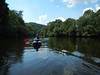
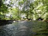
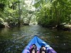


The above images may not be of the site on this page, but were taken nearby. They are loaded from Flickr so please click on them for image credits.
Click here to see more info for this site
Nearby sites
Click here to view sites on an interactive map of the areaKey: Red: member's photo, Blue: 3rd party photo, Yellow: other image, Green: no photo - please go there and take one, Grey: site destroyed
Download sites to:
KML (Google Earth)
GPX (GPS waypoints)
CSV (Garmin/Navman)
CSV (Excel)
To unlock full downloads you need to sign up as a Contributory Member. Otherwise downloads are limited to 50 sites.
Turn off the page maps and other distractions
Nearby sites listing. In the following links * = Image available
9.8km SW 216° Blot-l'Église menhir Standing Stone (Menhir)
10.1km ENE 75° Menhir de Bègues Standing Stone (Menhir)
12.5km S 171° Coeur Ballant* Natural Stone / Erratic / Other Natural Feature
12.9km W 278° Brosses menhir* Standing Stone (Menhir)
15.1km W 262° Menhirs of Barbouly* Stone Row / Alignment
15.6km ESE 109° Pierre Sanglante Rock Art
18.7km SSE 160° Pierre du Tombeau* Standing Stone (Menhir)
22.1km S 172° St-Hyppolyte burial chamber Burial Chamber or Dolmen
22.5km SSE 153° Pessat-Villeneuve menhir* Standing Stone (Menhir)
25.6km NW 324° Les Pierres Fougères Rock Outcrop
25.7km SSE 162° Stade de la Varenne Menhir* Standing Stone (Menhir)
29.1km NE 35° Menhir de Bransat Standing Stone (Menhir)
32.0km NW 320° Dolmen dit la Cabane du Loup (Doyet)* Burial Chamber or Dolmen
33.5km SSW 209° Pierrefit Standing Stone (Menhir)
33.6km S 174° Oppidum des Côtes de Clermont Ancient Village or Settlement
36.0km SW 234° Roc de las Fadas Standing Stone (Menhir)
36.1km SW 234° Banc de las Fadas Natural Stone / Erratic / Other Natural Feature
36.2km SSE 166° Menhir de Brézet Standing Stone (Menhir)
36.4km S 179° Menhir de Villars * Standing Stone (Menhir)
37.1km SSE 165° Menhir du Puy de la Poix* Standing Stone (Menhir)
37.3km S 187° Temple de Mercure* Ancient Temple
37.4km WSW 248° Rochers Saint-Julien (Dontreix) Rock Art
37.5km SSE 165° Menhir de la Grande Borne* Standing Stone (Menhir)
38.0km SSE 168° Orthostat de la Sarre Burial Chamber or Dolmen
39.4km WNW 290° Siège de Saint-Martin Rock Art
View more nearby sites and additional images


 We would like to know more about this location. Please feel free to add a brief description and any relevant information in your own language.
 Wir möchten mehr über diese Stätte erfahren. Bitte zögern Sie nicht, eine kurze Beschreibung und relevante Informationen in Deutsch hinzuzufügen.
 Nous aimerions en savoir encore un peu sur les lieux. S'il vous plaît n'hesitez pas à ajouter une courte description et tous les renseignements pertinents dans votre propre langue.
 Quisieramos informarnos un poco más de las lugares. No dude en añadir una breve descripción y otros datos relevantes en su propio idioma.