<< Other Photo Pages >> Grottes de la Balme - Cave or Rock Shelter in France in Rhone:Isère (38)
Submitted by AlexHunger on Tuesday, 17 May 2005 Page Views: 3330
Natural PlacesSite Name: Grottes de la BalmeCountry: France
NOTE: This site is 4.16 km away from the location you searched for.
Département: Rhone:Isère (38) Type: Cave or Rock Shelter
Nearest Town: Lyons Nearest Village: Vertrieu
Latitude: 45.852596N Longitude: 5.339558E
Condition:
| 5 | Perfect |
| 4 | Almost Perfect |
| 3 | Reasonable but with some damage |
| 2 | Ruined but still recognisable as an ancient site |
| 1 | Pretty much destroyed, possibly visible as crop marks |
| 0 | No data. |
| -1 | Completely destroyed |
| 5 | Superb |
| 4 | Good |
| 3 | Ordinary |
| 2 | Not Good |
| 1 | Awful |
| 0 | No data. |
| 5 | Can be driven to, probably with disabled access |
| 4 | Short walk on a footpath |
| 3 | Requiring a bit more of a walk |
| 2 | A long walk |
| 1 | In the middle of nowhere, a nightmare to find |
| 0 | No data. |
| 5 | co-ordinates taken by GPS or official recorded co-ordinates |
| 4 | co-ordinates scaled from a detailed map |
| 3 | co-ordinates scaled from a bad map |
| 2 | co-ordinates of the nearest village |
| 1 | co-ordinates of the nearest town |
| 0 | no data |
Be the first person to rate this site - see the 'Contribute!' box in the right hand menu.
Internal Links:
External Links:
")
Location Source: OpenStreetMap
You may be viewing yesterday's version of this page. To see the most up to date information please register for a free account.
")
")
Do not use the above information on other web sites or publications without permission of the contributor.
Nearby Images from Flickr


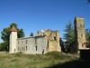

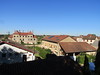
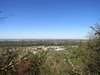
The above images may not be of the site on this page, but were taken nearby. They are loaded from Flickr so please click on them for image credits.
Click here to see more info for this site
Nearby sites
Click here to view sites on an interactive map of the areaKey: Red: member's photo, Blue: 3rd party photo, Yellow: other image, Green: no photo - please go there and take one, Grey: site destroyed
Download sites to:
KML (Google Earth)
GPX (GPS waypoints)
CSV (Garmin/Navman)
CSV (Excel)
To unlock full downloads you need to sign up as a Contributory Member. Otherwise downloads are limited to 50 sites.
Turn off the page maps and other distractions
Nearby sites listing. In the following links * = Image available
7.2km SSW 205° Camp de Larina* Ancient Village or Settlement
8.1km SSW 201° Pierre à Cupule de Chatelans Rock Art
9.7km SSW 208° Le Tombeau du General Burial Chamber or Dolmen
26.1km N 10° Grotte de la Colombiere* Cave or Rock Shelter
32.5km WSW 253° Montaberlet Menhir* Standing Stone (Menhir)
38.1km WSW 259° Monument des Droits de l'Homme* Modern Stone Circle etc
38.8km ESE 113° Pierre à Cupules de la Roche Rock Art
38.9km ESE 110° Blocs Cupulaires des Follioules Rock Art
39.1km SSW 196° Ciste de Meyrieu-les-Étangs Burial Chamber or Dolmen
40.0km ESE 111° Pierre à Cupules de Santourin Rock Art
40.1km WSW 258° Gros Caillou (Lyon)* Natural Stone / Erratic / Other Natural Feature
41.5km WSW 256° Musée Gallo-Romain* Museum
41.6km WSW 256° Lugdunum* Ancient Village or Settlement
42.7km N 8° Pierrefiche Menhir* Standing Stone (Menhir)
52.1km SSE 148° Dolmen dit la Pierre à Mata Burial Chamber or Dolmen
56.9km SE 142° Grottes des Echelles Cave or Rock Shelter
57.6km WSW 254° Dolmen dit la Roche aux Fées Burial Chamber or Dolmen
57.8km E 91° Dolmen de Quintal* Burial Chamber or Dolmen
58.1km ESE 119° Mont Peney Rock Art
58.7km WSW 257° Oppidum du Châtelar Ancient Village or Settlement
61.0km ESE 122° Grotte des Fées (Curienne) Cave or Rock Shelter
64.7km SE 126° Chignin Menhir* Standing Stone (Menhir)
68.9km NW 316° Musée départemental de Préhistoire Solutré* Museum
68.9km WSW 249° Dolmen de Vaudragon Burial Chamber or Dolmen
69.0km NW 316° Solutré-Pouilly Gisement Prehistorique* Natural Stone / Erratic / Other Natural Feature
View more nearby sites and additional images


 We would like to know more about this location. Please feel free to add a brief description and any relevant information in your own language.
 Wir möchten mehr über diese Stätte erfahren. Bitte zögern Sie nicht, eine kurze Beschreibung und relevante Informationen in Deutsch hinzuzufügen.
 Nous aimerions en savoir encore un peu sur les lieux. S'il vous plaît n'hesitez pas à ajouter une courte description et tous les renseignements pertinents dans votre propre langue.
 Quisieramos informarnos un poco más de las lugares. No dude en añadir una breve descripción y otros datos relevantes en su propio idioma.