<< Text Pages >> Cupules de Roussille - Rock Art in France
Submitted by holger_rix on Tuesday, 19 January 2016 Page Views: 689
Rock ArtSite Name: Cupules de RoussilleCountry: France
NOTE: This site is 13.687 km away from the location you searched for.
Type: Rock Art
Nearest Town: Châteldon Nearest Village: La Roussille
Latitude: 45.970380N Longitude: 3.564810E
Condition:
| 5 | Perfect |
| 4 | Almost Perfect |
| 3 | Reasonable but with some damage |
| 2 | Ruined but still recognisable as an ancient site |
| 1 | Pretty much destroyed, possibly visible as crop marks |
| 0 | No data. |
| -1 | Completely destroyed |
| 5 | Superb |
| 4 | Good |
| 3 | Ordinary |
| 2 | Not Good |
| 1 | Awful |
| 0 | No data. |
| 5 | Can be driven to, probably with disabled access |
| 4 | Short walk on a footpath |
| 3 | Requiring a bit more of a walk |
| 2 | A long walk |
| 1 | In the middle of nowhere, a nightmare to find |
| 0 | No data. |
| 5 | co-ordinates taken by GPS or official recorded co-ordinates |
| 4 | co-ordinates scaled from a detailed map |
| 3 | co-ordinates scaled from a bad map |
| 2 | co-ordinates of the nearest village |
| 1 | co-ordinates of the nearest town |
| 0 | no data |
Be the first person to rate this site - see the 'Contribute!' box in the right hand menu.
Internal Links:
External Links:
Chemin de Gaulichard à La Rousille, Chez Bonnet, Châteldon, Thiers, Puy-de-Dôme, Auvergne
Source: T4T35.fr
You may be viewing yesterday's version of this page. To see the most up to date information please register for a free account.
Do not use the above information on other web sites or publications without permission of the contributor.
Nearby Images from Flickr
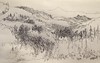
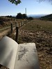
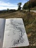
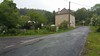

The above images may not be of the site on this page, but were taken nearby. They are loaded from Flickr so please click on them for image credits.
Click here to see more info for this site
Nearby sites
Click here to view sites on an interactive map of the areaKey: Red: member's photo, Blue: 3rd party photo, Yellow: other image, Green: no photo - please go there and take one, Grey: site destroyed
Download sites to:
KML (Google Earth)
GPX (GPS waypoints)
CSV (Garmin/Navman)
CSV (Excel)
To unlock full downloads you need to sign up as a Contributory Member. Otherwise downloads are limited to 50 sites.
Turn off the page maps and other distractions
Nearby sites listing. In the following links * = Image available
3.0km E 85° La Pierre du Sang* Rock Art
13.2km NNE 30° Pierres à Cupules de Courtines Rock Art
14.3km ESE 109° Pierre aux Fées (Saint-Priest-la-Prugne) Sculptured Stone
14.7km SSE 169° Pierres à Bassin de Montguerlhe Rock Art
15.8km SE 128° Pierre Saint-Martin (La Croix Saint-Martin) Rock Art
16.2km S 176° Pierre des Mousquetaires Rock Art
16.2km S 176° Rocher de l'Aigle Rock Art
17.8km ENE 79° Pierres du Calvaire Rock Outcrop
18.3km ENE 67° Pierre des Seigneurs Rock Art
18.4km E 79° Pierres du Joû Rock Outcrop
18.7km SE 125° Pierre de Bachasson Sculptured Stone
20.5km SE 126° Pierre Branlante de Salles Rock Outcrop
21.7km SE 134° Pierre Branlante des Chassagnes Rock Art
22.3km SSE 154° Barque des Morts Rock Art
28.7km WNW 290° Pierre Sanglante Rock Art
28.8km SSE 155° La Renaudie menhir Standing Stone (Menhir)
31.6km NNE 22° Rocher à Cupules de Droiturier Rock Art
32.0km W 261° Pessat-Villeneuve menhir* Standing Stone (Menhir)
32.6km SSW 213° Pierre-aux-Fées Rock Art
33.4km SW 227° Oppidum du Puy du Mur Ancient Village or Settlement
35.3km WSW 254° Stade de la Varenne Menhir* Standing Stone (Menhir)
35.4km W 266° Pierre du Tombeau* Standing Stone (Menhir)
35.9km SSE 152° Menhir du Col du Béal Standing Stone (Menhir)
36.4km WNW 299° Menhir de Bègues Standing Stone (Menhir)
36.5km NNE 18° Pierre Druidique de La Bruyère Rock Outcrop
View more nearby sites and additional images


 We would like to know more about this location. Please feel free to add a brief description and any relevant information in your own language.
 Wir möchten mehr über diese Stätte erfahren. Bitte zögern Sie nicht, eine kurze Beschreibung und relevante Informationen in Deutsch hinzuzufügen.
 Nous aimerions en savoir encore un peu sur les lieux. S'il vous plaît n'hesitez pas à ajouter une courte description et tous les renseignements pertinents dans votre propre langue.
 Quisieramos informarnos un poco más de las lugares. No dude en añadir una breve descripción y otros datos relevantes en su propio idioma.